
Kharkiv (Харків), Ukraine
 Go Back - Latest PENANG Sights/Streets/New Properties > Malaysia > World | Hokkien : Lessons : Dictionary | YouTube | Facebook | About Me : Contact Me
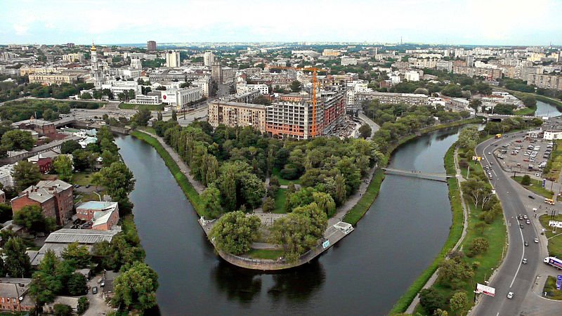
 Kharkiv, Ukraine
Source: https://commons.wikimedia.org/wiki/File:LopanStrelkaKharkov.jpg
Author: Dmitry Sleduk

Kharkiv (Ukrainian: Харків, Russian: Харьков) , in northeastern Ukraine, it the second-largest city in the country. It covers 310 sq km (119.7 sq mi) and has a population of 1.45 million people (2011 estimate), within a metropolitan area of 1.7 million people. The city is 152 m (499 ft) above sea level.
Kharkiv is a Ukrainian cultural hub within the Russian Empire. It is also a major scientific, education and transportation center for the Ukraine. The city is home to many industrial companies including the Morozov Design Bureau and the Malyshev Tank Factory.
Kharkiv is located in the Sloboda Ukraine region, at the confluence of three rivers, the Kharkiv, Lopan and Udy which continue into the Seversky Donets watershed. The area experiences a humid continental climate with hot summers and cold, snowy winters. Warmest month is July, with average high temperature of 25.9°C (78.6°F). Coldest month is January, with average low temperature of -8.5°C (16.7°F). July receives the most rain, at 60 mm (2.36 in).
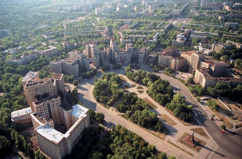
 Freedom Square, Kharkiv
Source: https://commons.wikimedia.org/wiki/File:Kharkov_Freedom_Square.jpg
Author: Shmuliko

According to archaeological excavations, the area of present-day Kharkiv has been inhabited since the Bronze Age. Artifacts of the Chernyakhov culture has been discovered here dating to the 2nd to 6th centuries.
The modern city of Kharkiv was founded in the mid 17th century, and named after its founder, Kharko. It was a fortified Cossack outpost. Kharkiv began to develop and industrialize in the 19th century. Its university was established in 1805 while the first newspaper in Ukrainian was published here in 1812.
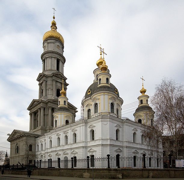
 Assumption Cathedral, also called Uspensky Cathedral, Kharkiv
Source: https://commons.wikimedia.org/wiki/File:Uspensky_Cathedral03.jpg
Author: EvgenyGenkin

Kharkiv served as the capital of the Ukrainian SSR from 1919 to 1934, while the Ukrainian People's Republic had its capital in Kiev. In January 1935, the national capital was moved from Kharkiv to Kiev. Kharkiv was severely devastated during the Second World War, with some 70% of its buildings destroyed and tens of thousands loving their lives, more than half of them Jews. The city was occupied by the Nazis from 1941 until 1943, when it was retaken by the Soviets.
Today Kharkiv is a developed city with a scientific-industrial base. It has a number of tourist sights but is still developing its tourist infrastructure.
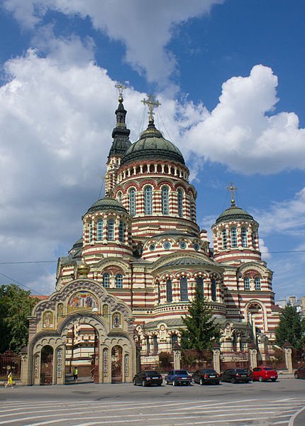
 Anunciation Cathedral, Kharkiv
Source: https://commons.wikimedia.org/wiki/File:%D0%91%D0%BB%D0%B0%D0%B3%D0%BE%D0%B2%D0%
B5%D1%89%D0%B5%D0%BD%D1%81%D0%BA%D0%B8%D0%B9_%D1%81%D0%BE%D0%B1%D0%BE%D1%80_-_%D0%A5%D0
%B0%D1%80%D1%8C%D0%BA%D0%BE%D0%B2.jpg
Author: Petar Milosevic

Visiting Kharkiv
Kharkiv International Airport (HRK) gets flights from Kiev as well as Dubai, Moscow, Tbilisi, Vienna and Yerevan.Exploring Kharkiv
Probably the easiest way to move about in Kharkiv is to take its Metro. You pay for your rides using token purchased from the automatic vending machines at the entrance. Each token costs 2UAH.Sights & Attractions in Kharkiv
- Annunciation Cathedral
Orthodox cathedral with an 80-meter-tall bell tower. Today it is the main Orthodox cathedral of Kharkiv. - Assumption Cathedral
This was the main Orthodox church of Kharkiv until the construction of the Annunciation Cathedral. - Derzhprom Building
Constructivist structure, a showcase project of the Soviet era, with what was then the tallest structure in Europe at the time it was built in 1928. - Freedom Square
An enormous public square covering 12 hectares. - Kharkiv Zoo
One of the biggest and most popular zoos in the Ukraine occupying 22 hectares. - Taras Shevchenko Monument
Memorial to Ukrainian poet, artist and humanist.
 Latest updates on Penang Travel Tips
 Map of Roads in Penang
Looking for information on Penang? Use this Map of Roads in Penang to zoom in on information about Penang, brought to you road by road.About this website

Thanks for reading this page. My name is Timothy Tye. My hobby is to research information about places, and share the information with people on this website. I started this website on 5 January 2003, and since then, have written about over 20,000 places, mostly in Malaysia and Singapore.
Please use the information on this page as guidance only. While I try my best to provide you information that is as accurate as I can get it to be, I do apologize for any errors. Also, as I might not be able to update some information on time, some of these pages may contain outdated information.
Copyright © 2003-2024 Timothy Tye. All Rights Reserved.