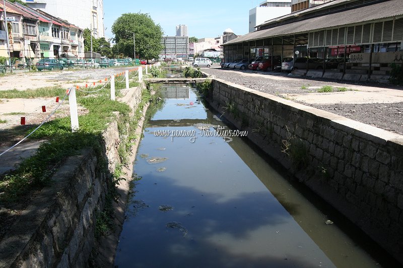
 Prangin Canal (19 March 2010)
The Forgotten Canals of George Town is a remnant of a fascinating past that has been literally paved over. Have you ever wondered how the people move goods about in 19th century George Town? In an age when motor vehicles such as cars, lorries and buses were not yet a common form of transportation, there was heavy reliance on bullock carts for the general goods transportation, while the well-to-do can afford horse carriages, rickshaws and sedan chairs. However, for the general population, going on foot is the norm for moving from place to place. For the transportation of goods, however, I discovered with much interest that canals once formed a vital role in George Town. With this discovery, I want to share with you the forgotten canals of George Town.
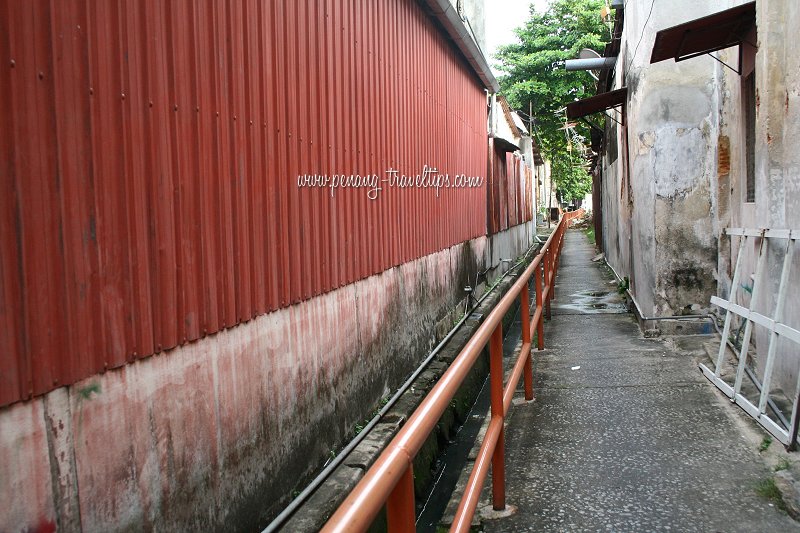 Muntri Canal (28 June 2006)
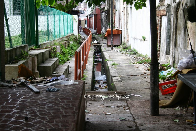 Muntri Canal (28 June 2006)
Canals or waterways formed a vital part of transportation in mid-19th century George Town. They allowed perahus and sampans to bring goods - everything from vegetables to pigs, chickens and sewing machines - to different parts of George Town easily, speedily, and at a lower cost than other forms of transport. Passengers are also taken by perahu, disembarking at different parts of town. The human-powered perahus required neither fuel nor fodder.
To assist in the rapid transit of goods, canals were dug at various parts of George Town, making George Town uncannily similar to Bangkok, but of course on a much smaller scale. 19th century George Town extended as far south as Sia Boey
 to the south, to Penang Road to the west in mid 19th century, to Transfer Road by the 3rd quarter of the 19th century.
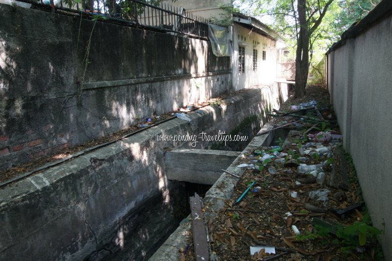 The bound ditch of Transfer Road (19 March 2010)
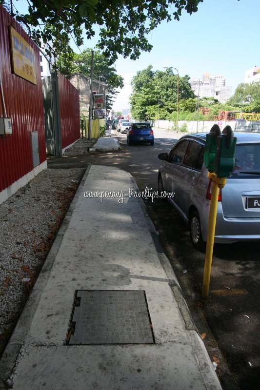 Route of bound ditch beside Transfer Road (19 March 2010)
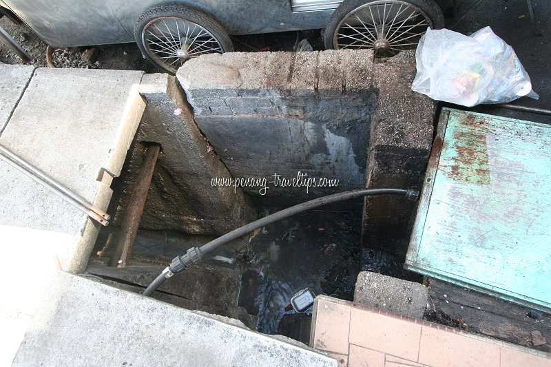 Looking down at Transfer Road ditch (19 March 2010)
Most of George Town's canals have today been paved over. Hence it is not surprising that most people, including historians, are unaware of them. The most visible of these is Prangin Canal. I am pleased to say that it is still visible today. This canal began as a river which over time was turned into a canal, and today appeared more like a ditch.
Prangin Canal
Prangin Canal was a very important canal in the 19th century, for it allowed vegetables and animals to be transported out from the farms located south of the canal, while finished goods are brought here from the ships anchored in the Penang harbour. At that time, the Seven Streets Precinct has not existed yet, and the land south of Prangin Canal was the Chinese village of Koay Kang'nga ("village across the river") dotted with vegetable and animal farms.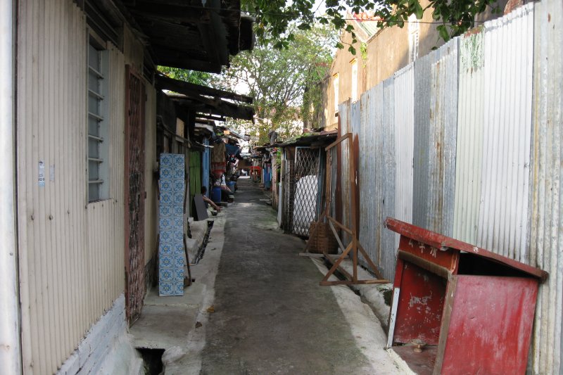 Malabar Canal (17 Dec 2008)
The trade along the Prangin Canal turned Prangin Road into a hive of activity. Bullock carts would be parked here to offload goods from the perahus - despite the ease of boats, bullock carts allow goods to brought to more precise locations. Auxiliary occupations such as barbers and cobblers set up their trades within the vicinity. These evolved into craftsmen guilds representing various occupational groups.
Prangin Canal is certainly not the only canal in town. There are three more canals which I have discovered so far, with likelihood that there is more. Many of these do not have names (at least, none that I know of), so I am calling them according to the roads they follow or intersect.
Apart from Prangin Canal, most of the other canals could not be more than 1.5 meters or 5 feet across. They are just wide enough for two perahus to pass each other, and upon off-loading or on-loading their goods, these boats reverse out of the canals, propelled by rowing.
Transfer Road Canal
There was another canal that was dug from North Beach to Burmah Road. It followed beside a country path that eventually became known as Transfer Road in the 1870's. I am calling it the Transfer Road Canal, for want of a better name, because in fact it pre-dates Transfer Road. There is a possibility that the Transfer Road Canal meets with Prangin Canal somewhere near Masjid Titi Papan, where there was a draw bridge that gave the mosque its name.I am still researching to discover whether Prangin Canal was extended along Burmah Road, but the possibility appears negative. Still, if the two canals meet, they would have carved an island out of George Town, giving it a geographic similarity to medieval Bangkok.
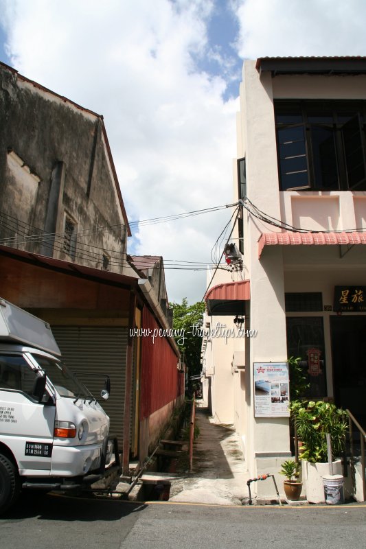 Muntri Canal (23 April 2009)
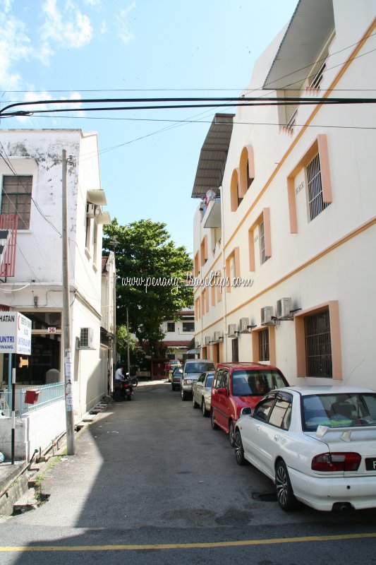 North side of Malabar Canal (23 April 2009)
Walking along Transfer Road, I can still see traces of the Transfer Road Canal, albeit paved over. The most visible remnant of the canal can be seen beside the Loh Boon Siew Mansion off Northam Road (Jalan Sultan Ahmad Shah). Here, you can see a deep ditch that replaces what was once the canal.
There are two more canals that disect the streets of the Inner City. I call them the Malabar Canal and the Muntri Canal, after the streets that they pass through. These canals probably was never named, existing only for their function.
Malabar Canal
Malabar Canal, or what we can see of it today, starts at Kampung Malabar, and ends at Chulia Street. It follows the side wall of Nam Hooi Wooi Koon, and is quite likely older than the present Nam Hooi Wooi Koon building. I believe that by the time that district association building was built, the role of waterways as a form of transportation has diminished. Today Malabar Canal is reduced to little more than a drain. There are squatters who have set up homes beside it.I am trying to determine whether the Malabar Canal ends at Chulia Street, or does it go to Leith Street, and possibly all the sea. This I will add upon further research.
Muntri Canal
Muntri Canal intersects Muntri Street and ends at Chulia Street. I am presently trying to determine whether the Muntri Canal continues towards Farquhar Street, and on the other end, whether it continues towards Carnarvon Street. Unfortunately much traces of the canal have been erased by development. I do believe places like Cheapside at Chulia Street may have once been a canal route.This is inconclusive. I will continue to research, talk to the locals, ask historians and history enthusiasts, to determine the existence of the many forgotten canals of George Town.
Article on the forgotten canals of George Town
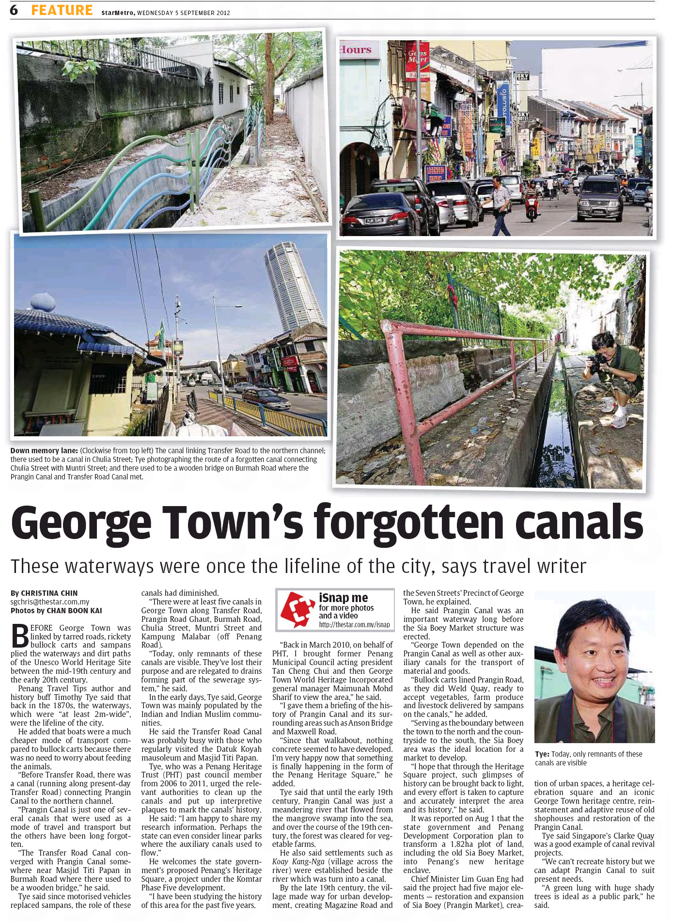
The Star on 5 September, 2012
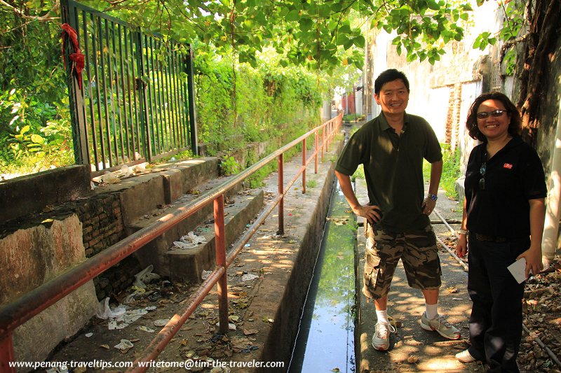 The Star reporter and I at the waterway between Muntri and Chulia Streets (30 August 2012)
Copyright © 2003-2025 Timothy Tye. All Rights Reserved.

 Go Back