 Bundaberg, Queensland
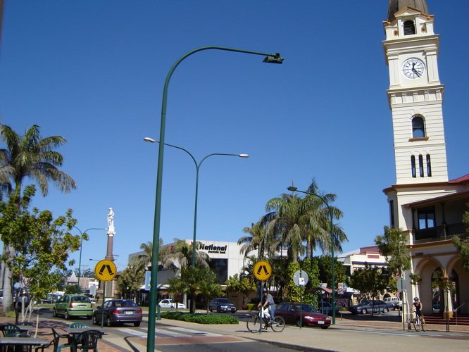
Source: https://en.wikipedia.org/wiki/File:Bundaberg,_le_bureau_de_poste.jpg
Author: Frances76
 Bundaberg is a small city in Queensland, Australia. It lies on the Burnett River, about 385 km (239 mi) north of Brisbane, and has a population of around 71,000 people (2012 estimate). Bundaberg is often known locally simply as Bundy.
Until the arrival of Europeans, the area around Bundaberg was inhabited by the Doondora people, particularly around Hervey Bay. The town was established in 1867 by timbergetters Bob and George Stewart. They were joined by farmers. Later on District Surveyor John Charlton Thompson survey and plot out the settlement, which was given the name Bundaberg in 1870. It was gazetted as a town in 1902, and as a city in 1913.
As with a number of other towns in Queensland, Bundaberg grew out of the sugar industry. Sugar cane plantations were successfully established in the area not long after it was established, leading to the construction of the first sugar mill in Bundaberg in 1882. The industry made used of Pacific islanders as semi-slave labor. The sugar industry is still an important part of Bundaberg's economy. It is also a producer of rum made from sugar cane molasses.
In addition to sugar cane, Bundaberg also had a timber industry. Its oldest saw mill began operations in 1868 and only shut down not long ago, on 26 May 2010. Today the city turns its sights to tourism as one of the important components of its economy. It touts itself as the Southern Gateway to the Great Barrier Reef, with reefs closest to it located at Lady Elliot Island and Lady Musgrave Island.
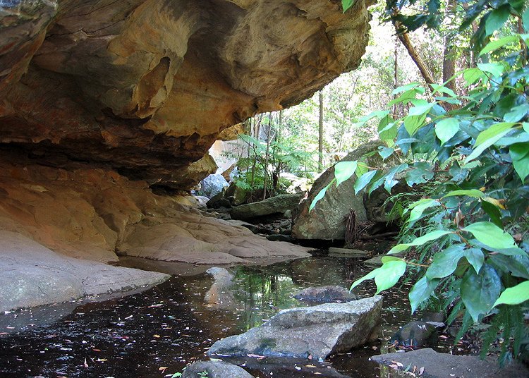
 Cania Gorge, Queensland
Source: https://en.wikipedia.org/wiki/File:CaniaGorge_Overhang.jpg
Author: Stuart Edwards

Visiting Bundaberg
You can drive to Bundaberg from Brisbane on the A1 highway, a journey of about four hours. There are four flights from Brisbane on QantasLink as well. Places of Interest in Bundaberg
- Bundaberg Rum Distilling Company
Facility producing the famous dark rum of Bundaberg. - Cania Gorge National Park
National park with 70m sandstone cliffs, home to a variety of wildlife. - Deepwater National Park
Coastal national park about 375 km from Brisbane. It protects the sand dunes and coastal heaths of the area. - Elliott Heads
Town at the mouth of the Elliott River in the Bundaberg region surrounded by sugar cane plantations. - Eurimbula National Park
National park located 411 km north of Brisbane. It has camping facilities at Bustard Beach. - Lady Elliot Island
Southernmost cay of the Great Barrier Reef located 85 km (46 nautical miles, 53 mi) from Bundaberg. - Lady Musgrave Island
14-hectare island on the Great Barrier Reef. It is a national park and part of the Capricornia Cays Important Bird Area. - Mon Repos Conservation Park
Turtle rookery located 14 km east of Bundaberg. - Moore Park Beach
A small town 15 km north of Bundaberg with almost 20 km of golden sandy beach.
Back to Discover Australia
 Latest updates on Penang Travel Tips
Songs about Penang
About this website

Hello and thanks for reading this page. My name is Timothy and my hobby is in describing places so that I can share the information with the general public. My website has become the go to site for a lot of people including students, teachers, journalists, etc. whenever they seek information on places, particularly those in Malaysia and Singapore. I have been doing this since 5 January 2003, for over twenty years already. You can read about me at Discover Timothy. By now I have compiled information on thousands of places, mostly in Peninsular Malaysia and Singapore, and I continue to add more almost every day. My goal is to describe every street in every town in Malaysia and Singapore.
Copyright © 2003-2024 Timothy Tye. All Rights Reserved.


 Go Back