Khyber Pass is a mountain pass linking Afghanistan with Pakistan. The pass has been known and in use since antiquity. It was part of the ancient trade route during the time of the Silk Road, and it was also used by various forces to launch invasions in Central and South Asia.
Khyber Pass cuts through the Safed Koh Mountains, which are part of the Hindu Kush Mountains. The summit of the pass is about 5 km into Pakistan, at Landi Kotal. According to historians, the name Khyber seems to be of Hebrew origin, meaning a fortress or palace. There has not been a clear explanation how it was derived from Hebrew.
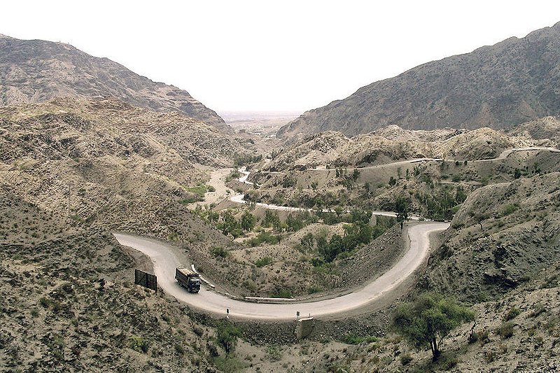
 The Khyber Pass in Pakistan
Khyber Pass was used by Darius I and Alexander the Great to invade India. Later on, Genghis Khan and other mongols also used the pass to conquer South Asia. Turkic-Mongols such as Timur Lane and Babur made used of Khyber Pass to penetrate India, enabling them to establish the Mughal Empire, which flourished from 1526 until 1857. When Persians under Nadir Shah and later the Afghans under Ahmad Shah Durrani launched their attacks on Mughal India, they too made use of Khyber Pass.
By the 20th century, the character of Khyber Pass changed, and Western and Japanese backpackers and hippies began traveling it. During the various conflicts in Afghanistan, the Khyber Pass was a major supply route for NATO forces. When the Taliban attempted to block off access to the pass in late 2008 and early 2009, they came into confrontation with the Pakistani government. Perhaps related to this impasse, a bridge on the Khyber Pass, about 15 miles from Peshawar, was blown up in February 2009. Though no one claimed responsibility, it is believed to be the work of militants supportive of the Taliban or sponsored by them.
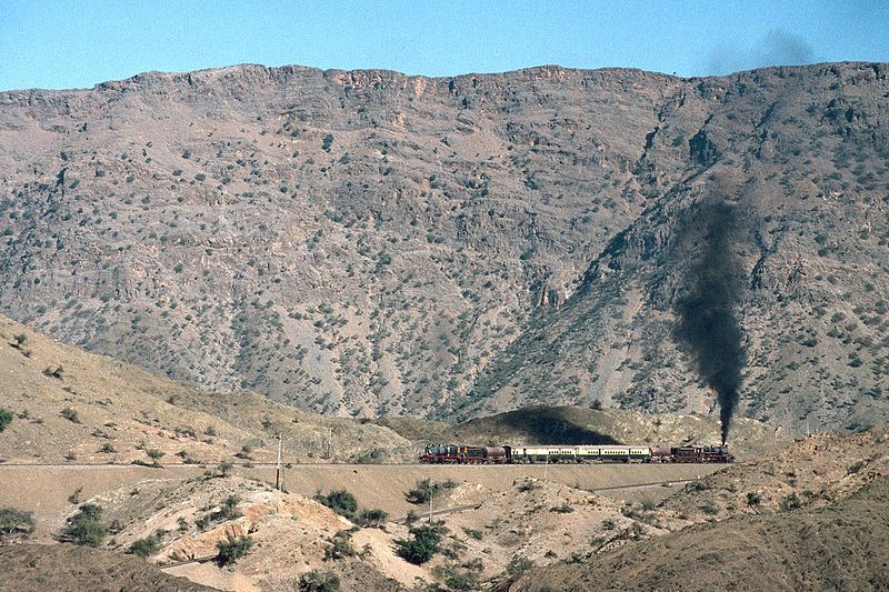
 Train of the Pakistan Railway passing through Khyber Pass
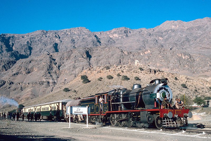
 Train leaving Shahgai in Pakistan for the Khyber Pass
Looking for information on Penang? Use this Map of Roads in Penang to zoom in on information about Penang, brought to you road by road.

Khyber Pass cuts through the Safed Koh Mountains, which are part of the Hindu Kush Mountains. The summit of the pass is about 5 km into Pakistan, at Landi Kotal. According to historians, the name Khyber seems to be of Hebrew origin, meaning a fortress or palace. There has not been a clear explanation how it was derived from Hebrew.
 The Khyber Pass in Pakistan
Source: http://commons.wikimedia.org/wiki/File:KhyberPassPakistan_enh2.jpg
Author: Gasparbarka

Author: Gasparbarka

Khyber Pass was used by Darius I and Alexander the Great to invade India. Later on, Genghis Khan and other mongols also used the pass to conquer South Asia. Turkic-Mongols such as Timur Lane and Babur made used of Khyber Pass to penetrate India, enabling them to establish the Mughal Empire, which flourished from 1526 until 1857. When Persians under Nadir Shah and later the Afghans under Ahmad Shah Durrani launched their attacks on Mughal India, they too made use of Khyber Pass.
By the 20th century, the character of Khyber Pass changed, and Western and Japanese backpackers and hippies began traveling it. During the various conflicts in Afghanistan, the Khyber Pass was a major supply route for NATO forces. When the Taliban attempted to block off access to the pass in late 2008 and early 2009, they came into confrontation with the Pakistani government. Perhaps related to this impasse, a bridge on the Khyber Pass, about 15 miles from Peshawar, was blown up in February 2009. Though no one claimed responsibility, it is believed to be the work of militants supportive of the Taliban or sponsored by them.
 Train of the Pakistan Railway passing through Khyber Pass
Source: http://commons.wikimedia.org/wiki/File:KhyberRailway_01.jpg
Author: MaltaGC

Author: MaltaGC

 Train leaving Shahgai in Pakistan for the Khyber Pass
Source: http://commons.wikimedia.org/wiki/File:KhyberRailway_02.jpg
Author: MaltaGC

Author: MaltaGC

 Latest updates on Penang Travel Tips
 Map of Roads in Penang
Looking for information on Penang? Use this Map of Roads in Penang to zoom in on information about Penang, brought to you road by road.
Copyright © 2003-2025 Timothy Tye. All Rights Reserved.

 Go Back