
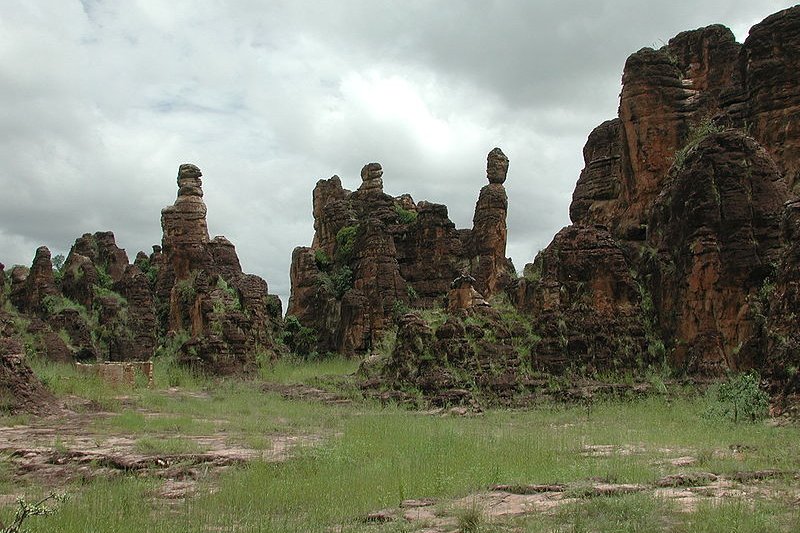
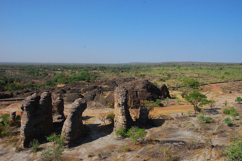
 Pics de Sindou, sandstone formation outside Sindou, Burkina Faso
Source: https://commons.wikimedia.org/wiki/File:Pics_de_Sindou_WP32_SDr9756.JPG
Author: Stefan Dressler

Places in Burkina Faso on this website
Burkina Faso is a landlocked country in central-western Africa. It shares a border with Mali to the north, Niger to the east, Benin to the southeast, Togo and Ghana to the south and Côte d'Ivoire to the southwest. The country is 274,200 sq km (105,869 sq mi) and has a population of 15.8 million people (2011 estimate). Its capital and largest city is Ouagadougou.
Burkina Faso is a semi-presidential republic with a president and prime minister. The country is on the Coordinated Universal Time (UTC+0). Vehicles drive on the right in Burkina Faso. Electricity is 220V 50Hz using European plug. The phone IDD code is +226. The West African CFA (XOF) is the official currency.
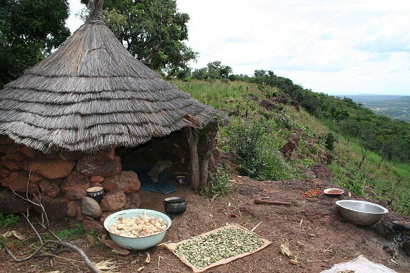 Rural house near summit of Mount Tenakourou, Burkina Faso
Source: https://commons.wikimedia.org/wiki/File:Mt_Tenakourou_MS_1954.JPG
Author: Marco Schmidt

In 2009, Burkina Faso has a nominal GDP of $8.105 billion, equivalent to a per capita nominal GDP of $564. Its per capita GDP at purchasing power parity is $1,314. The official language in the country is French. Indigenouos languages are spoken by 90% of the people.
Evidence of human habitation in the Burkina Faso area goes back as far as 14,000 BC. By the 16th century, the area around Wagadogo (present-day Ouagadougou) and Yatenga were the sites of ancient kingdoms of the Mossi people. These kingdoms were defeated by the French, which made the area a protectorate in 1896.
In around 1915-16, there was an armed opposition against the French colonial government, which was suppressed only after a series of defeats on the French side. Thereafter the French established French Upper Volta in 1919, to bolster its administration in the area and prevent future uprisings. The colony however was dismantled in 1932, and the region was split up between the Côte d'Ivoire, French Sudan and Niger.
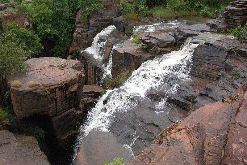 Banfora Cascades, Burkina Faso
Source: https://commons.wikimedia.org/wiki/File:Cascades_de_Banfora_Burkina_Faso.JPG
Author: Marco Schmidt

At the end of World War II, a reversal of the split took place, and the colony of French Upper Volta was revived as the French Union. It gained self-government on 11 December, 1958, and was called the Republic of Upper Volta. Two years later, on 5 August, 1960, it achieved full independence.
As with many African nations, the Republic of Upper Volta went through a few decades of instability, characterized by coups and takeovers. In the midst of political infighting, Captain Thomas Sankara was made prime minister in January, 1983. He was arrested shortly thereafter, but another coup on 4 August, 1983 brought him back, as the president of the country. On 4 August, 1984, Sankara announced a name change for the country, from Upper Volta to Burkina Faso, which means "land of honest people".
Three years later, on 15 October, 1987, Sankara was dead, killed in yet another coup d'état, staged by other officials. While his family fled the country, his body was dismembered and disposed.
Today Burkina Faso remains one of the poorest countries in the world. Its political scenario remains somewhat shaky. Nonetheless, it is said to be one of the safest countries to visit in Africa.
Planning your visit to Burkina Faso
You will need a visa to enter Burkina Faso. Air Burkina is the national airline. It runs a relatively new and well-maintained fleet of aircrafts. Upon arrival at the Ouagadougou Airport, don't be surprised if you're approached by uniformed men wanting to act as your porter. You are expected to allow them to carry your luggage, at the cost of US$1 per bag.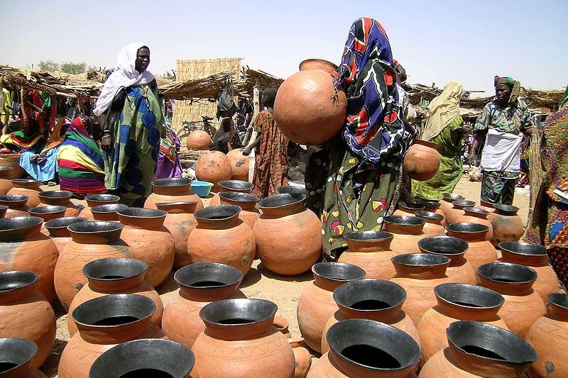 Songhay pottery at Gorom Gorom Market, Burkina Faso. The Songhai is the name of the Songhai Empire, which was a state in West Africa from the mid-15th to the late 16th century.
Source: https://commons.wikimedia.org/wiki/File:Songhay_pottery_gorom_gorom_market.jpg
Author: C. Hugues

Major Cities in Burkina Faso
- Ouagadougou - capital
- Banfora
- Bobo-Dioulasso
- Dédougou
- Gaoua
- Koudougou
- Ouahigouya
Places of Interest in Burkina Faso
- W National Park
 Pics de Sindou
Source: https://commons.wikimedia.org/wiki/File:Pic_de_sindou.JPG
Author: Wegmann

World Heritage Sites in Burkina Faso
Burkina Faso ratified the World Heritage Convention on 2 April, 1987. As of August 2010, it has only one site on the World Heritage List, in the Cultural category. Burkina Faso has submitted a further five sites presently on the World Heritage Tentative List.-
Cultural
- Ruins of Loropéni (2009)
- Les nécropoles de Bourzanga (1996)
- Les sites d'extraction de fer de Kindiba (1996)
- Les ruines de Loropeni (1996)
- Les gravures rupestres de Pobe-Mengao (1996)
- Parc National du W du Niger et aires protégées adjacentes (2004)
 Latest updates on Penang Travel Tips
About this website

Dear visitor, thank you so much for reading this page. My name is Timothy Tye and my hobby is to find out about places, write about them and share the information with you on this website. I have been writing this site since 5 January 2003. Originally (from 2003 until 2009, the site was called AsiaExplorers. I changed the name to Penang Travel Tips in 2009, even though I describe more than just Penang but everywhere I go (I often need to tell people that "Penang Travel Tips" is not just information about Penang, but information written in Penang), especially places in Malaysia and Singapore, and in all the years since 2003, I have described over 20,000 places.
While I try my best to provide you information as accurate as I can get it to be, I do apologize for any errors and for outdated information which I am unaware. Nevertheless, I hope that what I have described here will be useful to you.
To get to know me better, do follow me on Facebook!
Copyright © 2003-2025 Timothy Tye. All Rights Reserved.

 Go Back