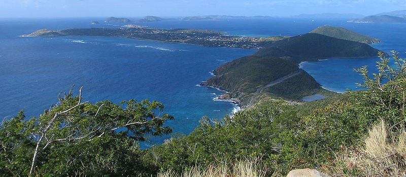
 View of the island of Virgin Gorda in the British Virgin Islands
Source: https://commons.wikimedia.org/wiki/File:VirginGordaOverview.jpg
Author: Jcljules

Places in the British Virgin Islands on this website
British Virgin Islands is a small cluster of islands in the Caribbean Sea. It is part of the Virgin Islands archipelago that includes the U.S. Virgin Islands. The capital of the British Virgin Islands is Road Town. The main islands of the group include Tortola, Virgin Gorda, Anegada and Jost Van Dyke. The islands cover a total area of 153 sq km (59 sq mi) and has a population of 28,000 people (2012 estimate). The islands are officially known as Virgin Islands, but are often called the British Virgin Islands to distinguish them from the islands belonging to the United States.
The earliest known inhabitants of the British Virgin Islands were the Arawak Indians. They were on the islands from 100 BC until the 15th century, when they were ousted by the Carib tribe.
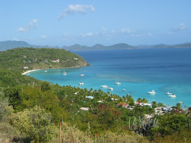
 White Bay, Little Jost Van Dyke Island
Source: https://commons.wikimedia.org/wiki/File:White_Bay_Jost_Van_Dyke.jpg
Author: Cemerp

In 1493 Christopher Columbus became the first European to sight them. He thereupon named them Santa Ursula y las Once Mil Virgenes, meaning "Saint Ursula and her 11,000 Virgins". This name was later shortened to Las Virgenes, and eventually translated into English as Virgin Islands.
Although the Virgin Islands were claimed by part of the Spanish Empire, the Spanish did not settle there. This gave other European powers the opportunity to take over them. The Dutch established a permanent settlement on the island of Tortola in 1648. Tortola fell under the Enlgish in 1680. Meanwhile, the Danish took control of St Thomas, St John and St Croix between 1672 and 1733. In 1917, Denmark sold these three islands to the United States for US$25 million, leading to their being renamed the United States Virgin Islands.
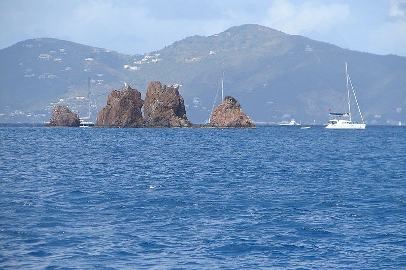
 The Indians, a group of islets in the British Virgin Islands
Source: https://commons.wikimedia.org/wiki/File:The_Indians,_BVI.JPG
Author: Legis

The British Virgin Islands experience a tropical climate. Temperature hovers between 24°C (75.2°F) and 32°C (89.6°F) in summer and 21°C (69.8°F) and 29°C (84.2°F) in winter. The islands have a distinct wet season from September to November, and a dry season from February to March. It is occasionally hit by hurricanes, especially between June to November.
Today the British Virgin Islands are one of the more affluent territories in the Caribbean, enjoying a per capita income of US$38,500 (2004 estimate). The two main components of its economy are tourism and offshore financial services. Tourism brings in 45% of the national income with the bulk of tourists coming from the United States.
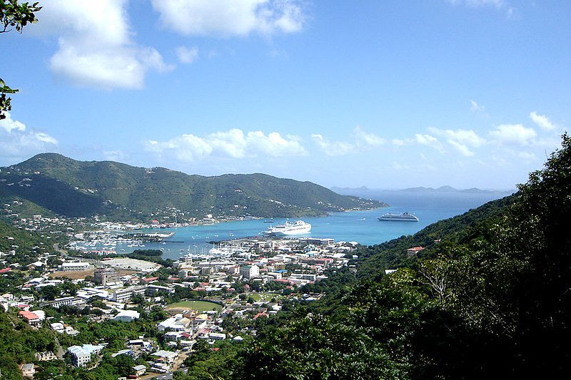
 Road Town, Tortola, British Virgin Islands
Source: https://commons.wikimedia.org/wiki/File:Roadtown,_Tortola.jpg
Author: Henry A-W

Planning your visit to British Virgin Islands, Country
Nationals of Canada, the EU, Japan, New Zealand, Singapore, South Korea, Switzerland and the United States do not require a visa to visit the British Virgin Islands. The airport serving British Virgin Islands is the Terrance B. Lettsome International Airport (EIS), formerly called the Beef Island Airport. As it is not able to handle wide-bodied aircrafts, visitors have to fly in from nearby destinations including San Juan, Antigua, Dominica, Sint Maarten and Saint Kitts.Towns on British Virgin Islands
- Road Town - capital
Islands of the British Virgin Islands
- Anegada
- Beef Island
- Cooper Island
- Dog Islands
- Eustatia
- Frenchman's Cay
- Ginger Island
- Great Camanoe
- Great Thatch
- Great Tobago
- Green Cay
- Guana Island
- Jost Van Dyke
- Little Jost Van Dyke
- Little Thatch
- Little Tobago
- Mosquito Island
- Nanny Cay
- Neckar Island
- Norman Island
- Peter Island
- Prickly Pear
- Saba Rock
- Salt Island
- Sandy Cay
- Scrub Island
- Tortola
- Virgin Gorda
 Latest updates on Penang Travel Tips

Copyright © 2003-2025 Timothy Tye. All Rights Reserved.

 Go Back