 Concepción, Chile
© https://commons.wikimedia.org/wiki/File:Concepcion-Chile%28001%29.jpg
Author: Paul T.J. Edmonds
Concepción is one of the major cities in Chile. It covers 222 sq km (85.7 sq mi) and has a population of 293,000 (2011 estimate). The metropolitan area, or Greater Concepción, includes other cities such as Talcahuano, San Pedro de la Paz, Hualpén, Chiguayante, Penco, Tomé Lota, Coronel and Hualqui. With 890,000 people, Greater Concepción is the second-largest conurbation in Chile, and in casual speech, is regarded as the second largest city in the country. It observes the Chile Standard Time (UTC-4) and in summer the Chile Standard Summer Time (UTC-3).
The climate of Concepción is classified as warm-summer mediterranean climate and some times as oceanic. January is the warmest month, when the temperature reaches 21°C. Coldest month is July, when it may drop to 4°C. July is also the wettest month, receiving 222 mm of precipitation.
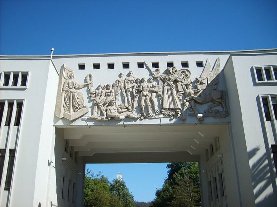
 Entrance arch at the University of Concepción
Source: https://commons.wikimedia.org/wiki/File:Arco_de_UdeC.JPG
Author: Daga

Concepción is located is a seismically active region, meaning it is prone to earthquakes. The latest was the massive earthquake of 27 February, 2010. Measuring 8.8 on the Richter scale, it destroyed 500,000 homes in Concepción and surrounding towns, and could be felt as far away as Santiago 520 km (322 mi) away.
Through the course of its history, Concepción has been destroyed by earthquakes and tsunamis numerous times, in 1570, 1657, 1687, 1730 and 1751, the last of which caused the site of the original Concepción to be abandoned. It was moved to its current location at the Valle de la Mocha, while the original site was only resettled in 1842, and is now called the city of Penco, also in Concepción Province. In the last hundred years, present city of Concepción has also been hit by major earthquakes, in 1939, 1960, and the aforementioned 2010 quake.
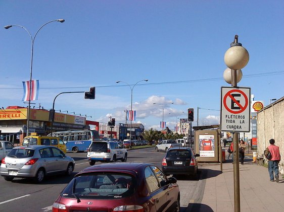
 Lincoyán, in Concepción
Source: https://commons.wikimedia.org/wiki/File:Av._Los_Carrera_-_Lincoy%C3%A1n.JPG
Author: Ex-BGDA

Concepción was founded in 1550 by Pedro de Valdivia. It was originally called Concepción del Nuevo Extremo. In its early years, it faces the hostility of the Mapuche natives, a tribe which remains independent until the 1870s. The Mapuche under their leader Lautaro destroyed the initial settlement of Concepción in 1555, but it was rebuilt with a new fort in 1557.
The proclamation of the Chilean War of Independence was done at the main square of Concepción on 1 January, 1818. This led to the declaration of independence on 12 February, 1818. However, Spain only formally recognized Chile's independence in 1840. Meanwhile, Concepción was once again destroyed by earthquake in 1835.
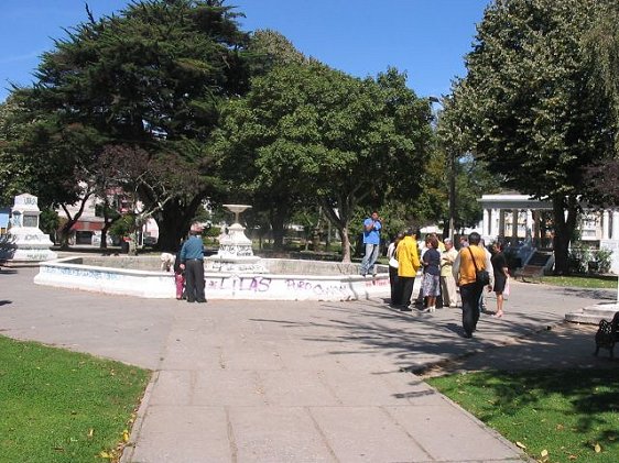
 Plaza Condell de Concepción
Source: https://commons.wikimedia.org/wiki/File:Plazacondell.jpg
Author: Nellorolleri

Visiting Concepción
The Carriel Sur International Airport (CCP) is the airport serving Concepción. It is the second largest airport in the country. The airport gets only domestic flights, from Santiago de Chile, Temuco and Puerto Montt.Places of Interest in Concepción
- Mural Historia de Concepción
A 3,000-sq-ft mural, done in the Socio-Realist style in 1945 by Gregario de la Fuente depicting the region's history. - Museo Hualpén
Museum housed in a beautiful heritage home showcasing the collection of world traveler Pedro del Rio Zañartu. - Plaza España
The main square of the city, with pubs and bistros. - Plaza Independencia
The square where Bernardo O'Higgins proclaimed Chile's independence in 1818. - The Huascar
The oldest floating historical relic in the world, this ais a ship captured from the Peruvian navy in the late 1800s.
 Latest updates on Penang Travel Tips
About this website

Dear visitor, thank you so much for reading this page. My name is Timothy Tye and my hobby is to find out about places, write about them and share the information with you on this website. I have been writing this site since 5 January 2003. Originally (from 2003 until 2009, the site was called AsiaExplorers. I changed the name to Penang Travel Tips in 2009, even though I describe more than just Penang but everywhere I go (I often need to tell people that "Penang Travel Tips" is not just information about Penang, but information written in Penang), especially places in Malaysia and Singapore, and in all the years since 2003, I have described over 20,000 places.
While I try my best to provide you information as accurate as I can get it to be, I do apologize for any errors and for outdated information which I am unaware. Nevertheless, I hope that what I have described here will be useful to you.
To get to know me better, do follow me on Facebook!
Copyright © 2003-2025 Timothy Tye. All Rights Reserved.

 Go Back