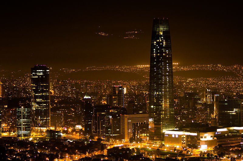
 Santiago de Chile at night
Source: https://commons.wikimedia.org/wiki/File:Santiago_nocturno_2013.jpg
Author: Cristian Quezada Valdés

Santiago is the capital and biggest city in Chile. It is also called Santiago de Chile, to differentiate it from other cities by that name. The city is located roughly two thirds down the length of Chile. The city proper covers 58 sq km (22.4 sq mi) within an urban area of 641.4 sq km and a metropolitan area of 15,403 sq km. It observes the Chile Standard Time (UTC-4) and in summer the Chile Standard Summer Time (UTC-3).
Santiago has an urban population of 6.7 million people and a metropolitan population of 7.2 million. It is the cultural and financial center of Chile, and has grown to become one of the most modern in Latin America.
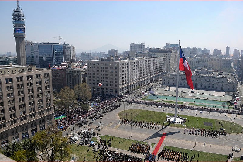 Raising of the Great National Flag at Plaza de la Ciudadanía, Santiago, on 17 Sept 2010, the 200th anniversary of the Republic of Chile
Source: https://commons.wikimedia.org/wiki/File:Izamiento_de_la_Gran_Bandera_Nacional_%282%29.jpg
Author: Gobierno de Chile

Santiago is located 520 m (1,706 ft) above sea level, in a valley called the Santiago Basin, with the Chilean Coastal Range to the west and the snow-capped Andes Mountain range within view to the east. The Andes near Chile rise to towering peaks, including the 6,570-m (21,555 ft) volcano, Tupungato.
Santiago enjoys a Mediterranean climate, though its seasons are the obverse of those in the northern hemisphere. The warmest month here is January, when temperatures rise to 29.7°C (85.5°F). Coldest month is July, when it drops to 1.7°C (35.1°F). Interestingly, July is also the wettest month with 86.6 mm (3.4 in) of precipitation. The city observes the Chile Time zone, which is four hours behind Coordinated Universal Time (UTC-4), and three hours behind during Daylight Saving Time of summer.
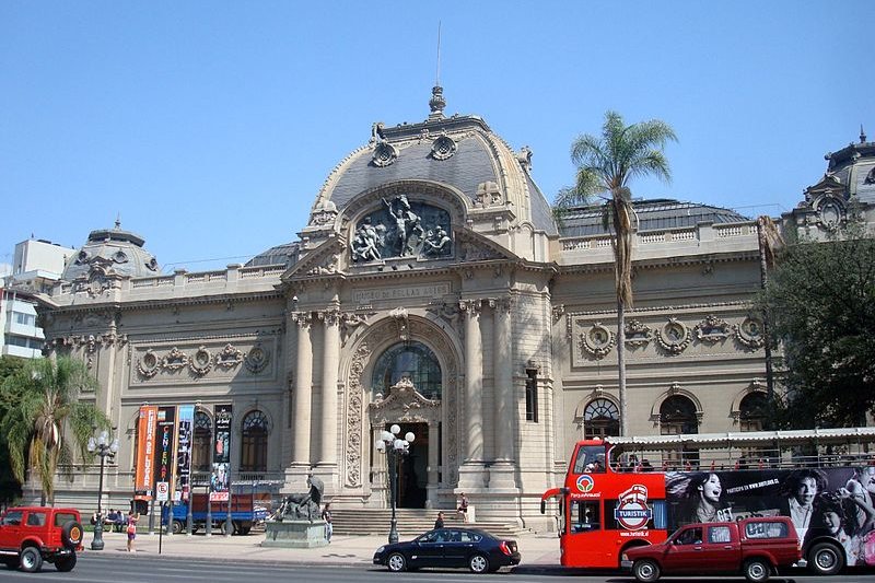 Museo Nacional de Bellas Artes, Santiago de Chile
Source: https://commons.wikimedia.org/wiki/File:Museo_Nacional_de_Bellas_Artes_2.jpg
Author: Carlos yo

Santiago was founded by Spanish Conquistador Pedro de Valdivia on 12 February, 1541. It was originally named Santiago del Nuevo Extremo. The founding was greeted with hostility by the Inca ruler Manco Cápac II, and in less than a year, the new settlers found themselves under siege from the natives. They endured 20 months of isolation before reenforcement arrived from Spain to repel the Incas.
The city grew quickly. Some of its finest buildings were constructed in the 18th century, among them the Santiago Metropolitan Cathedral and the presidential palace, La Moneda. In 1810, the Chileans fought a war with Spain which led to it gaining its independence, finally attained on 12 February, 1818.
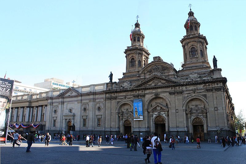 Metropolitan Cathedral of Santiago de Chile
Source: https://commons.wikimedia.org/wiki/File:Catedral,_Parroquia_y_Palacio,_Santiago.jpg
Author: Robert Cutts

By the 20th century, Santiago was far and away the biggest city in Chile. To control the growth that has become somewhat haphazard, a development plan was put in place in 1958. This allowed the construction of new infrastructure such as the Avenida Américo Vespucio Ring Road, the Pudahuel Airport and the Santiago Metro, all of which were built in the 1960's.
Despite its pleasant climate, Santiago is plagued by earthquakes. It suffered a terrible one in 1985. Although casualty figures were low, thousands were left homeless. Another massive earthquake struck on 27 February, 2010, killing 82 and causing massive destruction.
Visiting Santiago, Chile
The Santiago International Airport (SCL), also called the Pudahuel Airport or officially the Comodoro Arturo Merino Benítez International Airport, is the biggest airport in Chile. It is 15 km (9.3 mi) to the northwest of downtown Santiago. The airport is the 6th busiest in South America. It receives flights from all over the world.Arriving at Santiago Airport, you have the option to take the Centro Puerto buses (Ch$1400 one way, Ch$2500 return), the TurBus shuttle bus (Ch$1700 one way, Ch$2900 return) or private taxis (Ch$15,000 one way) to reach the city. The buses make a stop at the Pajaritos Metro Station, which is a good idea to alight, as taking the metro is often faster to reach downtown than to face the congested highways.
Exploring Santiago
The best mode of transport for sightseeing Santiago is the Santiago Metro (https://www.metrosantiago.cl/). There are now five colored lines to the system. If you are going to use the subway extensively, get the bip! smart card which allows you easy travel on the subway and buses.An alternative for visitors is to take the red Turistik (https://www.turistik.cl/en/index.htm) double-decker bus which cover some of the main sights within downtown Santiago. The flat fare of Ch$18,000 allow you unlimited travel from 9:00 am to 6:00 pm, so you can visit all the sights, shopping areas and restaurants of the city.
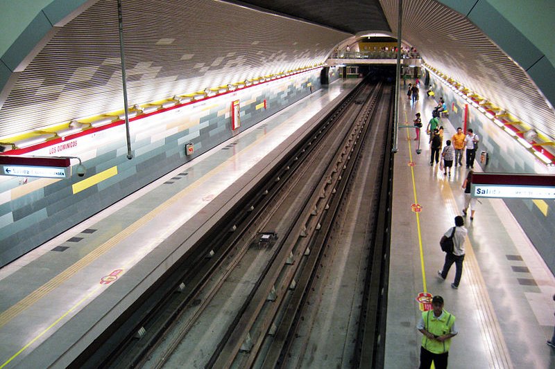 Los Domínicos station on the Santiago Metro
Source: https://commons.wikimedia.org/wiki/File:Estaci%C3%B3n_Los_Dom%C3%ADnicos,_Metro_de_Santiago.jpg
Author: Osmar Valdebenito

Places of Interest around Plaza de Armas and El Centro
Established in 1541, Plaza de Armas is at the heart of El Centro, the civic and commercial heart of Santiago. Many of the most important buildings of Chile are located around the plaza. Despite repeatly being devastated by earthquakes, the area continues to be the social hub of downtown Santiago.Historic Buildings, Streets and Neighborhoods
- Barrio Lastarría
- Barrio París-Londres
- Biblioteca Nacional
- Bolsa de Comercio
- Cancillería
- Casa Colorada
- Centro Cultural Estacíon Mapocho
- Centro Cultural Palacio La Moneda
- Club de la Unión
- Correo Central
- Ex Congreso Nacional
- Mercado Central
- Municipalidad de Santiago
- Palacio Alhambra
- Palacio de la Moneda
- Palacio de la Real de la Audencia
- Palacio de los Tribunales de Justicia
- Paseos Ahumada and Huérfanos
- Plaza Bulnes
- Posad del Corregidor
- Teatro Municipal
- Basilica y Museo de la Merced
- Catedral Metropolitania
- Iglesia de Santo Domingo
- Iglesia San Agustín
- Iglesia y Convento de San Francisco
- Museo Chileno de Arte Precolombino
- Museo de Arte Contemporaneo
- Museo de Artes Visuales
- Museo Nacional de Bellas Artes
Places of Interest to the west of El Centro
These are some of the oldest neighborhoods of Santiago. They include Barrio Brasil, Barrio Concha y Toro and Calle Dieciocho. This was where the city's elite had their residence before the relocated to even better surroundings in the Andean foothills. You can find here stately Neo-Classical and French-inspired buildings from the early 20th century.Historic Buildings, Streets and Neighborhoods
- Barrio Brasil
- Barrio Concha y Toro
- Biblioteca de Santiago
- Calle Dieciocho
- Confitería Torres
- Palacio Cousiño
- Basilica de los Sancramentinos
- Matucana 100
- Museo de la Solidaridad
- Museo Pedagógico Gabriela Mistral
- Parque Bernardo O'Higgins
- Parque Quinta Normal
Places of Interest to the northeast of El Centro
The neighborhoods to the northeast of El Centro include the commercial districts with their gleaming skyscrapers, condominiums and upscale shops as well as Barrio Bellavista, the city's bohemian quarter. This is an amazing transformation considering the area was once the outskirts of town with slums for the poor migrants from the countryside.Historic Buildings, Streets, Neighborhoods and other Sites
- Barrio El Golf
- Barrio Patronato
- Barrio Suecia
- Barrio Vitacura
- Cementerio General
- Centro Cultural Montecarmelo
- La Vega
- Patio Bellavista
- Plaza Camilo Mori
- Pueblo Los Dominicos
- Casa Museo La Chascona
- Museo de Arte Decorativo
- Museo de la Moda
- Museo de Tajamares
- Museo Ralli
- Parque Balmaceda
- Parque de las Esculturas
- Parque Metropolitano de Santiago
 Latest updates on Penang Travel Tips

Copyright © 2003-2025 Timothy Tye. All Rights Reserved.

 Go Back