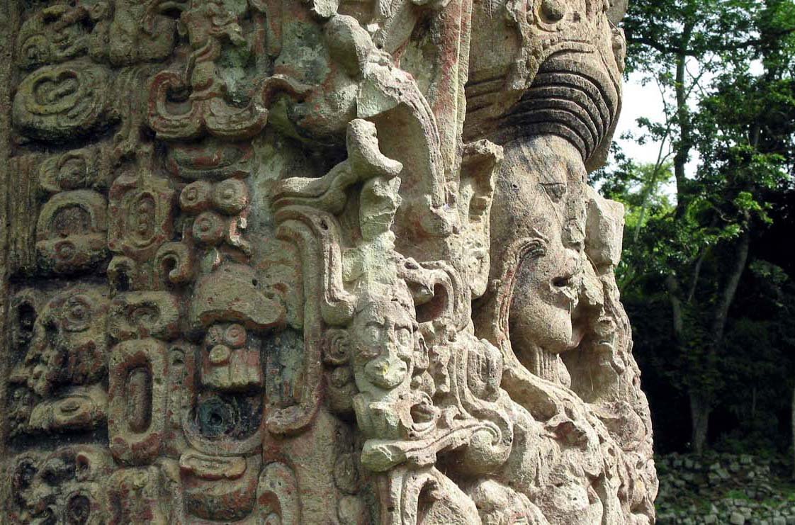
 Stela B in the Maya site of Copán, Honduras
Source: https://commons.wikimedia.org/wiki/File:CPN_ST_B_01.jpg
Author: Talk2winik

Honduras is a country in Central America. It is bordered by Guatemala to the west, El Salvador to the southwest and Nicaragua to the southeast. Honduras also has a coastline facing the Caribbean Sea to the north and the Pacific Ocean to the south. It covers 112,492 sq km (43,278 sq mi) and has a population of 8.3 million people (2011 estimate). The capital and largest city in Honduras is Tegucigalpa.
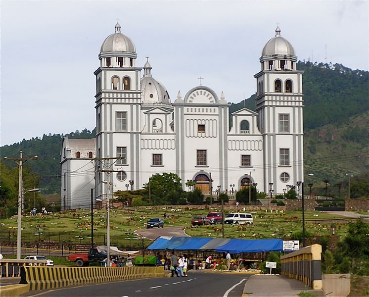
 Basilica Virgen de Suyapa in Tegucigalpa, Honduras
Source: https://commons.wikimedia.org/wiki/File:Basilica_Virgen_de_Suyapa.jpg
Author: Marduk

Honduras is on the North American Central Time Zone, which is six hours behind Coordinated Universal Time (UTC-6). Traffic is driven on the right here. The official currency is called the Lempira (HNL). The phone IDD code is +504. The electricity here is 110V/60Hz using the two-prong North American plug.
Honduras had a estimated nominal GDP of $33.371 billion in 2010, with a per capita nominal GDP of $1,912. Its per capita GDP at purchasing power parity is $4,175. The official language of Honduras is Spanish, although many indigenous languages are also spoken.
During pre-Columbian times, there were many Mayan cities in the area, the most famous of which is Copán. Christopher Columbus arrived in the Bay Islands, off the coast of Honduras, on his fourth and final voyage to the New World in 1502, setting the stage for the Spanish conquest of the land, led by Hernan Cortes in 1524.
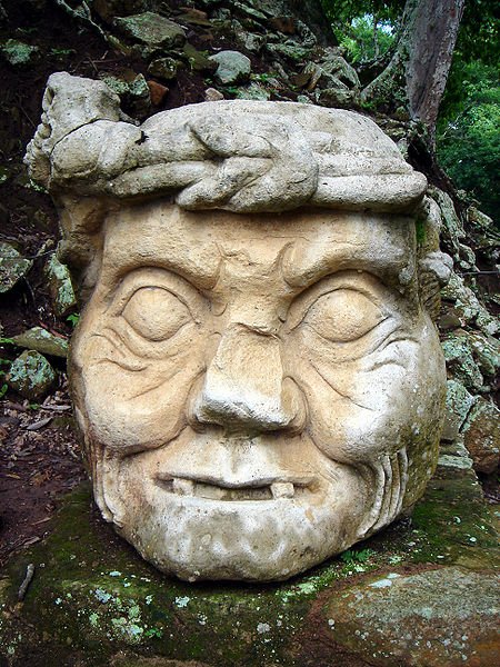
 Pauahtun head in the Maya site of Copán
Source: https://commons.wikimedia.org/wiki/File:Pauahtun_head,_Cop%C3%A1n_%28Honduras%29.jpg
Author: soyignatius

Honduras was ruled by Spain until 15 September 1821 when it declared its independence. It was part of the short-lived First Mexican Empire from 1821 to 1823, and the Federal Republic of Central America from 1823 to 1840. Today Honduras is a constitutional republic headed by a president.
Honduras is hot and humid in the lowlands and cool and drier in the highlands. Temperatures are fairly constant the whole year round. The wettest months are from September to February.
Planning your visit to Honduras
Visitors from most western countries as well as those from Japan, Malaysia and Singapore do not need a visa for entering Honduras.The Toncontín International Airport (TGU) in the capital Tegucigalpa is the main gateway to Honduras. The airport earns the dubious title of being one of the most dangerous in the world, due to its proximity to rugged mountain ranges, short runway and difficuty of approach. So far the largest aircraft that can land here are Boeing 757's.
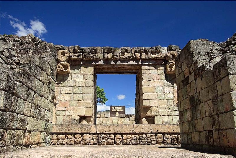
 Temple 22, Ruins of Copán, Honduras
Source: https://commons.wikimedia.org/wiki/File:CPN_STR_22_01.jpg
Author: Talk2winik

On 30 May, 2008, TACA Flight 390 crashed while attempting to land, killing 5 people - including two on the ground, and injuring 65. Since then, the government of President Zelaya has moved all wide-bodied aircrafts to land at the Soto Cano Air Base, a move opposed by local businessmen, who find the air base too far away. Nonetheless a coup d'état in 2009 disposed of President Zelaya, and now international flights continue to operate at Toncontín, at the passengers' peril.
Preparing Money for your trip to Honduras
The currency used in Honduras is the Honduran Lempiras (HNL).Major Cities in Honduras
World Heritage Sites in Honduras
Honduras ratified the World Heritage Convention on 8 June, 1979. As of August 2010, it has two World Heritage Sites, one cultural and one natural. Honduras does not have any sites on the World Heritage Tentative List.Places of Interest in Honduras
- Bay Islands of Honduras
- Cusuco National Park
- Lake Yojoa
- Río Plátano Biosphere Reserve
- Ruins of Copán
 Latest updates on Penang Travel Tips

Copyright © 2003-2025 Timothy Tye. All Rights Reserved.

 Go Back