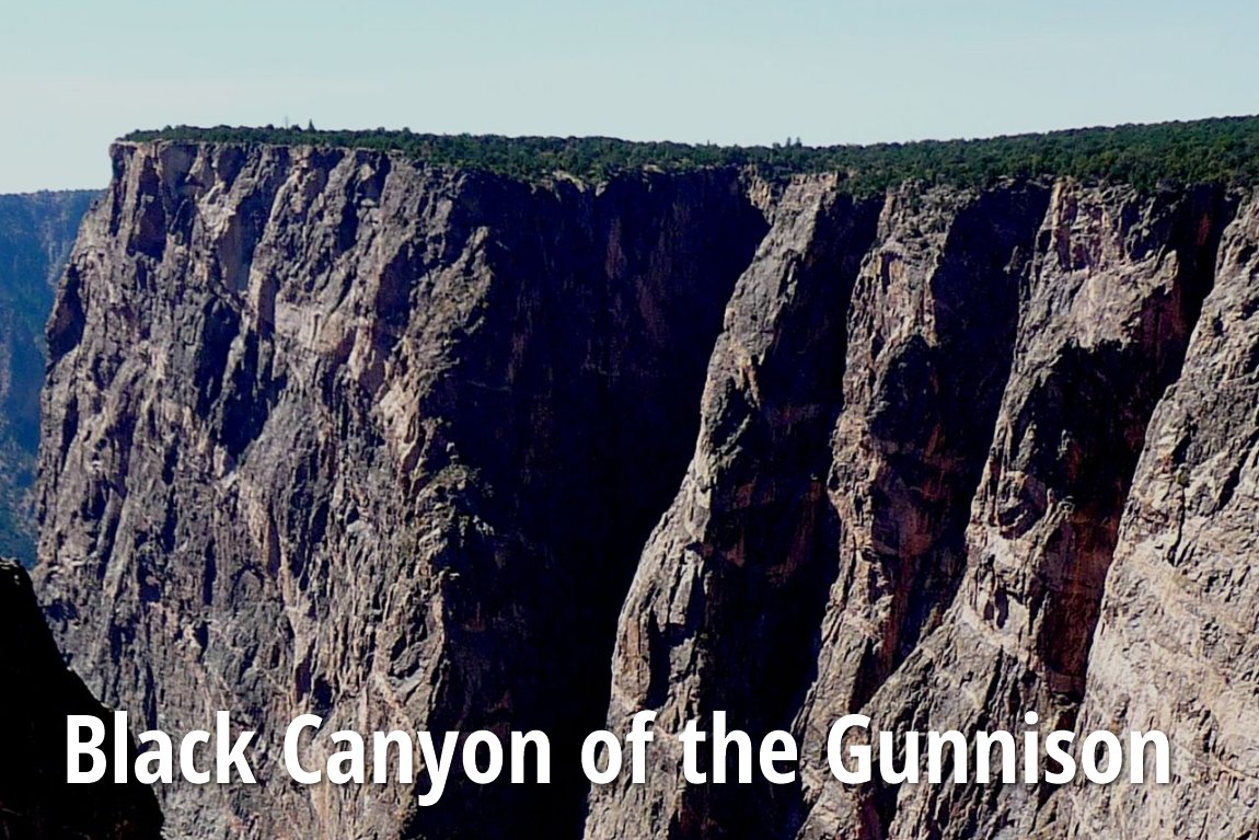
 Black Canyon of the Gunnison National Park
 https://commons.wikimedia.org/wiki/Category:Black_Canyon_of_the_Gunnison_National_Park#/media/File:Black_Canyon_of_the_Gunnison_National_Park_in_September_2011_-_Redwall_from_north_rim.JPG
 Daniel Mayer
Black Canyon of the Gunnison National Park is a spectacular canyon in western Colorado managed by the National Park Service. Located 250 miles southwest of Denver, the national park contains 12 miles of the 48 mile long canyon of the Gunnison river, including the deepest and most dramatic section which continues upstream into the Curecanti National Recreation Area and downstream into the Gunnison Gorge National Conservation Area. The national park encompasses the North Rim and South Rim of the Gunnison.
The Black Canyon has been known to Ute Indians a long time before the first Europeans saw it. When the United States gained independence in 1776, two Spanish expeditions had passed through the canyons. 19th century fur trappers would also have known of the Black Canyon, but left it undocumented. The canyons were only thoroughly explored in the late 19th and early 20th century. Early explorers came to prospect for minerals while later visitors came for recreation.
Black Canyon was established as a US National Monument on 2 March, 1933. Its status was elevated to National Park on 21 October, 1999. The main attraction of Black Canyon of the Gunnison National Park is the scenic drive along the south rim of the canyon. Campground is available, as well as hiking and nature trails. The north rim is more remote though also accessible by cars. The river can be reach by hiking down four hours and returning in six hours.
The canyon is also a place for extreme sports like rock climbing. Most of the climbs are difficult and are done only by advanced climbers. Impassable stretches of the river makes whitewater rafting a limited activity at Black Canyon.
Visiting Black Canyon of the Gunnison National Park
There are two ways to enter the park, through the more-developed south rim entrance 15 miles (24 km) east of Montrose, or the north rim entrance 11 miles (18 km) south of Crawford and is closed in the winter. At time of writing (March 2011), the East Portal and North Rim roads are closed while the South Rim Road is closed to vehicles beyond Gunnison Point.To reach the North Rim, State Route 92 to the unpaved North Rim Road, 11 miles south of Crawford. To reach the South Rim, take US Highway 50 and State Route 347. It is 15 miles east of Montrose. There are no bridges across the canyon, so if you wish to go from either rim to the other, you have to do a long drive circumnavigating the area. Allow two or three hours for that.
Entrance fees is $15 per vehicle, payable at the South Rim entrance station and North Rim ranger station, good for seven days, covering all occupants in a private, non-commercial vehicle. If you arrive on foot or on bicycles or motorcycles, the charge is $7 per person. Persons aged 16 and below enjoy free admittance.
List of National Parks in the United States
 Latest updates on Penang Travel Tips
About this website

Dear visitor, thank you so much for reading this page. My name is Timothy Tye and my hobby is to find out about places, write about them and share the information with you on this website. I have been writing this site since 5 January 2003. Originally (from 2003 until 2009, the site was called AsiaExplorers. I changed the name to Penang Travel Tips in 2009, even though I describe more than just Penang but everywhere I go (I often need to tell people that "Penang Travel Tips" is not just information about Penang, but information written in Penang), especially places in Malaysia and Singapore, and in all the years since 2003, I have described over 20,000 places.
While I try my best to provide you information as accurate as I can get it to be, I do apologize for any errors and for outdated information which I am unaware. Nevertheless, I hope that what I have described here will be useful to you.
To get to know me better, do follow me on Facebook!
Copyright © 2003-2025 Timothy Tye. All Rights Reserved.

 Go Back