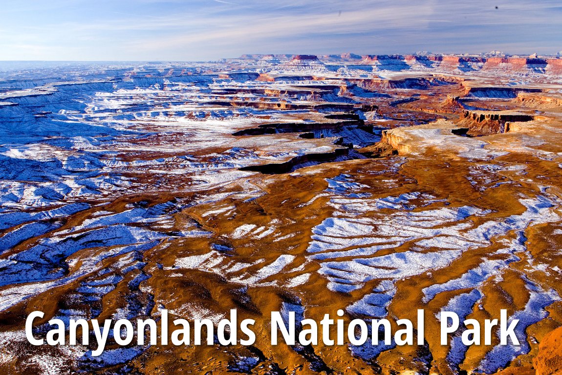
 Canyonlands National Park
 https://commons.wikimedia.org/wiki/Category:Canyonlands_National_Park#/media/File:Canyon_lands2.jpg
 Alwynloh
 )
)Canyonlands National Park is a national park near Moab, Utah. Covering an area of 527.5 sq miles (1,366 sq km), it was carved by the Colorado River, Green River and their tributaries. The landscape at Canyonlands is one of eroded canyons, buttes and mesas.
Canyonlands National Park is divided into four districts, separated by the rivers. They four are Island in the Sky, The Needles, the Maze, and the rivers themselves. In addition, there is also another separate section to the north called the Horseshoe Canyon Unit. Each section has its own character.
The Island in the Sky district is a mesa on the northern section of Canyonlands. It is located between the Colorado River and Green River. The view overlooking White Rim, a sandstone bench 1200 feet (365 m) below the Island, with the rivers another 1000 feet (304 m) below, can only be described as breathtaking.
The Needles got its name from the red and white banded rock pinnacles found there. It has a variety of rock formations including canyons, grabens, potholes, and a number of arches similar to those at nearby Arches National Park. However, those at Canyonlands are not that easy to reach. They require moderate hikes or four-wheel-drive trips to reach.
There is evidence of habitation by the Ancestral Puebloan Indians in The Needles. Their stone tools and mud dwellings have been well preserved, along with petroglyphs on the rock walls. The most famous petroglyph is called Newspaper Rock. It is located near the Visitor Center at the entrance of Needles district.
The Maze district west of the Colorado and Green rivers is the most remote and inaccessible section of Canyonlands National Park.
Separated from the other districts is the Horseshoe Canyon unit, with large panels of rock art made by hunter-gatherers from the Late Archaic Period, even older than the Ancestral Puebloans. The most notable panel in the canyon is named the Great Gallery.
Being a popular recreational destination, Canyonlands receive over 400,000 visitors per year. The area is ideal for hiking, mountain biking and just casual sightseeing. There are stretches of the Green River and Colorado River where you can go rafting and kayaking.
Visiting Canyonlands National Park
The more accessible districts of Canyonlands National Park are Island in the Sky district and the Needles district. Island in the Sky is accessible from Utah State Route 313 while the Needles on Utah State Route 211. The Maze district is very remote and is only accessible from the west, using Utah State Route 24 or 95 on unpaved roads. The districts are totally separated with no road connections them, if you wish to visit every one, traveling from one to another may require two to six hours of driving.Each district of Canyonlands has its own visitor center. While the national park itself is open 24 hours a day the whole year round, the opening hours of the visitor centers follow the season.
The visitor center at Island in the Sky opens from 8:00 am to 6:00 pm from late March to late October, and from 9:00 am to 4:30 pm from late October to late March, closing at 1:00 pm on Thanksgiving Day.
The visitor center at The Needles opens daily from 8:30 am to 4:30 pm with extended hours in March through October, and closes at 1:30 pm on Thanksgiving Day.
The Hans Flat Ranger Station at the Maze opens daily from 8:00 am to 4:30 pm.
Entrance fee to Canyonlands is $10 per non-commercial vehicle with its driver and all passengers, good for 7 days. Individuals arriving on foot, bicycles or motorcyles pay $5 per person, good for 7 days. Annual passes are available for unlimited visits over a year for $25.
List of National Parks in the United States
 Latest updates on Penang Travel Tips

Copyright © 2003-2025 Timothy Tye. All Rights Reserved.

 Go Back