 Casper, Wyoming
Source: https://commons.wikimedia.org/wiki/File:Casperpanorama.jpg
Author: Milonica

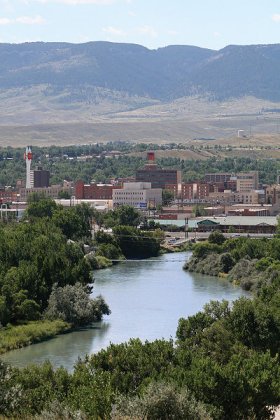
Casper is the second-largest city in Wyoming. Located in east-central Wyoming, at the north end of the Laramie Mountain Range, Casper is the county seat of Natrona County. The city is built on the North Platte River. It covers 28.8 sq mi (75.5 sq km) and has a population of 55,000 (2011 estimate).
As with much of Wyoming, Casper experiences a semi-arid climate. The hottest month here is July, when temperatures may rise to an average high of 86.8°F (30.44°C). Coldest month in Casper is January, when temperature drops to 12.2 °F (-11°C). Snow can be expected between December and March. May is the wettest month with 2.38 in (60.5 mm) of precipitation.
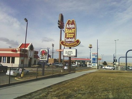
 Businesses along Wyoming Blvd in Casper
Source: https://commons.wikimedia.org/wiki/File:ArbysEasternCasperWY.jpg
Author: Xnatedawgx

A settlement was founded in the Casper area by settlers in the mid-19th century. As early as the 1840's there was a ferry service taking passengers across the North Platte River, until the Platte Bridge was built in 1859.
 View of Casper and the North Platte River
Source: https://commons.wikimedia.org/wiki/File:Casperskyline.jpg
Author: Adbay

In the 1860's the United States built a military garrison near the bridge. It was called the Platte Bridge Station. The garrison was later renamed Fort Casper, after Lieutenant Caster Collins who was killed by Native Americans. The town of Casper was only incorporated long after the military garrison had closed. Its growth was partly fueled by the westward expansion of the Wyoming Central Railway, giving it an advantage over rival townships such as Bessemer and Doouglas.
The discovery of petroleum in the 1890's turned Casper into a regional petroleum center. It even got the nickname of "The Old City". Over the decades refineries have opened and closed in the vicinity of Casper, although generally the petroleum production in the area has been in decline. The city however has diversified into other energy-related industries including the extraction of coal and uranium.
Visiting Casper, Wyoming
Casper is connected by Interstate 25 to Cheyenne in the south and Buffalo in the north. You can also fly in, landing at the Natrona County International Airport (CPR), served by Allegiant Air, Delta Air Lines and United Airlines.Places of Interest in Casper, Wyoming
- Fort Casper Museum
- National Historic Trails Center
- Nicolaysen Art Museum
 Latest updates on Penang Travel Tips

Copyright © 2003-2025 Timothy Tye. All Rights Reserved.

 Go Back