 Seven Devils Mountains, Idaho
Source: https://commons.wikimedia.org/wiki/File:Seven_Devils_Panorama_edit.jpg
Author: Adumbvoget

Idaho is a state on the northwestern part of Contiguous United States. It was the 43rd state to be admitted to the Union on 3 July, 1890. The state covers an area of 83,642 sq miles (216,632 sq km). Idaho has a population of 1.5 million people. Its biggest city and capital is Boise.
Idaho is primarily a landlocked, mountainous state. It shares a border with Washington and Oregon to the west, Nevada and Utah to the south, Montana and Wyoming to the east, and the Canadian province of British Columbia to the north.
The tallest peak in Idaho is Borah Peak, at 12,662 ft (3,859 meters), while its lowest point is in Lewiston, at the confluence of the Clearwater River with the Snake River. The climate of Idaho is varied. Although it is 350 miles from the Pacific coast, it still gets a moderating effect on its winter temperature from the ocean. Summers can be wet, and some times, very hot, while winters are dry and cold.
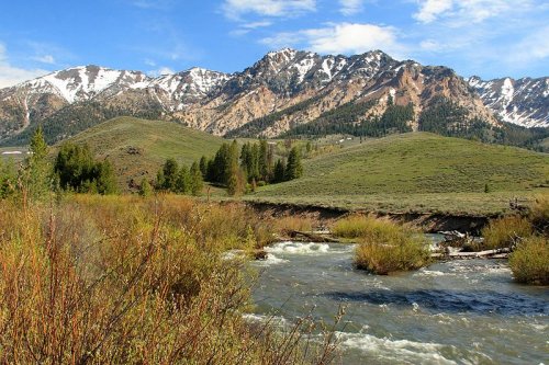
 Ketchum, Idaho
Source: https://commons.wikimedia.org/wiki/File:Outside_of_Ketchum,_Idaho.jpg
Author: Frank Kovalchek

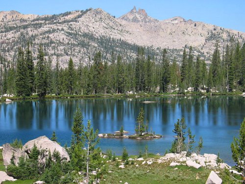
 Summit Lake, Sawtooth Wilderness, Idaho
Source: https://commons.wikimedia.org/wiki/File:Sawtooth_Wilderness_Summit_Lake_NorthRaker.jpg
Author: Seek writ awe there

Travel to Idaho
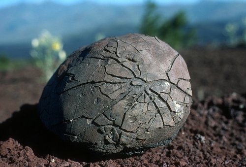
Most people go to Idaho either by self-driving or by plane. Boise Airport (BOI) is the main airport serving the state, receiving flights from most of the big cities in the United States. If you are going to the northern part of Idaho, then you should consider flying to Spokane in Washington, just about 20 miles from the Idaho border. Volcanic Bomb at Craters of the Moon National Monument, Idaho
Source: https://commons.wikimedia.org/wiki/File:Crmo_volcanic_bomb_20070516123632.jpg
Author: National Park Service

Travel within Idaho
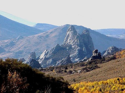
Apart from the major towns, public transport in Idaho is limited in the rural areas. Driving is probably the most practical means of going about if you wish to explore Idaho. The main Interstate highway serving the state is are I-90, I-84, I-15, and I-86. I-90 serves northern Idaho, passing through Coeur D'Alene. I-84 enters Idaho from Oregon and continues to Boise. I-15 enters Idaho from Utah and continues to Pocatello and Idaho Falls. Connecting I-84 with I-15 is the I-86, which passes through the southern part of the American Falls Reservoir. City of Rocks National Reserve, Idaho
Source: https://en.wikipedia.org/wiki/File:City_of_rocks_view_NPS.jpg
Author: Wallace Keck

Cities in Idaho
- Boise (205,300 / 585,000)
Biggest city and state capital. - Nampa (51,870)
Second biggest and fastest growing city in Idaho, within the Boise metropolitan area. - Pocatello (51,460 / 83,300)
Largest city in Bannock County in southeastern Idaho. - Idaho Falls (50,730 / 123,000)
Biggest city in Eastern Idaho. - Coeur d'Alene (40,000)
Largest city in the northern Idaho Panhandle.
Places of Interest in Idaho
- Bonanza
- City of Rocks National Reserve
- Frank Church-River of No Return Wilderness
- Gospel Hump Wilderness
- Nez Perce Indian Reservation
- Sawtooth National Recreation Area
- Sun Valley
National Parks of Idaho
Idaho has only one national park shared with Wyoming and Montana.National Monuments in Idaho
World Heritage Sites in Montana
- Yellowstone National Park (1978)
 Latest updates on Penang Travel Tips

Copyright © 2003-2025 Timothy Tye. All Rights Reserved.

 Go Back