 Indiana Travel Guide: Wabash River, Tippecanoe County, Indiana
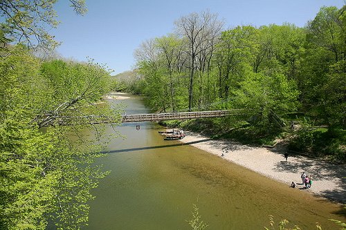
Source: https://commons.wikimedia.org/wiki/File:Wabash_River_at_Granville,_Indiana.png
Author: Wallace Keck

Indiana is a state in the Midwestern region of the United States. It is also one of the states in the Great Lakes Region. It shares a border with Michigan to the north, Ohio to the east, Kentucky to the south, Illinois to the west, and faces Lake Michigan to the northwest. Indiana covers an area of 36,418 sq miles (94,321 sq km), and has a population of around 6.3 million people. The capital and largest city is Indianapolis.
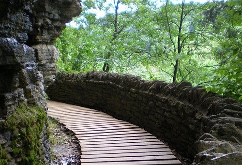
 Sugar Creek, Turkey Run State Park, Indiana
Source: https://en.wikipedia.org/wiki/File:Garden_of_the_gods.jpg
Author: Daniel Schwen

 Clifty Falls, Indiana
Source: https://commons.wikimedia.org/wiki/File:Clifty_Falls_State_Park.jpg
Author: Sarah Stierch

The name Indiana has been in use since around 1760, and is said to mean "Land of the Indians". Native American tribes have inhabited the land since prehistoric times. There are several ancient burial mounds in Indiana that have been preserved, include those near Evansville in southwestern Indiana.
Indiana is a relatively flat country. The highest natural point in the state is Hoosier Hill, which stands at a height of just 1,257 feet (383 meters) above sea level. The state experiences a humid continental climate with cool winters and warm summers. In winter, temperature can drop below 0°F (-18°C) while in summer it can reach 88°F (31°C). May to July are the wettest months in the state.
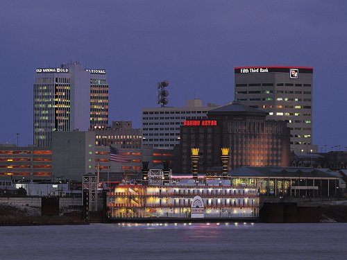
 Evansville, Indiana
Source: https://en.wikipedia.org/wiki/File:Evansvilleskyline.jpg
Author: Kentuckiana

Travel to Indiana
The Indianapolis International Airport receives flights from major airports around the country. If you are driving to Indiana, you can take Interstate 80 and 90 that cuts across the northern part of Indiana, going east-west. I-65, I-69, I-70 and I-74 radiates out of Indianapolis.Travel within Indiana
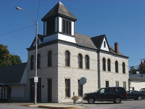
Driving would be the most practical way to explore Indiana. There are fourteen Interstate highways that crosses through Indiana, often known as the "Crossroads of America" (not because of the highways, but rather because of the railroad tracks that were in place before the highway came into the picture). Town Hall of Spencer, Indiana
Source: https://commons.wikimedia.org/wiki/File:Spencer_Town_Hall_and_Fire_Station.jpg
Author: Nyttend

Cities in Indiana
- Indianapolis (800,000)
Capital and largest city in Indiana. - Fort Wayne (256,000)
County seat of Allen County in northeastern Indiana. - Evansville (122,000)
County seat of Vanderburgh County on a bend of the Ohio River in southwestern Indiana. - South Bend (108,000)
County seat of St Joseph County in northern Indiana. - Gary (103,000)
City on the southeastern portion of the Chicago metropolitan area, 25 miles from Chicago, Illinois.
Places of Interest in Indiana
- Brown County State Park
The largest state park in Indiana. - Chain O'Lakes State Park
State park to the northwest of Fort Wayne. - George Rogers Clark National Historical Park
The largest US National Historical Park outside of Washington DC - Hoosier National Forest
Forest in south central Indiana with sights such as Lick Creek Settlement and Potts Creek Rockshelter Archaeological Site. - Indiana Dunes National Lakeshore
Dune land on the lake front near Porter, Indiana. - John Mellencamp's Mansion
Hometown of the famous rocker. - Lincoln Boyhood National Monument
Memorial to Abraham Lincoln who lived there during his boyhood between 1816 to 1830. - Prophetstown State Park
Park near the town of Battle Ground, with a living museum of Native American village and 1920's-style farm. - Turkey Run State Park
Park in Parke County in west-central Indiana.
 Latest updates on Penang Travel Tips

Copyright © 2003-2025 Timothy Tye. All Rights Reserved.

 Go Back