 Kasha-Katuwe Tent Rocks National Monument, New Mexico
Source: https://commons.wikimedia.org/wiki/File:Tent_rocks_MG_3183.jpg
Author: Julius Rückert

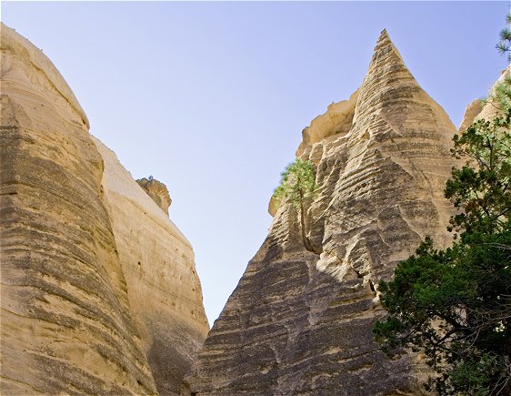
Kasha-Katuwe Tent Rocks National Monument preserves a site of natural rock formations in Sandoval County, New Mexico. The site, which covers 4,148 acres (16.78 sq km) is located some 40 miles to the south west of Santa Fe.
 Kasha-Katuwe Tent Rocks
Source: https://commons.wikimedia.org/wiki/File:Tent_rocks_MG_3179.jpg
Author: Julius Rückert

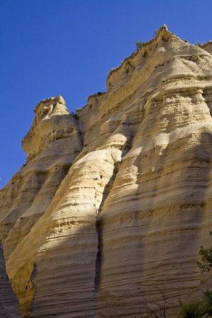
The terrain of Kasha-Katuwe comprises layers of volcanic rock and ash. This results in a flamboyant landscape of tapering hoodoos, similar to those seen in Cappadocia, Turkey.
Kasha-Katuwe Tent Rocks National Monument was designated a national monument by President Bill Clinton in January, 2001, just before he left office. The site, which covers 4,148 acres (16.78 sq km) is open only during the day. It is managed by the US Bureau of Land Management.
Visiting Kasha-Katuwe Tent Rocks National Monument, New Mexico
This national monument is located about 40 miles southwest of Santa Fe and 55 miles northeast of Albuquerque. From Interstate 25, turn off at Exit 259 then take State Highway 22 north. Look out for signage for Cochiti Pueblo and Kasha-Katuwe Tent Rocks National Monument.The area has basic facilities such as rest rooms, camping ground and parking area.
 Tent Rocks
Source: https://commons.wikimedia.org/wiki/File:Tent_rocks_MG_3171.jpg
Author: Julius Rückert

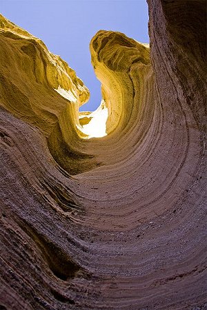
 Slot Canyon at Kasha-Katuwe Tent Rocks National Monument
Source: https://commons.wikimedia.org/wiki/File:Tent_rocks_MG_3174.jpg
Author: Julius Rückert

 Latest updates on Penang Travel Tips

Copyright © 2003-2025 Timothy Tye. All Rights Reserved.

 Go Back