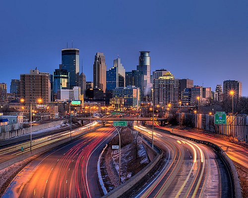
 Minneapolis skyline during the day
Source: https://commons.wikimedia.org/wiki/File:Minneapolis_skyline_151.jpg
Author: AlexiusHoratius

Minneapolis is the biggest city in Minnesota. Covering 58.4 sq mi (151.3 sq km), Minneapolis has a population of 383,000 (2011 estimate). It is within the Minneapolis-Saint Paul metropolitan area, which has a population of 3.5 million people, and is the 16th largest metropolitan area in the United States.
Minneapolis straddles the banks of the Mississippi River, to the north of the confluence with the Minnesota River, to the immediate west of Saint Paul, the capital of Minnesota. The terrain in this area was carved by glaciers resulting in an area dotted by lakes and waterfalls.
 Minneapolis skyline at dusk
Source: https://commons.wikimedia.org/wiki/File:MinneapolisSkyline.jpg
Author: PhotosByJeremiah

Minneapolis experiences a continental climate. Its winters are cold and dry, with average lows in January around 23°F (-5°C). Warmest month is July, when average temperature of the day may reach 77°F (25°C).
The area of present-day Minnepolis were inhabited by Dakota Sioux Native Americans. The first Europeans to arrive here were French explorers in the 1680's. The settlement of Minneapolis started as Fort Snelling, built by the US military in 1819. It is at Saint Anthony Falls, the tallest waterfall along the Mississippi. Initially there were two towns: Saint Anthony on the east bank of the river and Minneapolis on the west. The town of Minneapolis was incorporated in 1867. In 1872, the town of Saint Anthony was merged with Minneapolis to form a single city.
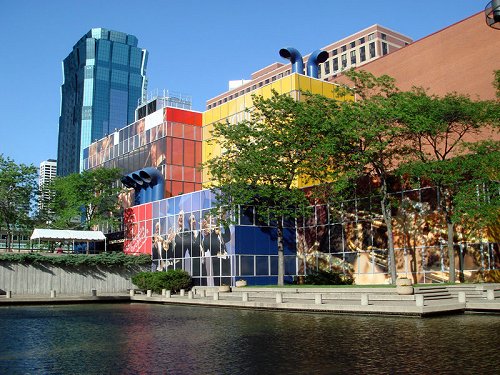
 Orchestra Hall, Minneapolis
Source: https://commons.wikimedia.org/wiki/File:060707-001-OrchestraHall.jpg
Author: Bobak Ha'Eri

The economy of Minneapolis was traditionally based on milling and timber. By the late 20th century, it has evolved to include commerce, finance, logistics and health care. Among the Fortune 500 companies with their headquarters in Minneapolis include Target Corporation, US Bancorp and PepsiAmericas.
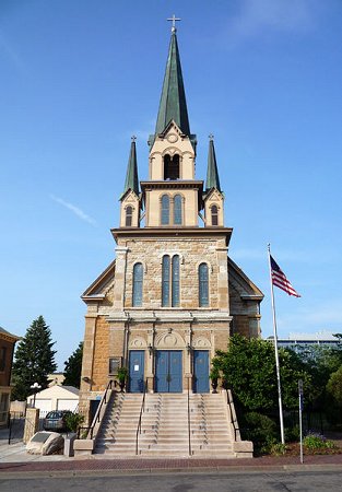
 Our Lady of Lourdes Catholic Church, Minneapolis
Source: https://commons.wikimedia.org/wiki/File:2008-0705-OurLadyofLourdesMPLS.jpg
Author: Bobak Ha'Eri

In the mid-20th century, a major urban renewal resulted in the demolition of some 40% of the buildings downtown, including many buildings that today are regarded as historically and architecturally significant. That unsympathetic form of urban renewal however is credited with generating better appreciation for heritage conservation.
Visiting Minneapolis, Minnesota
Interstate 35 and 94 are the two interstate highways connecting Minneapolis with the rest of the country. The I-35 runs north-south, connecting Minneapolis with Duluth to the north and Des Moines to the south. The I-9 runs northwest-southeast, connecting it with Fargo to the northwest and Eau Claire to the southeast.The Minneapolis-Saint Paul International Airport (MSP) is the main airport serving Minneapolis and Saint Paul. Arriving at this airport, you can take the Hiawatha Light Rail to downtown Minneapolis. Delta Air Lines has a hub in this airport, providing flights to major cities in the country as well as Tokyo, London, Amsterdam and Paris.
Places of Interest in Minneapolis, Minnesota
- Bakken Museum
- Bell Museum of Natural History
- Hennepin History Museum
- Lyndale Park
- Mill City Museum
- Minneapolis Institute of Arts
- Minneapolis Sculpture Garden
- Museum of Russian Art
- Our Lady of Lourdes Catholic Church
- Walker Art Center
- Weisman Art Museum
 Latest updates on Penang Travel Tips
About this website

Dear visitor, thank you so much for reading this page. My name is Timothy Tye and my hobby is to find out about places, write about them and share the information with you on this website. I have been writing this site since 5 January 2003. Originally (from 2003 until 2009, the site was called AsiaExplorers. I changed the name to Penang Travel Tips in 2009, even though I describe more than just Penang but everywhere I go (I often need to tell people that "Penang Travel Tips" is not just information about Penang, but information written in Penang), especially places in Malaysia and Singapore, and in all the years since 2003, I have described over 20,000 places.
While I try my best to provide you information as accurate as I can get it to be, I do apologize for any errors and for outdated information which I am unaware. Nevertheless, I hope that what I have described here will be useful to you.
To get to know me better, do follow me on Facebook!
Copyright © 2003-2025 Timothy Tye. All Rights Reserved.

 Go Back