Pinnacles National Monument, California
 Go Back
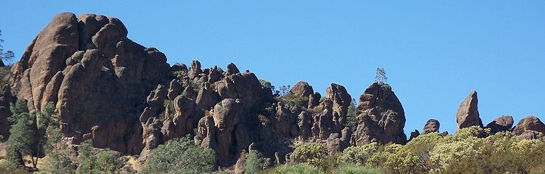 Pinnacles National Monument, California
Source: https://commons.wikimedia.org/wiki/File:USA-Pinnacles_National_Monument-Rim_Trail-14.jpg
Author: Eugene Zelenko

Pinnacles National Monument is a nature heritage site in San Benito County and Monterey County, California. It protects the Pinnacles, a jumble of eroded rock formations created by an extinct volcano.
Pinnacles National Monument covers 24,514 acres (9,920 ha). It was set aside as the Pinnacles Forest Reserve in 1906, and proclaimed a national monument by President Theodore Roosevelt on 16 January, 1908. It celebrated its Centennial in 2008 with numerous events honoring and remembering the people who were involved in the creation of the park.
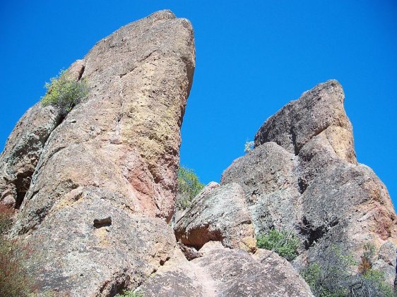 Rock formations at Pinnacles National Monument
Source: https://commons.wikimedia.org/wiki/File:USA-Pinnacles_National_Monument-Rim_Trail-1.jpg
Author: Eugene Zelenko
Pinnacles National Monument is in the Gabilan Mountains, about 80 miles (130 km) to the south of the San Francisco Bay Area, and about 40 miles (64 km) from the Pacific Ocean coast. The area has an elevation ranging from 824 ft (251 m) to 3,304 ft (1,007 m), at North Chalone Peak.
The vegetation of the area comprises California interior chaparral, woodlands, riparian and grassland. Temperature there ranges from 50°F to 100°F (10°C to 38°C). It receives some snow, especially in the higher parts, between mid-December to January.
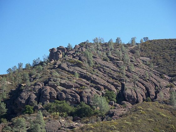 Pinnacles rock formations
Source: https://commons.wikimedia.org/wiki/File:USA-Pinnacles_National_Monument-Rim_Trail-12.jpg
Author: Eugene Zelenko
Visiting Pinnacles National Monument, California
From San Francisco, take US Highway 101 south till the city of Soledad. Turn off US 101 at Exit 303 and enter Soledad. From Soledad take State Highway 146 that leads to Pinnacles National Monument.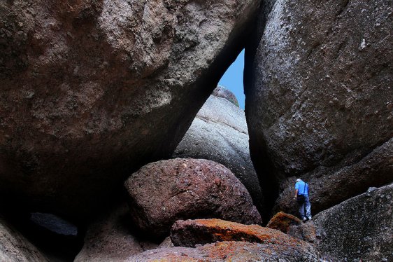 Boulders inside Balconies Cave, Pinnacles National Monument
Source: https://commons.wikimedia.org/wiki/File:Inside_Balconies_Cave_2.jpg
Author: Mila Zinkova
 Latest updates on Penang Travel Tips

Copyright © 2003-2025 Timothy Tye. All Rights Reserved.