 South Dakota, Prairie Wind Overlook, Badlands National Park, South Dakota
Source: https://commons.wikimedia.org/wiki/File:Cumulus_Clouds_over_Yellow_Prairie2.jpg
Author: Wing-Chi Poon

South Dakota is a state in the Midwestern region of the United States. It is 77,116 sq mi (199,905 sq km) in size, and measures 380 miles (610 km) from east to west and 210 miles (340 km) from north to south. It ranks 17th among the U.S. states by size.
South Dakota is bordered by North Dakota to the north, Minnesota to the east, Iowa to the southeast, Nebraska to the south, Wyoming to the southwest and Montana to the northwest. The highest point in South Dakota is Harney Peak, at 7,244 ft (2,209 m).
South Dakota has a population of slightly over 800,000 people, as of 2010 estimate. It is a sparsely populated state, ranking 46th out of the 50 in terms of population size.
South Dakota was known as Dakota Territory before gaining statehood on 2 November, 1889, becoming the 40th state to join the Union. It is within two time zones. The eastern half is in the Central time zone (-6/-5 GMT) while the western half in the Mountain time zone (-7/-6 GMT). The abbreviation for South Dakota is SD.
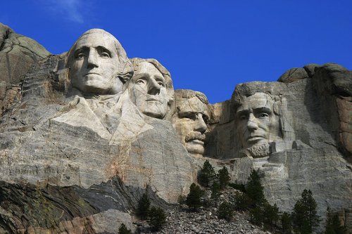
 Mount Rushmore National Memorial
Source: https://commons.wikimedia.org/wiki/File:Dean_Franklin_-_06.04.03_Mount_Rushmore_Monument_%28by-sa%29-2.jpg
Author: Dean Franklin

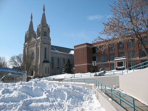
 St Joseph's Cathedral in winter in Sioux Falls
Source: https://commons.wikimedia.org/wiki/File:St_Josephs_3.jpg
Author: Sdgjake

Travel to South Dakota
By Plane The two main airports for South Dakota are the Sioux Falls Regional Airport (FSD) and the Rapid City Regional Airport (RAP).By Road Two interstate highways cut across South Dakota, with I-90 going east-west passing through Rapid City and Sioux Falls and I-29 going north-south from Fargo in North Dakota through Sioux Falls to Sioux City.
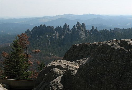
 The Needles, as seen from Harney Peak, South Dakota
Source: https://commons.wikimedia.org/wiki/File:Needles_from_Harney_Peak.jpg
Author: Jake DeGroot

Cities in South Dakota
- Aberdeen (25,000)
County seat of Brown County, home of Northern State University. - Brookings (22,000)
County seat of Brookings County and home of South Dakota State University. - Custer (1,800)
Small town considered the oldest established twon in the Black Hills. - Deadwood (1,400)
Small town and county seat of Lawrence County. - Mitchell (15,000)
County seat of Davison County. - Pierre (14,000)
State capital of South Dakota. - Rapid City (68,000)
Second largest city in South Dakota, on the eastern slope of the Black Hills. - Sioux Falls (124,000)
The largest city in Soluth Dakota. - Wall (800)
Small town famous for the Wall Drug Store.
Places of Interest in South Dakota
- Black Hills National Forest
- Minuteman Missile National Historic Site
- Mount Rushmore National Memorial
National Parks of South Dakota
National Monument in South Dakota
 Latest updates on Penang Travel Tips

Copyright © 2003-2025 Timothy Tye. All Rights Reserved.

 Go Back