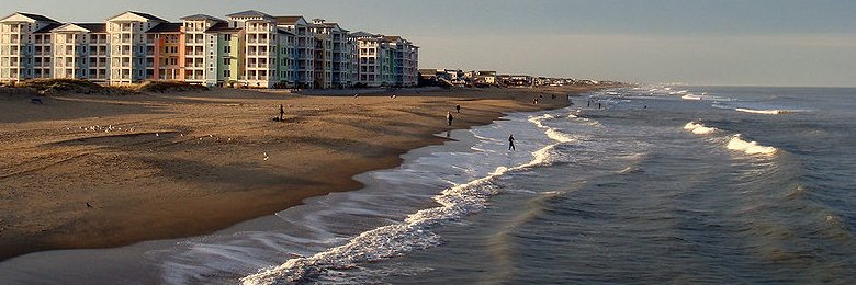
 Virginia, Virginia Beach
Source: https://commons.wikimedia.org/wiki/File:Sandbridgevacrawford.jpg
Author: Divineamor

Virginia, officially known as the Commonwealth of Virginia, is a state on the Atlantic coast in the Southern region of the United States. It has a total area of 42,774 sq mi (110,785 sq km), measuring 430 miles (690 km) from east to west and 200 miles (320 km) from north to south. It is the 35th largest of the 50 states in the U.S.
Virginia is bordered by Maryland to the northeast, North Carolina to the south, Tennessee to the southwest, Kentucky to the west and West Virginia to the northwest. The highest point in Vermont is Mount Rogers, which is 5,729 ft (1,747 m) tall.
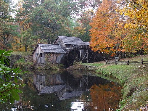 Mabrys Mill, Virginia
Source: https://commons.wikimedia.org/wiki/File:MabrysMill.jpg
Author: Lyricmac

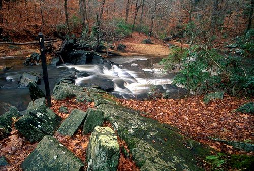 North Valley Trail, Virginia
Source: https://commons.wikimedia.org/wiki/File:North_valley_trail_pwfp.jpg
Author: National Park Service

Virginia has a population of 7.9 million people, making it the 12th most populous in the country. The largest city is Virginia Beach while the capital is Richmond. The state was formerly known as the Colony and Dominion of Virginia until became part of the United States on 25 June, 1788. It was the 10th state to gain admission to Union.
Virginia is in the Eastern time zone (-5/-4 GMT). Its abbreviation is VA.
 Appomattox Court House, Virginia
Source: https://commons.wikimedia.org/wiki/File:New_Appomattox_Court_House.jpg
Author: Doug Coldwell

Travel to Virginia
By PlaneDue to its proximity to the District of Columbia, travelers usually land at the Washington-Dulles International Airport (IAD) or the Ronald Reagan Washington National Airport (DCA), both located within Virginia but close to Washington, D.C. Of the two, Washington-Dulles has better international connections.
 Shenandoah Valley, Virginia
Source: https://commons.wikimedia.org/wiki/File:Shenandoah_Valley.jpg
Author: Karen Nutini

By Train
You can take the train by Amtrak to many cities in Virginia, including Alexandria, Charlottesville, Fredericksburg, Manassas, Norfolk, Richmond and Staunton.
By Road
Driving is the most practical way to explore Virginia. You should consider renting a car upon arrival at the airport. If you are driving to Virginia, there are several interstate highways to take. I-95 cuts through Virginia in the direction of Washington, D.C. and Baltimore, passing through Richmond. I-81 cuts diagonally through Virginia from southwest to northeast while I-64 goes across the state from east to west, connecting Virginia Beach with other parts of the state.
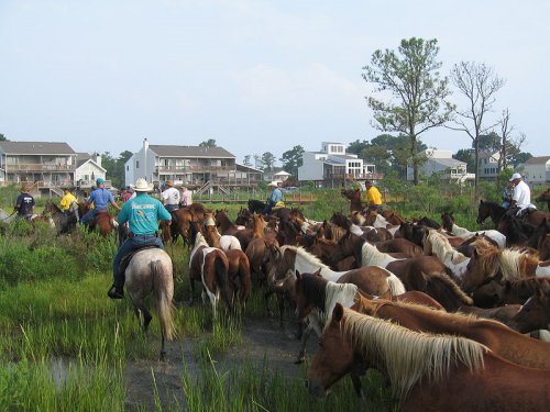 Salt Water Cowboys driving Chincoteague ponies in Chincoteague, Virginia
Source: https://commons.wikimedia.org/wiki/File:Chincoteague_Pony_Swim_1.jpg
Author: Leonard J. DeFrancisci

Cities in Virginia
- Alexandria (140,000)
City located 6 miles to the south of downtown Washington, D.C. - Arlington (208,000)
County across the Potomac River from Washington, D.C. - Charlottesville (43,000)
City named after Queen Charlotte, the consort of King George III of Great Britain. - Fredericksburg (23,000)
City 49 miles to the south of Washington, D.C. - Norfolk (243,000)
Seconde largest city in Virginia. - Richmond (204,000)
Capital of Virginia. - Roanoke (97,000)
A commercial and cultural hub of Virginia and southern West Virginia. - Virginia Beach (438,000)
Most populous city in Virginia. - Williamsburg (14,000)
City well-known for its restored historic area, Colonel Williamsburg. - Winchester (26,000)
City in the northwestern part of Virginia. - Yorktown (220)
Village where George Washington defeated General Cornwallis in the American Revolutionary War.
Places of Interest in Virginia
- Appomattox Court House and National Historical Park
- Blue Ridge Parkway
- Chincoteague
- Jamestown & Yorktown
- Skyline Drive
National Parks of Virginia
National Monuments in Virginia
National Memorials in Virginia
World Heritage Sites of Virginia
 Latest updates on Penang Travel Tips

Copyright © 2003-2025 Timothy Tye. All Rights Reserved.

 Go Back