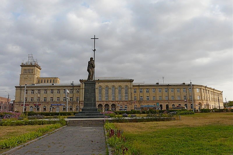
 The administrative building of Shirak Province in Gyumri, Armenia
Source: https://commons.wikimedia.org/wiki/File:Gyumri_Shirak_admin.jpg
Author: Rita Willaert

Author: Rita Willaert

Gyumri (Armenian: Գյումրի) is the capital and largest city of Shirak Province, in northwest Armenia. It covers 45 sq km (17.4 sq mi) and has a population of 146,000 (2011 estimate).
Gyumri is located by the banks of the Akhurian River, at an elevation of 1,509 m (4,952 ft). It is 126 km from Yerevan. With a history going back to the 8th century BC, it is one of the oldest cities with a recorded history in Armenia. Originally known as Gyumri (or Kumayri), it has also been called Alexandropol from 1840 to 1924 and Leninakan from 1924 to 1990.
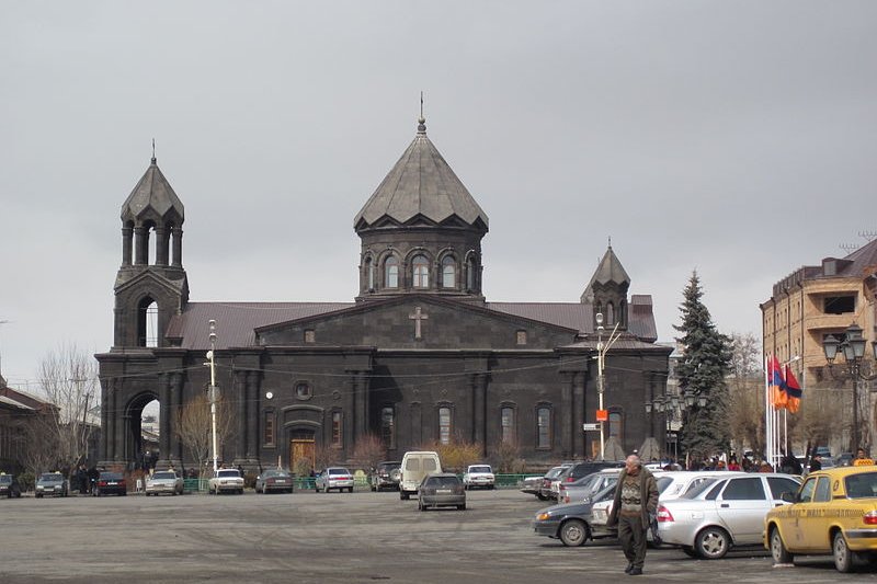
 Church of the Holy Mother of God, Gyumri
Source: https://commons.wikimedia.org/wiki/File:The_Holy_Saviour_Church_of_Gyumri.jpg
Author: Crispin Semmens

Author: Crispin Semmens

The earthquake of 1988 has destroyed many of the historic buildings in the old town of Gyumri, which otherwise has a rich history. Some of its neighborhoods, such as Kumayri, has survived the last two major earthquakes, in 1926 and 1988.
Today tourism has become an increasingly important source of revenue for Gyumri.
Visiting Gyumri
Shirak International Airport (LWN), located 5 km from Gyumri, is the second biggest airport in Armenia. It receives flights from Krasnodar, Moscow, Rostov-on-Don and Sochi.A more practical way to reach Gyumri from Yerevan is to take the van, called marshutni. You can board those at the Kino Rosia's parking lot.
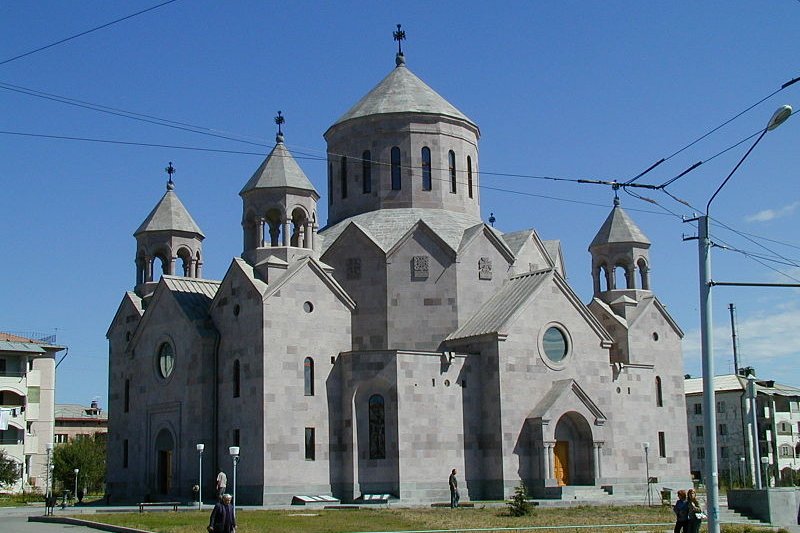
 Church of St Jacob of Nisibis, Gyumri
Source: https://commons.wikimedia.org/wiki/File:St-Hagop_gyumri.jpg
Author: Thomas Frederick Martinez

Author: Thomas Frederick Martinez

Places of Interest in Gyumri
- Aslamazyan Sisters House-Museum
Museum celebrating the work of Soviet-era artists, the Aslamazyan Sisters. - Cathedral of the Holy Mother of God (Surb Astvatsatsin)
Cathedral in Gyumri built in the 17th century. It is also called the Church of Seven Wounds (Yot Verk). - Cathedral of the Holy Saviour (Surb Amenapkich)
Cathedral that was originally built in 1847, destroyed by the 1988 earthquake, and has since been rebuilt. - Church of St Gregory the Illuminator
The local church dedicated to the patron saint of the Armenian Apostolic Church. - Church of St Jacob of Nisibis (Surb Hakob Mtsbinetsi)
A relatively new church completed in 2005. - Sev Ghul
Russian fortification dating to the 1830s.
 Latest updates on Penang Travel Tips
 Map of Roads in Penang
Looking for information on Penang? Use this Map of Roads in Penang to zoom in on information about Penang, brought to you road by road.
Copyright © 2003-2025 Timothy Tye. All Rights Reserved.

 Go Back