 Batu Uban, Penang (7 February 2019)
Batu Uban is a neighbourhood on the east central part of Penang Island. It centres on a hillock bordered by the Tun Dr Lim Chong Eu Expressway on the coast and Jalan Sultan Azlan Shah to the west. The traditional Malay village of Batu Uban still exists and is said to be one of the earliest settlements in Penang, pre-dating the arrival of Francis Light.
Today Batu Uban is characterised by the soaring apartments and condominiums, namely Sunny Ville, N-Park and E-Park. The location of Batu Uban, right at the centre of the east coast of Penang Island is strategic. It is roughly half way between George Town and Bayan Lepas, and it is also near the access to the Penang Bridge. There are two major roads serving Batu Uban namely the Tun Dr Lim Chong Eu Expressway and Jalan Sultan Azlan Shah. However this strategic location is also the reason these two major roads are congested, particularly during the evening rush hour and especially on Fridays.
Batu Uban on YouTube
 Map of Batu Uban, Penang
 Roads in Batu Uban
- Halaman Batu Uban
- Jalan Batu Uban
- Jalan Batu Uban 1
- Jalan Batu Uban 2
- Jalan Batu Uban 4
- Jalan Batu Uban 5
- Lorong Batu Uban 1
- Lorong Batu Uban 2
- Lorong Batu Uban 3
- Lorong Batu Uban 4
- Lorong Batu Uban 5
- Persiaran Batu Uban
- Persiaran Batu Uban 1
- Tingkat Batu Uban 1
- Tingkat Batu Uban 2
- Tingkat Batu Uban 3
 Housing Estates in Batu Uban
- Century Garden (GPS: 5.34741, 100.30392)

- The Sanctuary (GPS: 5.3475, 100.30771)

- Uni Vista (GPS: 5.35322, 100.3093)

- Vilaris @ The Sanctuary (GPS: 5.34867, 100.30682)

Apartments & Condominiums in Batu Uban
- Century Bay Apartments (GPS: 5.34499, 100.30519)

- Desa Bistari Apartment (GPS; 5.34605, 100.30563)

- E-Park Condominium (GPS: 5.35091, 100.30836)

- N-Park Condominium (GPS: 5.35024, 100.30734)

- Sunny Ville Condominium (GPS: 5.35151, 100.30714)

- Taman Batu Uban 2 Apartment (GPS: 5.34503, 100.30405)

- Taman Utara Flats (GPS: 5.35102, 100.30505)

- The Curve Condominium (GPS: 5.355, 100.30988)
 PLANNED
 - The Pier (GPS: 5.35222, 100.31332)
 PLANNED
 - The View (GPS: 5.35637, 100.31069)

- The Zen (GPS: 5.35134, 100.31092)

- Triuni Residences (GPS: 5.34917, 100.308)

- Villa Sri Kenanga (GPS: 5.35258, 100.30761)

- U1 @ Batu Uban (GPS: 5.35258, 100.30761)
 PLANNED
 - Zen6 (GPS: 5.35269, 100.31151)

- Zen9 (GPS: 5.35355, 100.31172)

 Commercial Properties in Batu Uban
- Sunny Point Complex (GPS: 5.35305, 100.30739)

 Sights in Batu Uban
- Masjid Jamek Batu Uban (GPS: 5.35041, 100.30917)

- Road Transport Department (GPS: 5.35157, 100.30402)

- San Kiang Cemetery (GPS: 5.3461, 100.30409)

History of Batu Uban
The settlement of Batu Uban predates the arrival of Captain Francis Light in Penang. Batu Uban is said to have been founded by Haji Mohammad Salleh, also called Nakhoda Intan, who came from Pagar Ruyong in Minangkabau. He was granted permission from the Sultan of Kedah to establish a settlement there in 1734.1 In 1749, the Sultan of Kedah awarded 100 acres of land to a Minangkabau trader-warrior, Dato' Jenaton, who had business interests on both sides of the Straits of Malacca (then known as the Malay Sea), in return for Dato' Jenaton having thwarted a Siamese invasion.Batu Uban is one only pocket of beachfront on the eastern coast of Penang Island that is not covered by mangrove swamp. A Minangkabau settlement is believed to have sprouted up in the area. It received an influx of traders from Arabia towards the mid 18th century, but was already in decline after the demise of Dato' Jenaton in 1789. While remains of Malay settlements remain in Batu Uban and Sungai Gelugor, many of the Malays and traders moved north to resettle in the newly-established George Town, in places that became present-day Malay Street and Acheen Street.
Location of Batu Uban
Measured from the junction of Jalan Batu Uban with Jalan Sultan Azlan Shah (GPS: 5.353240, 100.306804), Batu Uban is 8.3 km to Komtar, 1.9 km to the Penang Bridge, 8.8 km to the Second Penang Bridge and 8.0 km to the Penang International Airport.Public Transport in Batu Uban
The Batu Uban Malay village is close to the bus stop at Jalan Sultan Azlan Shah while the high rise apartments are a distance of about 250 meters from it. Rapid Penang Bus No. 301, 303 and 304 pass by along the road. Batu Uban is 8.3 km from Komtar, making it of moderate distance from the city centre.Amenities in Batu Uban
The nearest schools to Baru Uban are Sekolah Kebangsaan Sungai Gelugor, a Malay primary school, Sekolah Menengah Jenis Kebangsaan (Cina) Phor Tay, and three Chinese primary schools, Sekolah Rendah Jenis Kebangsaan (Cina) Keong Hoe in Sungai Dua; and Kwang Hwa Primary School and Shih Chung (Primary) Branch School in Sungai Nibong. The nearest market from Batu Uban is at Lip Sin. The nearest shopping mall is Queensbay Mall. The nearest hypermarkets are Tesco Extra and Lotus's Penang, both about the same distance away. The nearest petrol station from Batu Uban is the Mobil at Pantai Jerejak and the Caltex next to Lotus's Penang. There isn't a hospital really nearby. Pantai Hospital and Lam Wah Ee Hospital are both about equal distance away.Traffic in Batu Uban
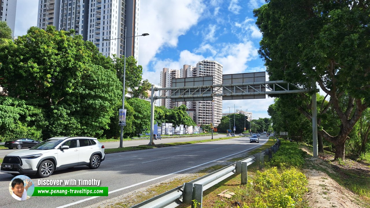
Due to it being surrounded by major roads, it is easy to go from Batu Uban to elsewhere in Penang. The Penang Bridge is just a short distance away. However, this proximity to major roads also work against it during rush hour, when the traffic jam entering Penang Bridge can create a deadlock around Batu Uban. Tun Dr Lim Chong Eu Expressway passing through Batu Uban (18 June 2024)
References
- Early History of Penang, edited by Muhammad Haji Salleh, published by USM, page
List of Towns in Penang and Towns in Malaysia

Copyright © 2003-2025 Timothy Tye. All Rights Reserved.

 Go Back