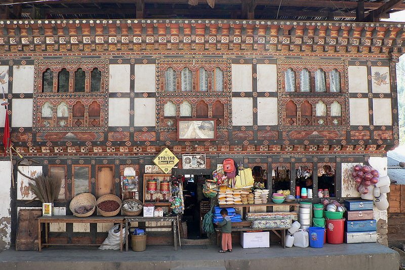
 Roadside shop in Thimphu, Bhutan
Source: https://commons.wikimedia.org/wiki/File:Roadside_shops_north_of_Thimphu.jpg
Author: Stephen Shephard

Thimphu is the capital and largest city in Bhutan. It has a population of over 80,000 people (2010 estimate). The city is located on the western bank of the Wang Chuu River, also called the Thimphu Chuu River, at a height of about 2,500 meters (8,202 ft) above sea level.Author: Stephen Shephard

Thimphu dominates Bhutan's economy, contributing close to half of the nation's GNP. This is where you find many of the government buildings such as the National Assembly and the Dechencholing Palace.
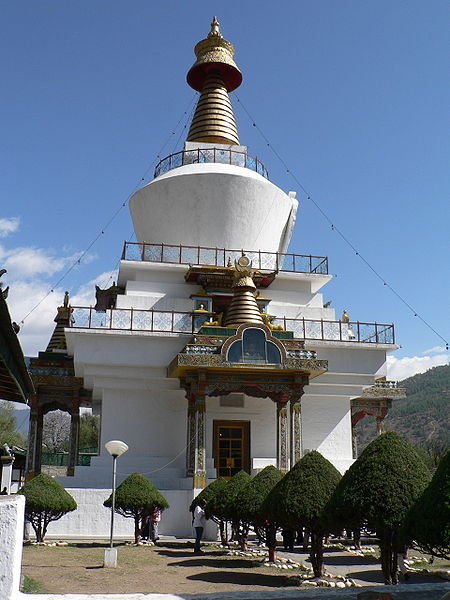
 National Memorial Chorten
Source: https://commons.wikimedia.org/wiki/File:Memorial_Chorten,_Thimphu.jpg
Author: Stephen Shephard

Author: Stephen Shephard

Climate of Thimphu
The warmest month in Thimphu is from May to June. However, it is also a wet and humid time. On the other hand, the winters are very cold. The best time to visit is in autumn, between the middle of September to end of October, when you are most likely to get blue skies. Temperature during this time is between 10°C to 23°C.Arriving in Thimphu
The international airport is not located in Thimphu, but rather in the town of Paro, which is 54 km (34 mi) away. It takes about one hour to get from the airport to the capital. As a tourist, you will most likely have your transfer arranged for you by the tour operator. This most likely will be a bus or van.Getting around Thimphu
Outside your tour itinerary, you can explore Thimphu on foot, or take a taxi or bus. Taxis have a set rate for places around the city, with the maximum charge set at 60 nu. Cheri Goemba Monastery
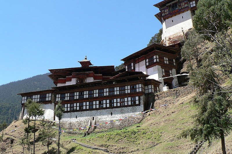
Source: https://commons.wikimedia.org/wiki/File:Cheri_Goemba_3.jpg
Author: Stephen Shephard

Author: Stephen Shephard

Places of Interest in Thimphu
- Botanical Gardens
A relaxing garden located 10 km from Thimphu city centre. - Changangkha Lhakhang
The oldest temple in Thimphu Valley. - Coronation Park
Park beside the river near the city stadium. - National Folk Heritage Museum
Museum showcasing the rural life in Bhutan. - National Memorial Chorten
This is a chorten, or Tibetan-style stupa, where the locals offer their prayers. - Simtokha Dzong
Built in 1629, this was the first Bhutanese monastic fortress built in a unified Bhutan. - Takin Preserve
A preserve for the takin, a cross between a cow and a goat, regarded as the national animal of Bhutan. - Textile Museum
Museum showcasing exquisite Bhutanese textiles and tapestries. - Trashichhoe Dzong
Monastic fortress housing both religious as well as civic bodies. - Zangthoperi Lhakhang
Temple built in the 1960's with beautiful murals and a collection of Bhutanese art. - Zorig Chusum School of Traditional Arts
School established in 1971 to preserve the traditional arts of Bhutan.
 Latest updates on Penang Travel Tips
 Map of Roads in Penang
Looking for information on Penang? Use this Map of Roads in Penang to zoom in on information about Penang, brought to you road by road.
Copyright © 2003-2025 Timothy Tye. All Rights Reserved.

 Go Back