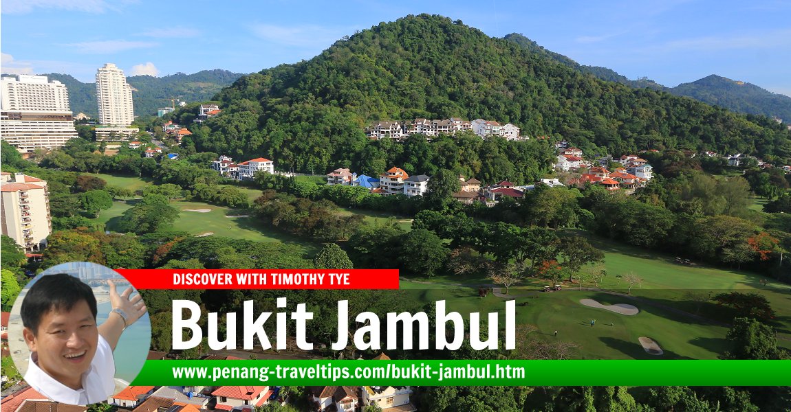
 Bukit Jambul, Penang (8 April 2017)
Bukit Jambul (GPS: 5.34031, 100.28307; Simplified/Traditional Chinese: 武吉占姆) is a place on the east-central part of Penang Island. It is bordered by Sungai Dua, Sungai Nibong Kecil, Bayan Baru, Relau and Bukit Gambir. In fact, parts of what is Sungai Nibong Kecil and Sungai Nibong Besar overlap with Bukit Jambul, which itself is within the district of Bayan Lepas.
Much of Bukit Jambul is hilly. The earliest development was at Hotel Equatorial in 1984, but since then, development of Bukit Jambul has spread to include areas which was previously part of Sungai Nibong Kecil. Bukit Jambul Complex, for example, is located within Sungai Nibong Kecil.
For the past thirty years, the one and only mainstream hotel in Bukit Jambul is the 5-star Hotel Equatorial. It is still the biggest hotel in the area, though there are now smaller mainstream hotels in the vicinity, among them AC Hotel Penang Bukit Jambul and Alora Hotel.
The name Bukit Jambul refers to the hillock on which Hotel Equatorial is located. The hill trek which is often regarded as Bukit Jambul is actually located at Bukit Pasir, but has since been referred to as the Bukit Jambul Hiking Trail. Within the Bukit Jambul area is the Penang Golf Club. Apart from Hotel Equatorial, Vistana Hotel is also located at the foot of Bukit Jambul.
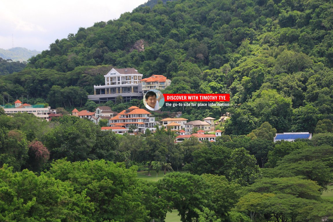
Within Bukit Jambul is a wide spectrum of neighbourhoods ranging from the affluent community of Lebuh Bukit Jambul, to the middle class homes in Solok Bukit Jambul, to the working class village of Kampung Seberang Paya, hemmed in between the Seri Nibung Apartments and the Bukit Jambul Golf Course.
Song about Bukit Jambul
 Map of Bukit Jambul, Penang
High-Rise Residential Properties in Bukit Jambul
- Alpine Tower (GPS: 5.3456, 100.27387)

- Ayu Heights (GPS: 5.34102, 100.2886)

- Bukit Jambul Indah/Jambul Apartments (GPS: 5.34161, 100.28215)

- Fairway View Apartment (GPS: 5.33715, 100.28923)

- Golf View Apartment (GPS: 5.33974, 100.29237)

- Hillcrest Residences (GPS: 5.33938, 100.28365)

- Jambul Heights (GPS: 5.33424, 100.27998)

- Krystal Suria Apartment (GPS: 5.33278, 100.29404)

- Lakeside Towers (GPS: 5.3455, 100.27616)

- Parkview Towers (GPS: 5.34524, 100.27451)

- Taman Bukit Jambul (GPS: 5.33476, 100.28832)

- Terrace Condominium (GPS: 5.34319, 100.28007)
- The Address @ Bukit Jambul (GPS: 5.33903, 100.28302)

 Landed Residential Properties in Bukit Jambul
- Asia Hills (GPS: 5.34623, 100.29182)

- BJ Cove (GPS: 5.343, 100.28183)

- Jambul Hill Residences (GPS: 5.33403, 100.2813)

- Krystal Garden (GPS: 5.33505, 100.29178)

- Metro Residence (GPS: 5.34699, 100.27375)

- Taman Jasmine (GPS: 5.33522, 100.29273)

- TréHaus (GPS: 5.34415, 100.27967)

- Vista Jambul (GPS: 5.33549, 100.27914)

Low- and Low-Medium-Cost properties in Bukit Jambul
- BJ Court (GPS: 5.33397, 100.29196)

- Dafe Court (GPS: 5.33381, 100.2897)

- Desa Daya (GPS: 5.33561, 100.28012)

- Desa Golf (GPS: 5.33415, 100.28036)

 Commercial Properties in Bukit Jambul
- Bayan Point (GPS: 5.33237, 100.29423)

- I-Avenue (GPS: 5.33287, 100.29336)

- Krystal Square (GPS: 5.33589, 100.29068)

- The CEO Building (GPS: 5.33649, 100.29237)

Streets in Bukit Jambul
- Halaman Bukit Jambul
- Jalan Bukit Gambir
- Jalan Bukit Jambul
- Jalan Kampung Relau
- Jalan Rumbia
- Jalan Tun Dr Awang
- Lebuh Bukit Jambul
- Lengkok Bukit Jambul
- Lintang Bukit Jambul
- Lintang Bukit Jambul 1
- Lintang Bukit Jambul 2
- Lintang Bukit Jambul 3
- Lorong Bukit Jambul
- Persiaran Bukit Jambul
- Persiaran Bukit Jambul 1
- Persiaran Bukit Jambul 2
- Persiaran Bukit Jambul 5
- Persiaran Bukit Jambul 6
- Solok Bukit Jambul
- Solok Bukit Jambul 1
- Solok Bukit Jambul 2
- Solok Bukit Jambul 3
- Solok Bukit Jambul 4
- Solok Bukit Jambul 5
- Solok Kampung Relau 1
- Tingkat Bukit Jambul
- Tingkat Bukit Jambul 1
- Tingkat Bukit Jambul 2
 Hotels in the Bukit Jambul area
The hotels in the Bukit Jambul area is ideal for visiting executives to the Bayan Lepas Free Industrial Zone, as they are not as far away as those in the city. There are a number of hotels and executive suites in this area.Alora Hotel(GPS: 5.333710, 100.294285; closed)
- Hotel Equatorial (GPS: 5.337897, 100.284578)

- AC Hotel Penang Bukit Jambul (GPS: 5.336519, 100.291774)

 Sights in Bukit Jambul
- BJ Complex Clocktower (GPS: 5.333470, 100.291439)

- Bukit Jambul Complex (GPS: 5.33376, 100.29096)

- Bukit Jambul Hiking Trail (GPS: 5.3429, 100.28211)

- Fairview International School (GPS: 5.34589, 100.27485)

- Kayu Mati Muslim Cemetery (GPS: 5.33386, 100.28106)

- Masjid Al-Ittifaq (GPS: 5.33283, 100.2871)

- Murraya Indah Neighbourhood Park (GPS: 5.34347, 100.29146)

- Tai Su Yah Temple (GPS: 5.33658, 100.28817)

- Taman Kejiranan Bukit Jambul (GPS: 5.33567, 100.28847)

- Tanah Lapang Bukit Jambul (GPS: 5.33446, 100.28822)

What to eat at Bukit Jambul
- Andy Tan recommended the Nasi Melayu in front of Bukit Jambul Complex on 13 November, 2019.
- Hokkien Mee at New Cathay Cafe (GPS: 5.335368, 100.289794), in Bukit Jambul, Penang, was recommended by Evevy Ang on 20 September, 2019
- Laksa and Fried Popiah at Qi Yen Kopitiam (GPS: 5.332854, 100.291381), in Bukit Jambul, Penang, was recommended by Easter Yeoh on 18 September, 2019
- Wan than mee at Taman Bukit Jambul, in Bukit Jambul, Penang, was recommended by Deric Ong on 17 September, 2019
 Coffee Shops and Restaurants in Bukit Jambul/Sungai Nibong Kecil
- Daorae Korean BBQ Restaurant
- Golden Cafe (coffee shop)
- Golden Phoenix Chinese Restaurant, Hotel Equatorial
- HK Gourmet Kitchen (Hong Kong cuisine)
- Hou Mei Yuen Cafe (pan mee shop)
- Ichyo Japanese Restaurant
- Kampachi Japanese Restaurant, Hotel Equatorial
- Nasi Kandar Zamruud
- New Cathay Cafe (GPS: 5.33539, 100.28978)

- Restoran Istimewa Chou Yang
- Restoran Khaleel
- Tanduk Cafe
- Thanks Boss Kopitiam
Clinics in Bukit Jambul area
- E.L. Lim Dental Surgery
- Happy Life TCM Clinic (GPS: 5.33649, 100.29237)
- Relau Dental Surgery
 Businesses in Bukit Jambul
- 7-Eleven (convenience store)
- Advance Optometrist
- Agensi Pekerjaan Strategi Setia
- Bamboo Catering
- Ban Hin Bee (electrical appliances)
- Bata (shoe store)
- BJ Complex Indian Barber
- BJ Pharmacy
- Cellini (furniture)
- Chian Soon Tyre Battery (PG) Sdn Bhd
- Chuan Peng Heang (Chinese pastries)
- Clara International (beauty academy)
- Diang Exhaust Pipe Service
- Dr Clean Dry Cleaning Centre
- Duaria (car dealer)
- Easyclean Dryclean & Laundry
- Farmasi Rheco
- Happy Mart (convenience store)
- Hock Hee Tyre (Tayaria)
- Hong Keong Hardware
- Hong Leong Bank
- Hot Print Design & Advertising
- Jion Pharmacy
- Kedai Teh Bamboo (tea shop)
- Madam Hsu Beauty Parlour
- Maybank
- Medix Lab (medical lab)
- Northern Image (furniture)
- Ohana Confinement Villa (GPS: 5.33804, 100.28558)

- On-Cost Auto Mart (car accessories)
- Pusat Tuisyen Bestari, phone: 016 421 8007
- Sen Heng
- Sweet Forest Pastries
- The Vitamin Shop (pharmacy)
- T&T Kitchen Utensil Supplies
- Thye Huat (hardware)
- TopKids Bukit Jambul
- Watsons
Clinics in Bukit Jambul
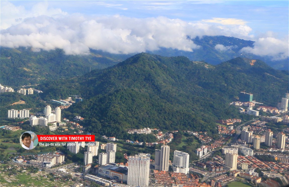 Aerial view of Bukit Jambul in 2017 (3 April 2017)
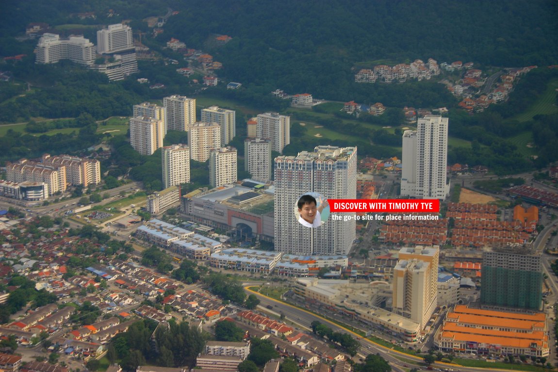 Aerial view of Bukit Jambul in 2006 (29 August 2006)
Location of Bukit Jambul
Measured from the junction of Persiaran Bukit Jambul with Jalan Tun Dr Awang (GPS: 5.331621, 100.283118), Bukit Jambul is 12.8 km to Komtar, 6.3 km to the Penang Bridge, 7.5 km to the Second Penang Bridge and 4.6 km to the Penang International Airport.Going to Bukit Jambul
Rapid Penang Bus 301 and 302 pass along Jalan Bukit Gambir, which skirts through the Bukit Jambul area. Buses no. 301, 302, 303, 304, 305, 306, 307 and 308 all pass through Jalan Tun Dr Awang, which also skirts the Bukit Jambul area.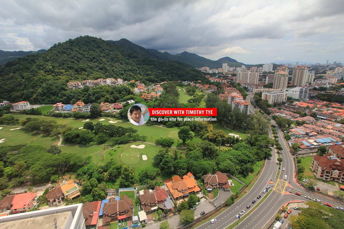 Bukit Jambul, Penang (14 August 2014)
 Bukit Jambul, Penang (29 April 2015)
List of Towns in Penang and Towns in Malaysia

Copyright © 2003-2025 Timothy Tye. All Rights Reserved.

 Go Back