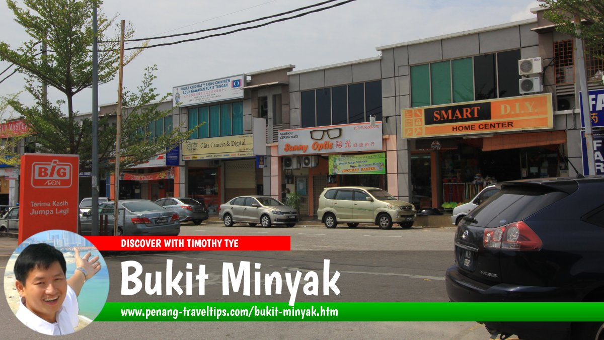
 Bukit Minyak, Seberang Perai Tengah (13 July 2014)
Bukit Minyak (GPS: 5.32874, 100.44836) is a place in Seberang Perai Tengah. It is named after the village of Kampung Bukit Minyak which is located along the banks of Sungai Juru (also called Sungai Rambai and Sungai Ara upstream).
Bukit Minyak is characterized by a mixed development comprising both residential as well as industrial properties. The Bukit Minyak Industrial Park is located here.
Bukit Minyak is bordered by the North-South Expressway to the west, Simpang Ampat to the south, Alma to the northeast and Bukit Tengah to the northwest.
 Map of Bukit Minyak, Seberang Perai
High-rise residential properties in Bukit Minyak
- Goodfields Residence (GPS: 5.32974, 100.44924)

- Utama Sanctuary (GPS: 5.33443, 100.46243)

 Landed Residential Properties in Bukit Minyak
- 98 Residence (GPS: 5.32646, 100.43764)

- BM Permai (GPS: 5.33281, 100.452)

- Carnation Villa (GPS: 5.33281, 100.452)

- Sentinelle Ville (GPS: 5.33114, 100.46273)

 Petrol Stations in Bukit Minyak
- BHPetrol Bukit Minyak (GPS: 5.34103, 100.4374)

- Caltex Bukit Minyak (GPS: 5.32878, 100.44888)

- Petron Bukit Minyak (GPS: 5.32936, 100.44812)

- Petronas Bukit Minyak (GPS: 5.33834, 100.44015)

- Shell Bukit Minyak (GPS: 5.33493, 100.46472)

Shopping centres and hypermarkets in Bukit Minyak
- AEON Big Bukit Minyak (GPS: 5.32842, 100.44616)

Hospitals and public clinics in Bukit Minyak
- Klinik Kesihatan Bukit Minyak (GPS: 5.32599, 100.44887)

 Schools in Bukit Minyak
- Kolej Vokasional Seberang Perai (GPS: 5.32687, 100.44207)

- SK Bukit Minyak (GPS: 5.33444, 100.45854)

- SK Permai Indah (GPS: 5.33125, 100.44094)

- SMK Permai Indah (GPS: 5.32944, 100.44372)

Places of worship in Bukit Minyak
- Masjid Tok Lebai Hashim (GPS: 5.33213, 100.45036)

Roads in Bukit Minyak
Getting there
Exit the North-South Expressway at the Juru Interchange (Exit 160). There isn't a regular Rapid Penang bus service to this area, which is served mostly by factory buses.Nearby Sights
 Federal Route 1 heading towards Bukit Minyak (17 March 2013)
Bukit Minyak is  on the Map of Seberang Perai
More on Penang Mainland; List of Towns in Penang and Towns in Malaysia

Copyright © 2003-2025 Timothy Tye. All Rights Reserved.

 Go Back