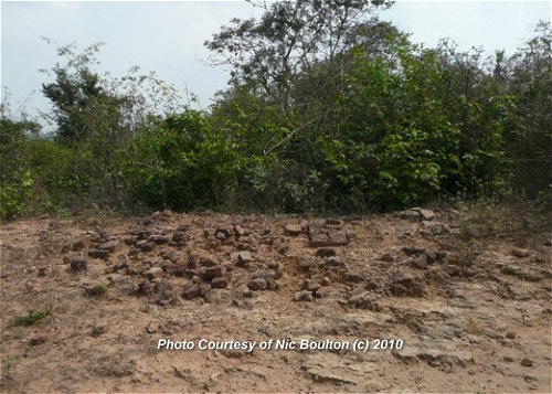
 Kuk Dong (1February, 2010)
© Nick Boulton
Prasat Kuk Dong (GPS: 13.31624, 103.96764), or simply just Kuk Dong, is a small, rather disappointing Angkor ruin. It was explored by my online friend Nic Boulton, who wondered aloud whether he actually found it. Well anyway, he thought he did, and volunteered the information on how to get there, which I am adding to this page.
Nic discovered it through the directions provided by some country folks who were at the Community Learning Centre on a poultry adult education course. It got him to within 150 meters of the ruins, the final 150 meters of which was courtesy of a kind young lady who was tending her cattle in a nearby field, and she sort of brought him by the nose to Kuk Dong.
Prasat Kuk Dong is  in the centre of the Map of Angkor
According to Nic, Kuk Dong is a raised mound, roughly 20 meters in diameter.There seems to be a sandstone floor to it in parts, although this is pretty worn. In some photos you can make out the weathering on the floor as it falls down in small 'plateaus'. There is a circular flat area surrounding the mound. Perhaps this was a path or a moat in earlier times.
The only really discernable ruins remaining are a few coarse building blocks (see the first picture on this page). The only other thing that was notable was a single Linga-base that was present. This was in quite good condition and seemed pretty incongruous with the rest of the site.
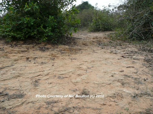 Possible Sandstone floor of Kuk Dong (1February, 2010)
© Nick Boulton
How to reach Kuk Dong
From the Community Learning Centre in the village of Kok Srok, head north (yes, back up the road you just came down from Prasat Prei Monti). After about 40 m, you will see Junction
  on the right. It is depressed about 1 meter lower than the main road so should be easy to find. The path is of very soft sand so you will have to go on foot from here (there were some 4-wheeled vehicle tracks in the sand, but they looked like an agricultural vehicle - I doubt that a tuk-tuk driver would go down here).
Head East down this path for about 700m. You will come to a crossroads with another sand path (actually it is a slightly offset crossroads) this is Junction
 . Looking diagonally to the left (i.e. towards the North East) is a field of crops. You need to leave the path and head for the diagonally opposite corner of this field.
The Northeast corner of the field is Junction
 . You will see the mound ahead of you (covered in trees and bushes) at Junction
  . There are a few entrances around the edge of it. The most obvious one is another 20 meters North East of Junction
  .
.
Directional Map to Kuk Dong
Here's my interpretation of the direction provided to me by Nic to reach Kuk Dong. Yoni of Kuk Dong, lingga missing (1February, 2010)
© Nick Boulton
Directional Photos to Kuk Kong
The following photos from Nic Boulton shows the direction to take to reach Prasat Kul Dong.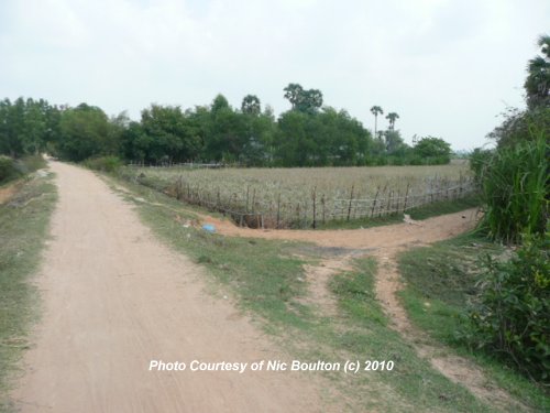 Turn Right to Kuk Dong
  (1February, 2010)
© Nic Boulton
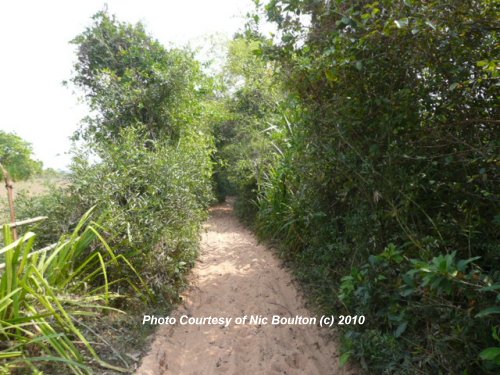 Travelling on the sandy track between
  and
and  (1February, 2010)
© Nic Boulton
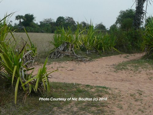 At Junction 3 looking towards Kuk Dong and Junction
(In this picture, you are looking at Junction 3 from the West and you need to go towards the North East,
so you are actually making a 1/8th turn to the left so as to head across the field.)(1February, 2010)
© Nic Boulton
 Latest updates on Penang Travel Tips
 Map of Roads in Penang
Looking for information on Penang? Use this Map of Roads in Penang to zoom in on information about Penang, brought to you road by road.
Copyright © 2003-2025 Timothy Tye. All Rights Reserved.

 Go Back