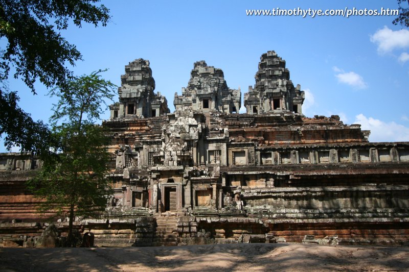
 Ta Keo (24 February, 2006)
Ta Keo (GPS: 13.44457, 103.88249) is a majestic but otherwise plain Angkor temple-mountain dedicated to Shiva. Its name, which means "tower of glass/crystal" is really a modern description rather than the original ancient name.
Judging from the lack of carvings found on it, Ta Keo was probably never completed before it was abandoned. joining a whole lot of ancient Angkor abandoned projects. Nevertheless, even as it is, Ta Keo was impressive.
360° View of Ta Keo on Google Maps Street View
Ta Keo is  in the centre of the Map of Angkor
This gigantic temple is similar in appearance to Phnom Bakheng and Pre Rup. Its call to fame at Angkor is that Ta Keo was the first temple to be built entirely of sandstone. As it is incomplete, hence unadorned, this aspect makes it look all the more massive. Temple carving had just started when somehow, the whole project stopped.
I have visited Ta Keo a few times, and while I marvelled at this temple, I shook my head whenever I thought of climbing it. The staircase up this temple - and a few other ruins in Angkor, if I may add - were so steep! The east and south staircases are the easiest to climb, but still all are steep. Like Bayon, Phnom Bakheng and Pre Rup, Ta Keo was built to play the role of a state temple. In this case, for Jayavarman V, son of Rajendravarman, who built of Pre Rup and East Mebon.
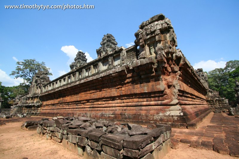
 Side view of Ta Keo (24 February, 2006)
If you read about Bayon, Phnom Bakheng and Pre Rup, you'd learn that these state temples are all located right at the centre of the ruler's city. In this case, Jayavarman V broke with tradition in that Ta Keo was not placed in the centre of his new capital Jayendranagari, but sited due north, at the centre of the west bank of a baray.
Designed to represent the five peaks of Mount Meru, Ta Keo has five towers, or prasats, at the centre of its top tier. Like all Angkor ruins, Ta Keo is a modern Khmer name. The ancient name for this temple is Hema-sringagiri, which means "Mountain of Golden Peaks". These probably refers to the prasats which would be gilded when completed - alas, they never were.
There is a causeway that connects the east entrance of Ta Keo to the East Baray half a kilometers away, though this is hardly visible today. A moat, now dry, surrounds Ta Keo. What makes Ta Keo so "impenetrable" is that its outer enclosure is sitting on a raised platform. Once you've climbed that through the gopuras, you find that the inner enclosure is also on another raised platform, as high as 5.5 meters. On this second platform is the pyramid temple. On both sides of the inner enclosure gopura is a library.
The pyramid temple is on three tiers. Together with the platform, Ta Keo is over 21 meters high - which is pretty high. At the top of the pyramid are the prasats, five unadorned towers of massive stones. Had Ta Keo been completed, these prasats would most likely be heavily adorned with carvings. But as they are, they gave us a glimpse at home an Angkor temple was like, in the middle of construction.
Like many of the temples that face the east, Ta Keo is best visited in the morning. On a clear day, you can visit it at any other time, as the prasats look similar at different times from different angles.
Construction Details
Built in the late 10th to early 11th Centuryby King Jayavarman V (reigned 968-1001)
and King Suryavarman I (reigned 1002-1050)
How to reach Ta Keo
There are two ways to reach Ta Keo. It depends on whether you're coming from the direction of Angkor Thom, or from Ta Prohm. From Angkor Thom, Ta Keo is 1 kilometer to the east of Angkor Thom's Victory Gate. You would have passed by Thommanon and Chau Say Tevoda on your way here.From the opposite direction, Ta Keo is also a similar distance from Ta Prohm. Ta Keo is located on a bend of the road, bordered by it on the west and south. Something as big as Ta Keo would not be easy to overlook, so most tuk tuk drivers will be able to take you there. If you're on a packaged tour, it may also be included in the itinerary, if time permits. If you wish to use the tuk tuk driver that drove me, contact him, Mr Han (contact details below), to see if he is available to take you.
 Latest updates on Penang Travel Tips
 Map of Roads in Penang
Looking for information on Penang? Use this Map of Roads in Penang to zoom in on information about Penang, brought to you road by road.
Copyright © 2003-2025 Timothy Tye. All Rights Reserved.

 Go Back