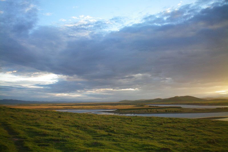
 Landscape of Gansu Province
Source: https://commons.wikimedia.org/wiki/File:%E4%B9%9D%E6%9B%B2%E9%BB%84%E6%B2%B3%E7%AC%AC%E4%B8%80%E6%B9%BE1.JPG
Author: Zhangmoon618

Author: Zhangmoon618

Gansu Province 甘肃省 is a province of China located on the western part of the country. Sandwiched between the Tibetan plateau and Huangtu plateau, Gansu Province borders Mongolia, Inner Mongolia Autonomous Region and Ningxia Autonomous Region to the north, Shaanxi Province to the east, Sichuan Province to the south, Qinghai Province to the west and Xinjiang Autonomous Region to the northwest.
Gansu Province covers 454,000 sq km (175,000 sq mi). It is the 7th largest province in China. Gansu has a population of 26.5 million people (2011 estimate), and a large percentage of Hui Chinese, who regard it as their historical home. The province has a GDP of CNY 338.2 billion in 2009, ranking 27th and a per capita GDP of CNY 12,836, putting it in 30th position.
Parts of Gansu Province is in the Loess Plateau, with other parts within the Gobi Desert, Badain Jaran Desert and Tengger Desert. The Huanghe is the main river flowing through the region. The terrain in mountainous with the highest mountain being Qilian Shan, at 5,547 meters.
Going to Gansu Province
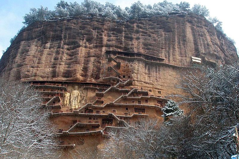
Visitors to Gansu province can fly to the airport in Lanzhou, the provincial capital. Maijishan, Gansu Province
Source: https://commons.wikimedia.org/wiki/File:Majishan_entire_hill_20090226.jpg
Author: MarsmanRom

Looking for information on Penang? Use this Map of Roads in Penang to zoom in on information about Penang, brought to you road by road.

Author: MarsmanRom

Tourist Destinations in Gansu Province
- Dunhuang
- Jiayuguan
- Kongtongshan National Park
- Maijishan National Park
- Mingshashan-Yueyaquan National Park
- Tianshui
- Wuwei
- Xiahe
- Zhangye
Main Cities of Gansu Province
- Lanzhou - provincial capital
- Jiuqian
- Longxi
- Pingliang
List of Provinces in China
 Latest updates on Penang Travel Tips
 Map of Roads in Penang
Looking for information on Penang? Use this Map of Roads in Penang to zoom in on information about Penang, brought to you road by road.
Copyright © 2003-2025 Timothy Tye. All Rights Reserved.

 Go Back