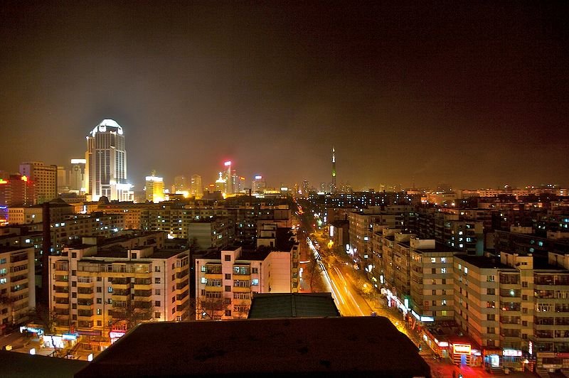
 Harbin, Heilongjiang Province, China
Source: https://commons.wikimedia.org/wiki/File:Harbin_at_Night.jpg
Author: julharton

Harbin (哈尔滨) is the capital and largest city in Heilongjiang Province, in northeastern China. It is a sub-provincial city. Its urban area covers 2,089 sq km (806 sq mi) while the sub-provincial city limits cover 53,068 sq km (20,489 sq mi). Harbin has an urban population of 4.5 million people and a sub-provincial city population of 10.6 million. It is the 10th biggest city in China. It is itself subdivided into eight district, three county-level cities and seven counties.
Harbin is located on the southeastern edge of the Songnen Plain. The city is on the southern bank of the Songhua River. The city experiences a monsoon-influenced humid continental climate. The city is famous for its bitterly cold winters. January is the coldest month, when average low temperature may drop to -24°C. Warmest month is July, when temperatures reach 28°C. July is also the wettest month, with 143 mm of precipitation.
The Harbin area has seen human habitation going back to at least 2,200 BC. The modern city was established in 1898, on the site of a small village, by Polish engineer Adam Szydłowski, when the Chinese Eastern Railway line was being constructed. The railway line was financed by Russia, and the city bear evidence of Russian architecture from those early days.
Russian influence in Harbin waned following the Russian defeat in the Russo-Japanese War of 1904-05. Harbin had a head start in industry, commerce and banking for northeastern China. It is a cosmopolitan city with communities of Jews, Poles, Germans, Tatars, Latvians, Georgians and other East Europeans.
Until the late 1940's, the Russian population in Harbin outnumbered ethnic Chinese and Manchus. The majority were refugees who fled Russia after the communist take over. In the mid 1950's, as China also fell to Communist rule, they emigrated in large numbers to Australia, Brazil and the United States. By the late 1980's, the Russian population of Harbin numbered just 30 elderly persons.
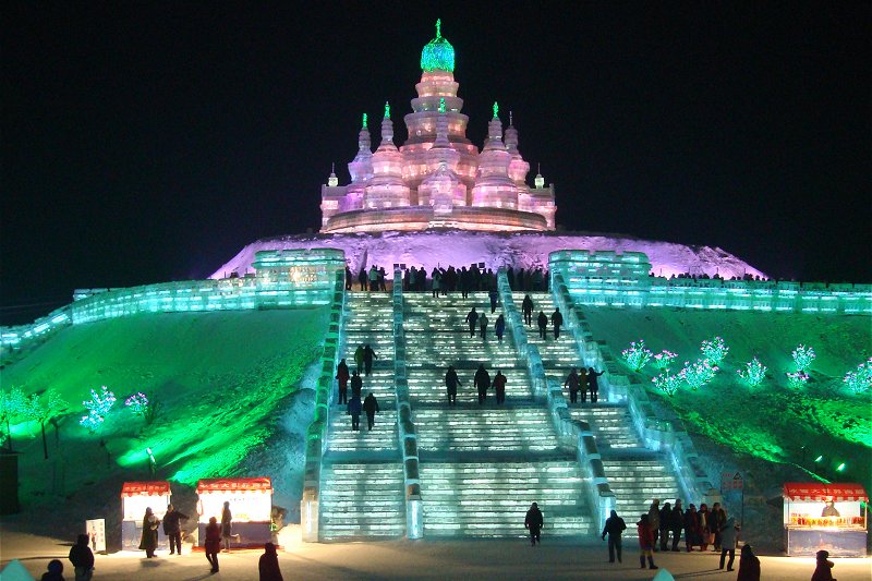
 Harbin Ice and Snow World
Author: julharton

Harbin (哈尔滨) is the capital and largest city in Heilongjiang Province, in northeastern China. It is a sub-provincial city. Its urban area covers 2,089 sq km (806 sq mi) while the sub-provincial city limits cover 53,068 sq km (20,489 sq mi). Harbin has an urban population of 4.5 million people and a sub-provincial city population of 10.6 million. It is the 10th biggest city in China. It is itself subdivided into eight district, three county-level cities and seven counties.
Harbin is located on the southeastern edge of the Songnen Plain. The city is on the southern bank of the Songhua River. The city experiences a monsoon-influenced humid continental climate. The city is famous for its bitterly cold winters. January is the coldest month, when average low temperature may drop to -24°C. Warmest month is July, when temperatures reach 28°C. July is also the wettest month, with 143 mm of precipitation.
The Harbin area has seen human habitation going back to at least 2,200 BC. The modern city was established in 1898, on the site of a small village, by Polish engineer Adam Szydłowski, when the Chinese Eastern Railway line was being constructed. The railway line was financed by Russia, and the city bear evidence of Russian architecture from those early days.
Russian influence in Harbin waned following the Russian defeat in the Russo-Japanese War of 1904-05. Harbin had a head start in industry, commerce and banking for northeastern China. It is a cosmopolitan city with communities of Jews, Poles, Germans, Tatars, Latvians, Georgians and other East Europeans.
Until the late 1940's, the Russian population in Harbin outnumbered ethnic Chinese and Manchus. The majority were refugees who fled Russia after the communist take over. In the mid 1950's, as China also fell to Communist rule, they emigrated in large numbers to Australia, Brazil and the United States. By the late 1980's, the Russian population of Harbin numbered just 30 elderly persons.
 Harbin Ice and Snow World
Source: https://commons.wikimedia.org/wiki/File:Harbin_Ice_and_Snow_World_2010.jpg
Author: Dayou_X

Harbin has grown rapidly in recent years, its economy propelled by the availability of natural resources, good transport infrastructure and abundant human resources. It is gearing itself to be a regional trading and retail hub. The city also has a diversified manufacturing base that includes light industries, textile, medicine, foodstuff, automobile, and metallurgy, among others.
Harbin has built a worldwide reputation for its winter culture. The annual Harbin International Ice and Snow Sculpture Festival is one of the four major ice and snow festivals, ranking alongside the Sapporo Snow Festival of Japan, Quebec City Winter Carnival of Canada and Ski Festival of Norway.
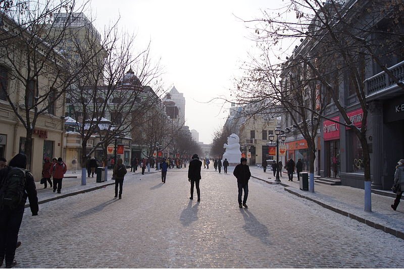
 Street in Harbin
Author: Dayou_X

Harbin has grown rapidly in recent years, its economy propelled by the availability of natural resources, good transport infrastructure and abundant human resources. It is gearing itself to be a regional trading and retail hub. The city also has a diversified manufacturing base that includes light industries, textile, medicine, foodstuff, automobile, and metallurgy, among others.
Harbin has built a worldwide reputation for its winter culture. The annual Harbin International Ice and Snow Sculpture Festival is one of the four major ice and snow festivals, ranking alongside the Sapporo Snow Festival of Japan, Quebec City Winter Carnival of Canada and Ski Festival of Norway.
 Street in Harbin
Source: https://commons.wikimedia.org/wiki/File:Harbin_Street.jpg
Author: Fredrik Rubensson

You can also reach Harbin by train. The journey from Beijing takes up to 18 hours.
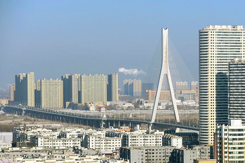
 Songpu River Bridge in Harbin, Heilongjiang Province
Author: Fredrik Rubensson

Planning your trip to Harbin
The Harbin Taiping International Airport (HRB) is the largest airport in northeastern China. In addition to flights from major cities in China, it also receives flights from Hong Kong, Krasnoyarsk, Seoul, Vladivostok and Yakutsk. The airport is 33 km (21 mi) to the southwest of downtown Harbin. There is a bus service connecting the airport to the city. The fare is ¥20. Taxis are also available for between ¥100 to ¥120 depending on destination.You can also reach Harbin by train. The journey from Beijing takes up to 18 hours.
 Songpu River Bridge in Harbin, Heilongjiang Province
Source: https://commons.wikimedia.org/wiki/File:Songpu_Bridge,_Harbin_city.jpg
Author: siyang xue

Looking for information on Penang? Use this Map of Roads in Penang to zoom in on information about Penang, brought to you road by road.

Author: siyang xue

Exploring Harbin
Taxis are relatively inexpensive in Harbin, and is the usual mode of transport for foreign visitors to the city.Places of Interest in Harbin
- Church of St Sofia
- Flood Control Monument
- Harbin Northern Forest Zoo
- Japanese Germ Warfare Experimental Base
- Jile Si
- Provincial Museum
- Qiji Futu Pagoda
- Stalin Park
- Sun Island Park
- Zhaolin Park
- Zhongyang Dajie
 Latest updates on Penang Travel Tips
 Map of Roads in Penang
Looking for information on Penang? Use this Map of Roads in Penang to zoom in on information about Penang, brought to you road by road.
Copyright © 2003-2025 Timothy Tye. All Rights Reserved.

 Go Back