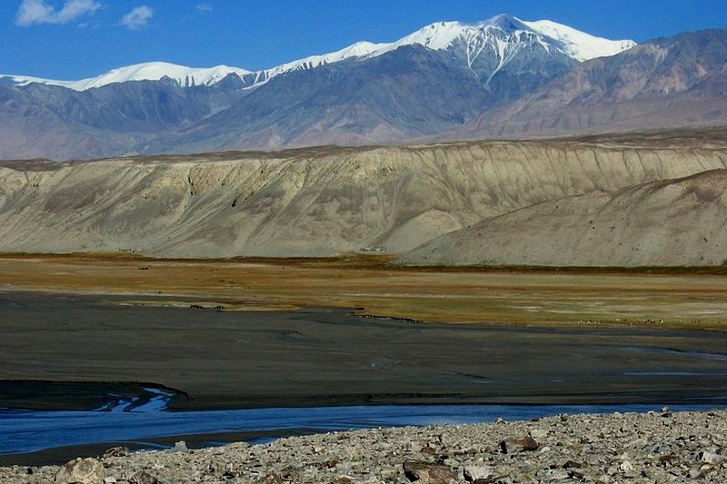
 View from the Karakoram Highway, Xinjiang
Source: https://commons.wikimedia.org/wiki/File:Karakorum-d05.jpg
Author: Colegota

Xinjiang (Simplified Chinese: 新疆) is an autonomous region on the northwestern part of China. It is officially called the Xinjiang Uyghur Autonomous Region. The name Xinjiang dates back to the Qing Dynasty and means "new territory". The area is the traditional home of several minority ethnic groups including the Uyghur, Han, Kazakh, Hui, Kyrgyz and Mongol. The old transliteration of Xinjiang was Sinkiang.
Xinjiang Ugyhur Autonomous Region is the biggest political subdivision in China. It covers 1,660,000 sq km (640,930 sq mi) and has a population of 22 million people (2011 estimate), ranking it as the 24th most populous region of the country. It borders Tibet Autonomous Region and India's Leh District to the south, Qinghai Province and Gansu Province to the southeast, Mongolia to the east, Russia to the north, and Kazakhstan, Kyrgyzstan, Tajikistan, Afghanistan, Pakistan and another border with India, all to the west.
Within Xinjiang is the lowest point in China, the Turpan Depression, at 155 meters below sea level, and the second highest mountain in China, the K2, at 8,611 meters above sea level. The Tian Shan mountain range divides Xinjiang into the Dzungarian Basin in the north and the Tarim Basin in the south. It also forms the border between Xinjiang and Kyrgyzstan. The Tarim Basin is occupied to a large extend by the Taklimakan Desert.
 Mosque in Yanqi, Xinjiang
Author: Colegota

Xinjiang (Simplified Chinese: 新疆) is an autonomous region on the northwestern part of China. It is officially called the Xinjiang Uyghur Autonomous Region. The name Xinjiang dates back to the Qing Dynasty and means "new territory". The area is the traditional home of several minority ethnic groups including the Uyghur, Han, Kazakh, Hui, Kyrgyz and Mongol. The old transliteration of Xinjiang was Sinkiang.
Xinjiang Ugyhur Autonomous Region is the biggest political subdivision in China. It covers 1,660,000 sq km (640,930 sq mi) and has a population of 22 million people (2011 estimate), ranking it as the 24th most populous region of the country. It borders Tibet Autonomous Region and India's Leh District to the south, Qinghai Province and Gansu Province to the southeast, Mongolia to the east, Russia to the north, and Kazakhstan, Kyrgyzstan, Tajikistan, Afghanistan, Pakistan and another border with India, all to the west.
Within Xinjiang is the lowest point in China, the Turpan Depression, at 155 meters below sea level, and the second highest mountain in China, the K2, at 8,611 meters above sea level. The Tian Shan mountain range divides Xinjiang into the Dzungarian Basin in the north and the Tarim Basin in the south. It also forms the border between Xinjiang and Kyrgyzstan. The Tarim Basin is occupied to a large extend by the Taklimakan Desert.
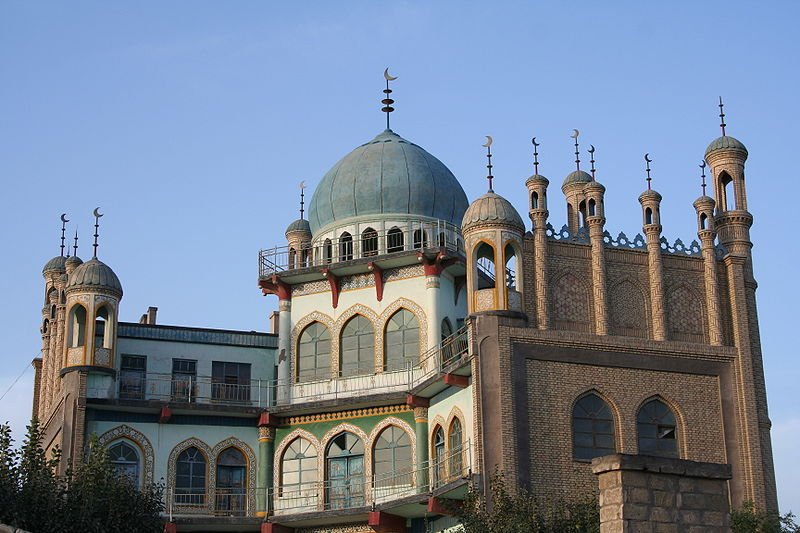
 Mosque in Yanqi, Xinjiang
Source: https://commons.wikimedia.org/wiki/File:Mosque_yanqi_xinjiang.jpg
Author: Rolf Müller

The capital and biggest city in Xinjiang is Ürümqi. The region has two prefecture-level cities, seven prefectures and five autonomous prefectures for ethnic minorities including the Mongol, Kirgiz, Kazakh and Hui peoples.
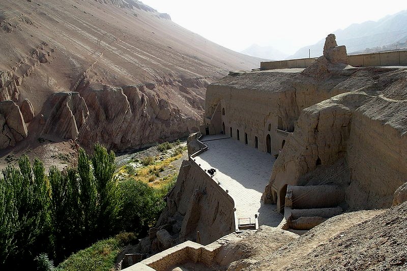
 Bezeklik Caves near Turpan, Xinjiang
Author: Rolf Müller

The capital and biggest city in Xinjiang is Ürümqi. The region has two prefecture-level cities, seven prefectures and five autonomous prefectures for ethnic minorities including the Mongol, Kirgiz, Kazakh and Hui peoples.
Going to Xinjiang
The Ürümqi Diwopu International Airport (URC) is the gateway to Xinjiang. It is connected to major cities in China as well as with cities in neighboring countries including Kabul and Baku. You can also reach Xinjiang by taking a train. A trip from Beijing to Ürümqi takes 42 hours while Chengdu is 49 hours away. Bezeklik Caves near Turpan, Xinjiang
Source: https://commons.wikimedia.org/wiki/File:Bezelik_Caves_01.jpg
Author: T Chu

Looking for information on Penang? Use this Map of Roads in Penang to zoom in on information about Penang, brought to you road by road.

Author: T Chu

Tourist Destinations in Xinjiang
- Hanas National Nature Reserve
- Karakul Lake
- Sayram Lake National Park
- Shipton's Arch
- Tianshan Tianchi National Park
Main Cities of Xinjiang
- Ürümqi - regional capital
- Aletai
- Cherchen
- Hami
- Karamay
- Kashgar
- Khotan
- Turpan
- Yarkand
- Yining
 Latest updates on Penang Travel Tips
 Map of Roads in Penang
Looking for information on Penang? Use this Map of Roads in Penang to zoom in on information about Penang, brought to you road by road.
Copyright © 2003-2025 Timothy Tye. All Rights Reserved.

 Go Back