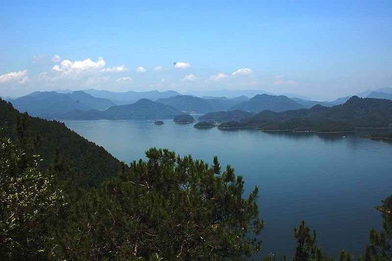
 Qiandao Lake, Zhejiang Province
Source: https://commons.wikimedia.org/wiki/File:Thousand_Island_Lake.JPG
Author: ZHart

Zhejiang Province 浙江省 is a coastal province on the central eastern part of China. It is located to the south of Shanghai and Jiangsu Province, with Anhui Province to the northwest, Jiangxi Province to the west, and Fujian Province to the south of it. Its coast faces the East China Sea to the east.
The name Zhejiang means "crooked river". The river in question is the Qiantang River, which flows through the capital and largest city of the province, Hangzhou. Zhejiang Province covers 101,800 sq km (39,300 sq mi). It is the 25th biggest city in the country.
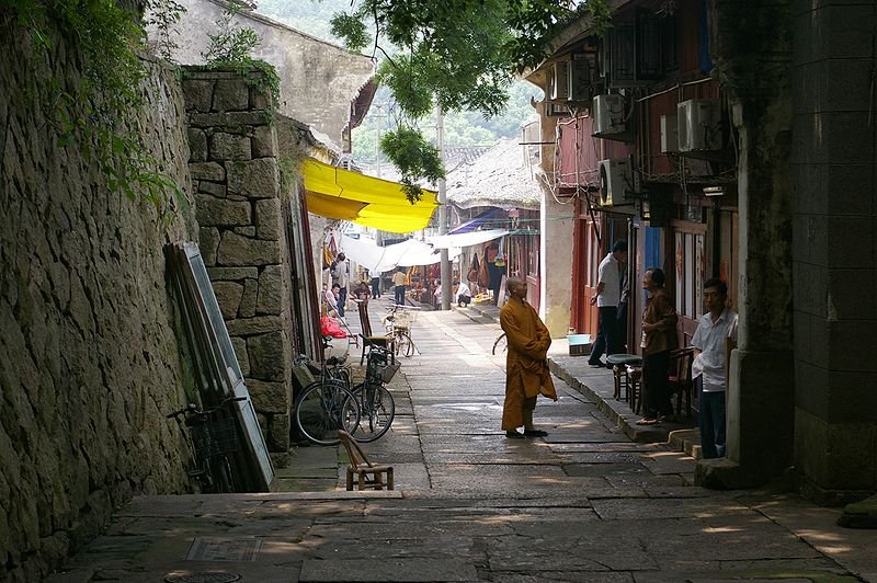
 Village at Mount Putao
Author: ZHart

Zhejiang Province 浙江省 is a coastal province on the central eastern part of China. It is located to the south of Shanghai and Jiangsu Province, with Anhui Province to the northwest, Jiangxi Province to the west, and Fujian Province to the south of it. Its coast faces the East China Sea to the east.
The name Zhejiang means "crooked river". The river in question is the Qiantang River, which flows through the capital and largest city of the province, Hangzhou. Zhejiang Province covers 101,800 sq km (39,300 sq mi). It is the 25th biggest city in the country.
Main Cities in Zhejiang Province
- Hangzhou - provincial capital
- Huzhou
- Ningbo
- Wenzhou
- Yiwu
- Zhoushan
Tourist Sights in Zhejiang Province
- Baoguo Temple
- Guoqing Temple
- Jiaxing
- Moganshan
- Mount Dalei
- Putuo Shan
- Qiandao Lake
- Qita Temple
- Shaoxing
- West Lake of Hangzhou
- Wuzhen
 Village at Mount Putao
Source: https://commons.wikimedia.org/wiki/File:20090606_Putuoshan_8847.jpg
Author: Jakub Halun

Zhejiang Province has a population of 52 million people (2011 estimate), making it the 10th most populous province in China. In 2009 it has a GDP of CNY 2.28 trillion, making it the 4th most productive province of the country, with a per capita GDP of CNY 44,335, also the fourth highest. It is divided into 11 prefecture-level cities.
Zhejiang is a mountainous province. The highest peak is Huangyajian Peak, at 1,921 meters high. Mountain ranges in Zhejiang that are between 200 to 1000 meters include the Yandang Mountains, Tianmu Mountains, Tiantai Mountains and Moganshan. Zhejiang experiences a humid subtropical climate.
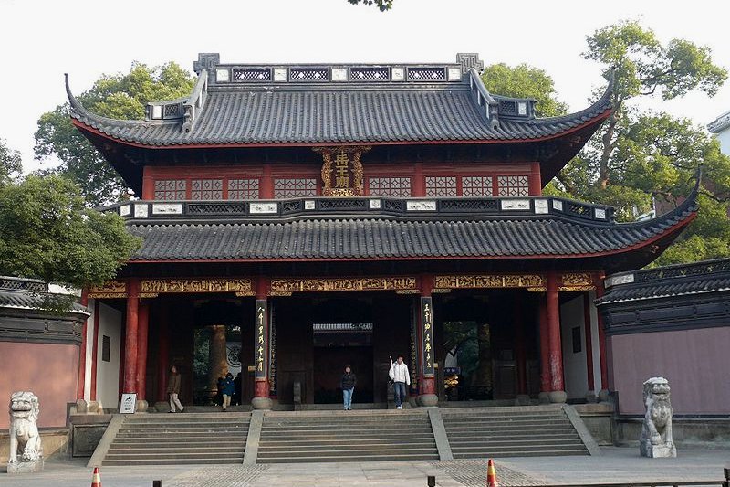
 Yue Fei Temple in Hangzhou
Author: Jakub Halun

Zhejiang Province has a population of 52 million people (2011 estimate), making it the 10th most populous province in China. In 2009 it has a GDP of CNY 2.28 trillion, making it the 4th most productive province of the country, with a per capita GDP of CNY 44,335, also the fourth highest. It is divided into 11 prefecture-level cities.
Zhejiang is a mountainous province. The highest peak is Huangyajian Peak, at 1,921 meters high. Mountain ranges in Zhejiang that are between 200 to 1000 meters include the Yandang Mountains, Tianmu Mountains, Tiantai Mountains and Moganshan. Zhejiang experiences a humid subtropical climate.
 Yue Fei Temple in Hangzhou
Source: https://commons.wikimedia.org/wiki/File:Yue_Fei_temple_13.jpg
Author: Peter17

The Hangzhou airport is about an hour from downtown Hangzhou. A taxi will cost you ¥90. There is also a shuttle bus to the Hangzhou Railway Station. The fare is ¥20.
Looking for information on Penang? Use this Map of Roads in Penang to zoom in on information about Penang, brought to you road by road.

Author: Peter17

Planning your trip to Zhejiang Province
The city of Hangzhou is the main gateway to places in Zhejiang Province. You can reach Hangzhou by flight from Beijing and Hong Kong, arriving at the Hangzhou Xiaoshan International Airport (HGH). There are also international flights connecting Hangzhou with Bangkok, Delhi, Kuala Lumpur, Osaka, Seoul, Singapore and Tokyo.The Hangzhou airport is about an hour from downtown Hangzhou. A taxi will cost you ¥90. There is also a shuttle bus to the Hangzhou Railway Station. The fare is ¥20.
List of Provinces in China
 Latest updates on Penang Travel Tips
 Map of Roads in Penang
Looking for information on Penang? Use this Map of Roads in Penang to zoom in on information about Penang, brought to you road by road.
Copyright © 2003-2025 Timothy Tye. All Rights Reserved.

 Go Back