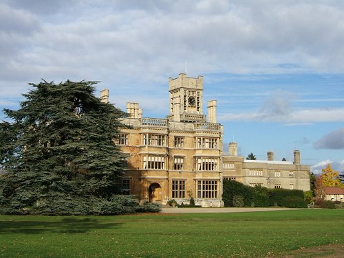
 Shuttleworth Agriculture College, Bedfordshire
Source: https://commons.wikimedia.org/wiki/File:Shuttleworth_ag_college.jpg
Author: Giles Keen

Bedfordshire is a ceremonial county in the East of England region. It covers 1,235 sq km (477 sq mi) and has a population of slightly over 600,000 people.
Bedfordshire is bordered by Northamptonshire to the north, Cambridgeshire to the northeast, Hertfordshire to the southeast and Buckinghimshire to the west. On the southern part of Bedfordshire are the Chiltern Hills. The rest of Bedfordshire is part of the basin of the River Great Ouse. The biggest town in Bedfordshire is Luton while the county town is Bedford.
Bedfordshire has a comparatively climate. The wettest month here is July, which gets 56.9 mm of precipitation. July and August are the warmest months, with average temperature of around 21.5°C. Coldest month is February, at 0.6°C.
Towns in Bedfordshire
Map of Towns in Bedfordshire
Sights in Bedfordshire
- Bedford Museum & Art Gallery
- Chiltern Hills
- De Grey Mausoleum
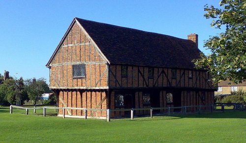
- Elstow Moot Hall
- Houghton House
- Imperial War Museum Duxford
- Luton Hoo
- Luton Museum & Art Gallery
- Someries Castle
- Stockwood Craft Museum
- Whipsnade Tree Cathedral
- Woburn Abbey
- Woburn Safari Park
- Woburn Village
- ZSL Whipsnade Zoo
 Elstow Moot Hall, Bedfordshire
Source: https://commons.wikimedia.org/wiki/File:Moot-hall.jpg
Author: Shritwod

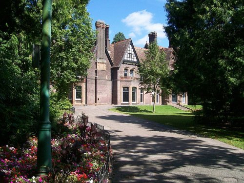
 Luton Museum
Source: https://commons.wikimedia.org/wiki/File:Luton_Museum.jpg
Author: DearCatastropheWaitress

Visiting Bedfordshire
Being to the north of London, Bedfordshire is the location of Luton Airport, one of the airports serving Greater London. If you are coming from London or Birmingham by car, take the M1 and A1 roadways.Map of Ceremonial Counties of England
 Latest updates on Penang Travel Tips

Copyright © 2003-2025 Timothy Tye. All Rights Reserved.

 Go Back