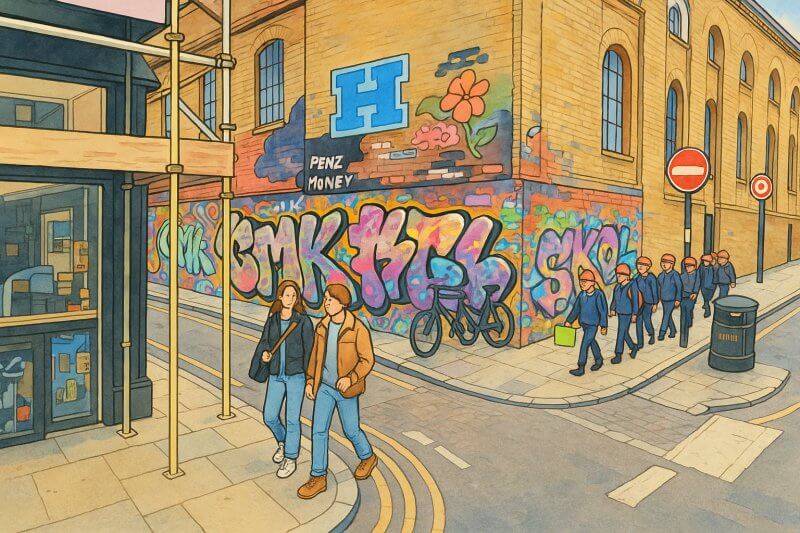
The East End, London
A Vibrant Corner of London with Deep Historical Roots
Where is the East End of London?
The East End of London lies immediately to the east of the historic City of London, stretching outward toward the River Lea. It hugs the northern banks of the River Thames and extends inland to encompass traditional working-class neighborhoods, industrial heritage sites, and areas of recent redevelopment.Different organisations, local councils, and historians may define the East End slightly differently:
- Historic definitions focus mostly on Tower Hamlets and parts of Hackney.
- Modern interpretations often include parts of Newham and even Waltham Forest as the city has expanded.
Size and Population of the East End
The East End does not have fixed official boundaries, which leads to some variation depending on interpretation. However, it is generally considered to cover about 20–25 square kilometres (8–10 square miles). The population of the East End is estimated at around 600,000 people, spread across key boroughs like Tower Hamlets, parts of Hackney, Newham, and historically a part of the old East Ham area. However, having said that, there is no universal agreement over where constitutes East End.Map of East End, London
Major Roads of the East End
Several important roads crisscross the East End:- Whitechapel Road (A11) – running east from Aldgate, a historic artery through the East End.
- Commercial Road (A13) – linking the City with the Docklands and Newham areas.
- Roman Road – an ancient thoroughfare now serving communities like Bow.
- Mile End Road (A11) – a continuation of Whitechapel Road toward Stratford.
The History of the East End
The term "East End" came into regular use during the late 18th century.Before this time, the area was known simply as "beyond Aldgate" or as distinct villages like Stepney and Whitechapel. By the 19th century, overcrowding, poverty, and rapid industrialization created conditions that firmly established the East End’s image as the gritty heart of working-class London.
Throughout its history, the East End has welcomed waves of immigrants:
- Huguenot refugees in the 17th century.
- Jewish communities in the 19th century.
- Bengali immigrants in the 20th century.

Painting of East End (View full-size image here)
Demographics of the East End
The East End is one of the most ethnically diverse areas of London. Today, significant communities include:- British Bangladeshis (especially in Whitechapel and Brick Lane).
- Caribbean communities (notably in Hackney).
- Somali, Vietnamese, and Eastern European populations.
Real Estate and Living Conditions
The East End remains mixed in terms of affluence:- Areas like Whitechapel, Stepney, and Bow still retain working-class roots and offer relatively affordable housing compared to central London.
- The Isle of Dogs, Canary Wharf, and nearby Docklands areas have transformed into some of the most expensive residential and commercial zones in London.
Important Buildings and Landmarks in the East End
The East End boasts several famous and fascinating sites, including:- The Tower of London – historically marking the entrance to the East End.
- Brick Lane – vibrant for its street art, curries, and Sunday markets.
- Canary Wharf – London's modern financial powerhouse, with soaring skyscrapers.
- Victoria Park – often called the “People’s Park”, a historic and beloved green space.
- Spitalfields Market – a bustling destination for shopping and dining.
Characteristics of the East End
The East End has a complex identity:- Historically working-class, tied to dock work, tailoring, and manufacturing industries.
- Residential areas are dense, lively, and diverse.
- Commercial hubs have emerged, particularly in Canary Wharf and along major roadways.
Public Transport: Underground, DLR, and Rail
The East End is exceptionally well-connected by public transport:- London Underground:
- District Line (Whitechapel, Stepney Green, Bow Road)
- Hammersmith & City Line (Whitechapel, Mile End)
- Central Line (Bethnal Green, Mile End, Stratford)
- Jubilee Line (Canary Wharf, Canning Town)
- Docklands Light Railway (DLR):
- Runs through the Isle of Dogs, Poplar, Limehouse, and Stratford, providing easy access to Docklands and east London hubs.
- National Rail Services:
- Overground connections through Whitechapel, Hackney, and Stratford.
Fun Facts about the East End
- The East End was the site of the infamous Jack the Ripper murders in 1888, a mystery that still fascinates historians and tourists today.
- Pie and mash shops, a staple of traditional Cockney cuisine, originated here.
- The East End’s Docklands hosted the 2012 London Olympics at Stratford, which sparked massive urban regeneration.
- The word “Cockney” historically referred to someone born within the sound of Bow Bells — the bells of St Mary-le-Bow Church in nearby Cheapside, which some include in the East End's wider influence.