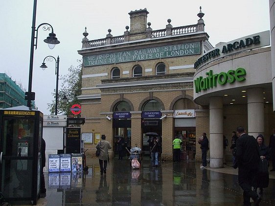
 Gloucester Road Station (GPS: 51.49437, -0.18278)
Source: https://commons.wikimedia.org/wiki/File:Gloucester_Road_stn_building_look_south.JPG
Author: Sunil060902

Gloucester Road Station (GPS: 51.49437, -0.18278) is a London Underground station in the Kensington area in west London. Located on Travelcard Zone 1, the station is served by the District Line and Piccadilly Line, both between Earl's Court Tube Station and South Kensington Tube Station, and by the Circle Line between South Kensington Tube Station and High Street Kensington Tube Station.
The entrance to the Gloucester Road Tube Station is at the junction of Gloucester Road and Cromwell Road. Among the sights in the vicinity includes Cromwell Hospital and Baden-Power House.
Gloucester Road Tube Station began operations on 1 October 1868 as part of the Metropolitan Railway.
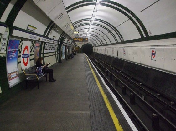
 Platform level at Gloucester Road Station (GPS: 51.49437, -0.18278)
Source: https://commons.wikimedia.org/wiki/File:Gloucester_Road_stn_Piccadilly_westbound_look_east.JPG
Author: Sunil060902

Nearby Sights
1. Baden Powell HouseFacility offering economic lodging for visiting scouts and their family members.
Gloucester Road Station is  on the Map of London Underground Lines & Tube Stations
 Latest updates on Penang Travel Tips
Other Rapid Transit Lines
About this website

Dear visitor, thank you so much for reading this page. My name is Timothy Tye and my hobby is to find out about places, write about them and share the information with you on this website. I have been writing this site since 5 January 2003. Originally (from 2003 until 2009, the site was called AsiaExplorers. I changed the name to Penang Travel Tips in 2009, even though I describe more than just Penang but everywhere I go (I often need to tell people that "Penang Travel Tips" is not just information about Penang, but information written in Penang), especially places in Malaysia and Singapore, and in all the years since 2003, I have described over 20,000 places.
While I try my best to provide you information as accurate as I can get it to be, I do apologize for any errors and for outdated information which I am unaware. Nevertheless, I hope that what I have described here will be useful to you.
To get to know me better, do follow me on Facebook!
Copyright © 2003-2025 Timothy Tye. All Rights Reserved.

 Go Back