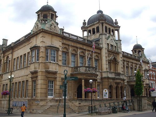
 Redbridge Town Hall
Source: https://commons.wikimedia.org/wiki/File:Ilford_Redbridge_Town_Hall.JPG
Author: Sunil060902

The London Borough of Redbridge is a borough of Greater London located on the northeastern part of Outer London. The borough covers 56.41 sq km (21.8 sq mi), and is bordered by the London Borough of Waltham Forest to the west, the London Borough of Newham to the south, the London Borough of Barking and Dagenham to the southeast and the London Borough of Havering to the east.
The London Borough of Redbridge has a population of 260,000 (2011 estimate), of which White British accounts for 53% of the population. The borough was named after a bridge across the River Roding. That bridge is no longer standing today - it was pulled down in 1921.
How to reach Redbridge
Take the London Underground Central Line. Stations in this borough include the Snaresbrook, South Woodford, Woodford, Wanstead, Redbridge, Gants Hill, Newbury, Barkingside, Fairlop and Hainault tube stations.Districts of the London Borough of Redbridge
- Aldborough Hatch
- Aldersbrook
- Barkingside
- Clayhall
- Cranbrook
- Fairlop
- Fullwell Cross
- Gants Hill
- Goodmayes
- Hainault
- Ilford
- Little Heath
- Loxford
- Newbury Park
- Redbridge
- Seven Kings
- Snaresbrook
- South Woodford
- Wanstead
- Woodford
- Woodford Bridge
- Woodford Green
- Woodford Wells

Copyright © 2003-2025 Timothy Tye. All Rights Reserved.

 Go Back