Road Numbering in Britain
Understanding Road Classifications in Britain
British roads are primarily categorised into the following types:
- M roads (Motorways): Major high-speed roads built for long-distance travel with controlled access.
- A roads: Key arterial routes that connect cities, towns, and regions. They may be either single or dual carriageways.
- B roads: Local routes that connect smaller towns, villages, and rural areas, or provide alternative routes to A roads.
- Other letters: Occasionally, other designations like 'C', 'D', or 'U' are used by local authorities for internal administrative purposes, but these are not typically signposted or used by the general public.
The A Road System
A roads form the backbone of the national road network outside of the motorway system. They are designed to facilitate significant volumes of traffic and are crucial for economic and logistical connectivity. A roads are either primary or non-primary, with primary routes marked by green road signs and offering better quality infrastructure, while non-primary A roads typically use white signs with black text.
The numbering of A roads is both hierarchical and geographical. The system divides Great Britain into six radial zones centred on London (and for Scotland, also centred on Edinburgh). The zones are numbered clockwise from Zone 1 in the east (between the A1 and A2) to Zone 6 in the north-west (between the A6 and A1).
Key points about A road numbers include:
- Single-digit A roads (e.g. A1, A2) are the most important, often national routes of historic significance.
- Two-digit A roads are still major roads, usually forming main routes between large cities.
- Three- and four-digit A roads generally serve more regional or local roles but still offer significant connectivity.
For example, the A1 connects London to Edinburgh and is one of the most important trunk roads in the country, forming the boundary between Zones 1 and 6.
The B Road System
B roads are less significant than A roads but still form an important part of the UK's road infrastructure. They typically handle local traffic and provide connections to A roads or serve rural and suburban areas. Like A roads, B roads are also numbered and follow a similar zonal pattern, although with less national consistency.
The numbering system for B roads is as follows:
- Three- and four-digit numbers are commonly used (e.g. B1234, B4086).
- Fewer rules exist regarding B road numbering, so they may sometimes appear out of numerical order or extend through multiple zones.
B roads are marked with white signs containing black lettering, similar to non-primary A roads. They are rarely dual carriageways and are more likely to pass through residential or rural landscapes.
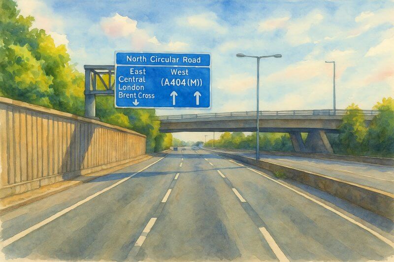
Painting of motorway in the United Kingdom (View full-size image here)
The Motorway (M Road) System
Motorways are the highest standard roads in Britain and are designed for fast, long-distance travel with multiple lanes, grade-separated junctions, and limited access. Motorways are numbered independently of A and B roads, although many follow the paths of major A roads with which they are associated (e.g. the M1 largely parallels the A5 and A6 in parts).
Some key facts about motorways include:
- They are denoted by the letter M (e.g. M1, M25).
- Motorways with A(M) suffixes indicate A roads that have been upgraded to motorway status (e.g. A1(M)).
- Motorway signs use blue backgrounds with white text, distinguishing them clearly from other types of roads.
History of the British Road Numbering System
Before the 20th century, roads in Britain were mostly identified by local names or turnpike numbers. However, with the growth of motor traffic in the early 1900s, there was increasing pressure for a systematic, national method of road identification.
In 1921, the Ministry of Transport introduced the first road numbering system for Great Britain. The aim was to provide a clear, logical way to navigate the expanding road network. Roads were divided into A and B classifications based on their importance, and the zonal system radiating from London was established to assign road numbers.
The initial lists were published in 1922-23 and created the framework for what we see today. This system has largely endured with minor adjustments, such as the addition of new zones to accommodate growing regions or the introduction of new roads like the motorways, which began construction in the late 1950s.
Were Road Numbers Meant to Replace Road Names?
Despite the introduction of the numbering system, there was never a serious attempt to replace road names with numbers for public usage. Road names remain vital for navigation, postal services, and local identity. Instead, numbers were intended to assist with long-distance travel and mapmaking, not to supplant local nomenclature.
While some countries such as the United States use numbered highways extensively in public discourse, British road users tend to refer to roads by both name and number, especially in local contexts. For instance, a road may be described as "the A40 (Western Avenue)" or "the A3 near Tolworth."
Summary
Britain's road numbering system is a practical and historical framework that has evolved to meet the needs of motorists, planners, and mapmakers. From the major M motorways and arterial A roads to the local B routes, the system reflects a structured approach to mobility across the nation. The numbered routes coexist with named roads, enriching both the navigational and cultural experience of travel in Britain. Whether you're following the A1 to Edinburgh or meandering along a rural B road in Kent, the road numbers provide a consistent guide through the vast web of Britain's highways.