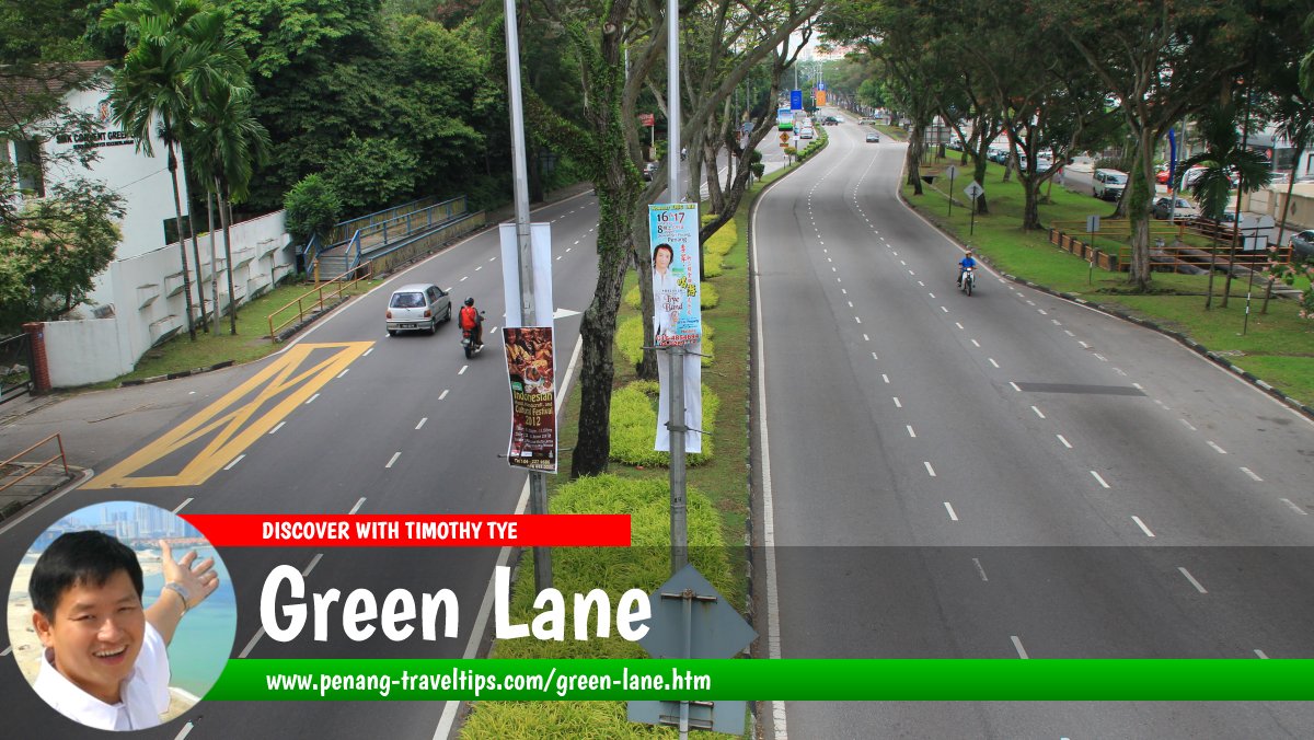
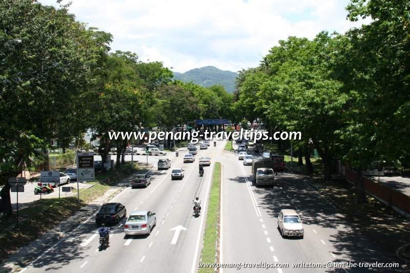
 Green Lane, Penang (31 May 2012)
B. Melayu
Green Lane (Malay: Jalan Masjid Negeri; Traditional/Simplified Chinese: 青草巷; Pinyin: Qīngcǎo xiàng; Penang Hokkien: Chnae3 Chau1 Hang33
 ) is a major road and locality in George Town, Penang. Although it is one of the busiest roads in George Town today, Green Lane was just a quiet country lane as recently as the 1950's, when the land in Green Lane was being developed into some of the earliest suburbs of the city. During that time, a few noted schools were established or relocated here, among them the Penang Free School, Convent Green Lane, Heng Ee High School and Georgetown Secondary School. Several religious institutions were also established here including the Church of the Holy Spirit (now Cathedral of the Holy Spirit), Wat Nai and Wat Pinbang-Onn.
Measured at the junction with Jalan Ayer Itam (GPS: 5.407893, 100.302669), Green Lane is 6.0 km to Komtar, 6.7 km to the Penang Bridge, 14.7 km to the Second Penang Bridge and 14.5 km to the Penang International Airport.
 Map of Green Lane (Jalan Masjid Negeri), Penang
 Roads in the Green Lane area
- Batu Green
- Lorong Delima 1
- Lorong Delima 3
- Glugor Green
- Green Drive
- Jalan Besi
- Jalan Cheeseman
- Jalan Free School
- Jalan Hamilton
- Jalan Hargreaves
- Jalan Hijau 1
- Jalan Hijau 3
- Jalan Hijau 4
- Jalan Kennedy
- Jalan Mas
- Jalan Phillips
- Jalan Pinhorn
- Jalan Sir Hussein
- Jalan Taylor
- Jalan Tembaga
- Jalan Thorpe
- Lebuhraya Mas
- Lengkok Ariff
- Lengkok Hijau
- Lintang Batu
- Lintang Delima 1
- Lintang Delima 2
- Lintang Delima 3
- Lintang Delima 4
- Lintang Delima 5
- Lintang Delima 7
- Lintang Delima 8
- Lintang Delima 9
- Lintang Delima 10
- Lintang Delima 11
- Lintang Delima 12
- Lintang Delima 13
- Lintang Delima 14
- Lintang Delima 15
- Lintang Hijau
- Lintang Mas
- Lorong Delima 1
- Lorong Delima 2
- Lorong Delima 3
- Lorong Delima 4
- Lorong Delima 5
- Lorong Delima 6
- Lorong Delima 7
- Lorong Delima 8
- Lorong Delima 9
- Lorong Delima 10
- Lorong Delima 11
- Lorong Delima 12
- Lorong Delima 13
- Lorong Delima 14
- Lorong Delima 15
- Lorong Delima 16
- Lorong Delima 17
- Lorong Delima 18
- Lorong Delima 20
- Lorong Hijau 3
- Lorong Hijau 4
- Lorong Hijau 5
- Persiaran Mas
- Taman Besi
- Taman Hijau 1
- Taman Hijau 2
- Taman Hijau 3
- Taman Hutchings
- Taman Kennedy
- Taman Wu Lien Teh
- Tingkat Besi
 Residential Properties in Green Lane
- Condo Gembira (GPS: 5.3857, 100.30072)

- Delima Palace Condominium (GPS: 5.38411, 100.29766)

- Greenlane Heights (GPS: 5.38411, 100.29766)

- Greenlane Heights Block A (GPS: 5.39434, 100.29984)

- Greenlane Heights Block B (GPS: 5.39346, 100.29872)

- Greenlane Heights Block 3 (GPS: 5.39299, 100.29803)

- Greenlane Heights Block E (GPS: 5.393, 100.29706)

- Greenlane Heights Block G (GPS: 5.39129, 100.29661)

- Greenlane Heights Block H (GPS: 5.39129, 100.29661)

- Greenlane Heights Flamingo Series (GPS: 5.39077, 100.29619)

- Greenlane Heights Jay Series (gPS: 5.39113, 100.29515)

- Greenlane Heights Kingfisher Series (GPS: 5.39177, 100.29524)

- Greenlane Park (GPS: 5.38846, 100.29666)

- Krystal Heights (GPS: 5.38417, 100.29831)

- Menara Greenview (GPS: 5.38578, 100.29915)

- Mutiara Court Apartment (GPS: 5.37639, 100.3013)

- Mutiara Indah (GPS: 5.37373, 100.29518)

- Mutiara Place (GPS: 5.37764, 100.30048)

- Mutiara Ria (GPS: 5.37493, 100.29982)

- Mutiara View (GPS: 5.37725, 100.30045)

- Taman Lembah Hijau (GPS: 5.39263, 100.29607)

 Landed Residential Properties and Housing Estates in Green Lane
- Green Garden (GPS: 5.38411, 100.29766)

- Island Glades (GPS: 5.38392, 100.30517)

- Island Park (GPS: 5.38971, 100.30236)

- Taman Greenview (GPS: 5.38791, 100.30337)

 Markets in Green Lane
- Batu Lanchang Market (GPS: 5.39042, 100.30612)

- Greenlane Heights Market (GPS: 5.39347, 100.29791)

Petrol Stations along Green Lane
- BHP Green Lane (GPS: 5.38779, 100.30379)

- Caltex Green Lane (GPS: 5.39516, 100.30286)

- Petron Green Lane (GPS: 5.39345, 100.30317)

- Petronas Green Lane (GPS: 5.3886, 100.30407)

- Shell McDonald's Green Lane (GPS: 5.4009, 100.30433)

- Shell Gembira Parade Green Lane (GPS: 5.38547, 100.30492)

 Schools in the Green Lane area
- Chung Hwa Confucian High School (GPS: 5.39058, 100.30066)

- Convent Green Lane (GPS: 5.39698, 100.30422)

- Han Chiang High School (GPS: 5.40692, 100.30427)

- Penang Free School (GPS: 5.40316, 100.3052)

Hospitals in Green Lane
- Carl Corrynton Medical Centre (GPS: 5.40261, 100.3036)

- Lam Wah Ee Hospital (GPS: 5.3916, 100.30397)

- Optimax Eye Specialist Hospital (GPS: 5.3991, 100.30422)

Tropicana Medical Centre
 Public Parks in Green Lane
- Taman Kejiranan Karpal Singh (GPS: 5.38042, 100.29932)

- Taman Kejiranan Lintang Delima 2 (GPS: 5.38659, 100.30125)

- Taman Kejiranan Lintang Delima 10 (GPS: 5.38479, 100.30313)

What to eat in Green Lane
- Adrian Goh recommended the Western Food from the new vendor at Gembira Parade, in Green Lane, Penang, on 30 October, 2019.
- Mee Sua Kor at Batu Lanchang Market Hawker Centre was recommended by Sam Lim on 16 September, 2019
- Oyster Noodles for dinner at Good Corner Kopitiam in Island Park, recommended by Eddy Tong on 27 August, 2019
Shopping Malls in Green Lane
- Gembira Parade (GPS: 5.3865, 100.30359)

Libraries in Green Lane
- Penang Digital Library (GPS: 5.40496, 100.30393)

 Mosques along Green Lane
- Penang State Mosque (GPS: 5.40667, 100.30149)

Chinese & Buddhist Temples in Green Lane
- Hong Sun Seah Temple (GPS: 5.3854, 100.30279)

- Malaysian Buddhist Meditation Centre (GPS: 5.39538, 100.30446)

- Wat Nai (GPS: 5.39577, 100.30405)

- Wat Pinbang-Onn (GPS: 5.39416, 100.30378)

- Yew Bee Estate Tua Pek Kong Temple (GPS: 5.38024, 100.29712)

 Churches in Green Lane
- Cathedral of the Holy Spirit (GPS: 5.39394, 100.30173)

- Trinity Methodist Church (GPS: 5.4019, 100.3036)

- Victory Lutheran Church (GPS: 5.38041, 100.30293)

Government Buildings along Green Lane
- Penang Senior Officers' Quarters (GPS: 5.39962, 100.30293)

Organisations in Green Lane
- Eden Handicap (GPS: 5.40149, 100.30156)

- Penang Home for the Infirm and Aged (GPS: 5.39044, 100.30318)

- Persatuan Kebajikan Kanak-Kanak OKU Taman Island Penang (GPS: 5.38227, 100.30599)

- Spastic Children's Association of Penang (GPS: 5.38945, 100.30374)

- World Red Swastika Society (GPS: 5.38989, 100.30361)

- Young Women's Christian Association (GPS: 5.40597, 100.30297)

Graves in Green Lane
Private Clinics in Green Lane
- Klinik Joe Fernandez
- Sim Children & Child Heart Clinic (GPS: 5.39424, 100.30275)
 Businesses in Green Lane
- Afcar Auto (used car dealer)
- Airmas Auto (Ford dealer)
- AsterSpring Green Lane (skincare)
- Autobinee Corporation (Nissan Dealership)
- Beyong Auto Air-Conditioner Service Centre
- Cahaya Suriamas Otomobil (used imported car dealer)
- Daiwa Housing Agency
- Dragon Car Wash Centre
- First Advance Auto (used car dealer)
- Fitness Pro (fitness equipment)
- Gaya Pertama Otomobil (used car dealer)
- Getha (bedding)
- GIVI Point (motorcycle dealer)
- Green Lane McDonald's
- Havana konzept (flooring)
- Hong Huat Motor (used car dealer)
- Inwedding Bridal House
- Jungle Bath (bathroom fixtures)
- Kia Dealership
- Kimgress (tiles & ceramics)
- Light Paradise
- Mastertan Auto (used car dealer)
- Maybank
- McLaren Saksama (loss adjusters)
- Mega Fortune Franchise (motorcycle dealer)
- Metro Penang (developer)
- Metroworld Realty
- Mezzo Concept Kitchen
- Micro Furniture
- Monier (roof tiles)
- Nardia Laboratory (beauty parlour)
- Peugeot Dealership
- Plus Twelve Internet Cafe
- Prime View (developer)
- Sejati Baru (maid agency)
- Sim Housing
- Spring Production & Art Studio (art academy)
- Sun Tec Auto (used car dealer)
- Soon Lee Driving Centre
- The Masque Botanical
- Topkids Primary Educare
- Trinity Auto (used car dealer)
- Trinity Methodist Church Kindergarten
- Venus Tiles
- Vertec Auto (used car dealer)
- Wei Wei Beauty & Slimming Specialist
Updates on Green Lane
6 February, 2016The Star reports that the Penang Island City Council (MBPP) will ensure the minimal cutting down of trees along Green Lane when it widens a stretch of the road. 18 trees on the north-bound stretch from the Lorong Batu Lanchang junction to the Jalan Air Itam junction will be affected when the stretch is widened from two lanes to three. According to MBPP engineering department deputy director A. Rajendran, no trees on the stretch from the Free School Road junction to the Hamilton Road junction will be affected by the widening. The road widening project is expected to cost RM7.85 million. It includes improvements to the pedestrian walkway, drainage system and street lamps.
26 September, 2014
The Star reports on the roadwork at the Udini end of Green Lane, stating that it will be delayed a third time, with slated completion now moved to early 2015. So far, the planned "elevated U-turn" linking Green Lane to Yeap Chor Ee Road has also not materialized.
1 December 2012, The Star: The Penang Island Municipal Council (MPPP) bowed to the demands of the NGOs in not chopping down the 44 affected trees, and will instead relocate them along with the other 18 affected by the road-widening project.
The Green Lane Road Widening is a RM7.5 million project to accommodate the increase in traffic along the road, projected at between 10% to 15%, in anticipation of the completion of the Second Penang Bridge in September 2013.
30 November 2012, The Star: The Penang Island Municipal Council (MPPP) plans to cut down and transplant trees along Green Lane despite objections from several non-governmental organisations (NGOs). According to MPPP Engineering Department Deputy Director A Rajendran, twenty of the trees are diseased and pose a danger to motorists. The MPPP will however try to save and heal forty-four of the eighty-eight trees affected in the road-widening project.
The NGOs that were most vociferous against the chopping down of those trees were the Consumer Association of Penang (CAP) and Sahabat Alam Malaysia (SAM). Both held a protest at the Green Lane site on 28 Nov 2012. The Penang MCA advisor Datuk Koay Kar Huah also threw his support for the two NGOs. Meanwhile, the MPPP decided to hold a dialogue with CAP, SAM as well as with the Malaysian Nature Society (MNS) and Friends of the Penang Botanic Gardens to brief them of the plan on 30 Nov 2012.
24 November 2012 The Star: The Penang Island Municipal Council (Majlis Perbandaran Pulau Pinang) issued a statement dated 22 November 2012 that trees on the 700-meter stretch of Green Lane from the Udini roundabout to the Shell petrol station will make way for road widening and upgrading of drainage. An arborist appointed has identified 80 trees in the area of which 44 are to be cut down, 20 to be transplanted, and 16 to be left remaining. The trees that are to be removed are those considered problematic. They include the semarak api (Delonix regia), the weeping fig (Ficus benjamina), the angsana, the Chinese banyan (Ficus microcarpa), and the yellow flame (Peltophorum pterocarpum). These are regarded as common trees that are easily found.
History of Green Lane
The development of Green Lane was carried out in phases. In the 1950's, the government quarters around Cheeseman Road was developed. Within this area are roads such as Taylor Road, Jalan Sir Hussein (named after Sir Dr. Hussein Hasanally Abdoolcader, a noted Penang lawyer).On the Penang Free School side of Green Lane are also new roads. These include Free School Road, which was named after the school itself, as well as minor roads named after some of its headmasters from the turn of the 20th century, among these, Hamilton Road (after W. Hamilton, 1925-26), Pinhorn Road (R.H. Pinhorn, 1904-1925), Hargreaves Road (W. Hargreaves, 1891-1904) and Hutchings Garden, after the founder of the school, Rev. Sparke Hutchings.

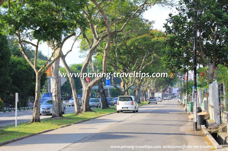
Green Lane, at the turning to Island Park (14 April 2009)

The land south of Hamilton Road was occupied by the Green Lane Convent as well as Thai Buddhist temples. The housing estate developed behind them all had the word "Hijau" to it. These are some of the earliest roads with numbers in their names in Penang. Around the Church of the Holy Spirit was developed Island Park in the 1960's. The roads here were named after metal, namely Mas (for emas, gold), Besi (iron), Tembaga (brass) and Gangsa (bronze).
Next came Island Glades, later renamed Taman Mutiara, a name that never caught on. The roads here are all named Delima (ruby). In between Island Glades and Island Park came a later development, Taman Greenview, in the late 1970's.
Across Green Lane from Island Glades is the housing development of Batu Lanchang. The Lam Wah Ee Hospital was moved here in the late 1970's. The roads in the suburb bordered by Lebuhraya Gelugor, Lebuhraya Batu Lanchang and Green Lane have their names derived from amalgamating the names of the neighbouring areas. Hence we get names such as Batu Green (Batu Lanchang + Green Lane) and Gelugor Green (Gelugor + Green Lane).
 Service road running parallel to Green Lane (23 September 2012)
Green Lane ends at the Udini Roundabout, which is today served by a flyover as well as an underpass. This roundabout marks the traditional city limit of George Town until the 1970's, when the metropolitan area expands and spills south, reach as far as Teluk Kumbar by the turn of the 21st century.
Green Lane was renamed Jalan Masjid Negeri in the late 1970's, upon the completion of the Penang State Mosque, much to the chagrin of its residents as well as the people of Penang at large, the majority of whom still prefer the lush connotation that the name Green Lane conjures. "Green Lane" lives on in sights along the road, among them Convent Green Lane and Green Lane McDonald's.
Traffic along Green Lane has increased tremendously in the past half a century. No longer is it a quiet lane through the countryside, Green Lane is today one of the main ring roads of George Town. To contain the ever-increasing traffic flow, a number of viaducts have been built over the road since the early 1980s. They include the Hamilton Road Flyover and the Batu Lanchang Autopont Bridge. The northern end of Green Lane is likewise connected to Scotland Road with a flyover. The latest traffic enhancement project, taking place near the Udini Roundabout, will see a viaduct to provide southbound traffic direct access to Yeap Chor Ee Road. The construction is expected to start in December 2012 and completed in 2014.
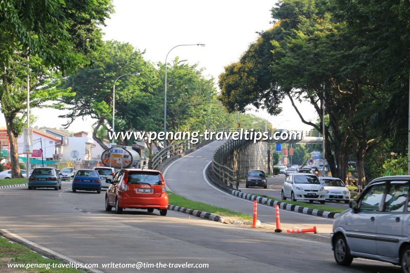
 Green Lane at the Batu Lanchang Autopont Bridge (23 September 2012)
Getting there
If you are coming from George Town and using public transport, Rapid Penang buses 102, 206 and 304 pass by Green Lane.List of Streets in Penang and Streets in Malaysia

Copyright © 2003-2025 Timothy Tye. All Rights Reserved.

 Go Back