Gurney Expressway (Persiaran Gurney Paired Road)
 Go Back
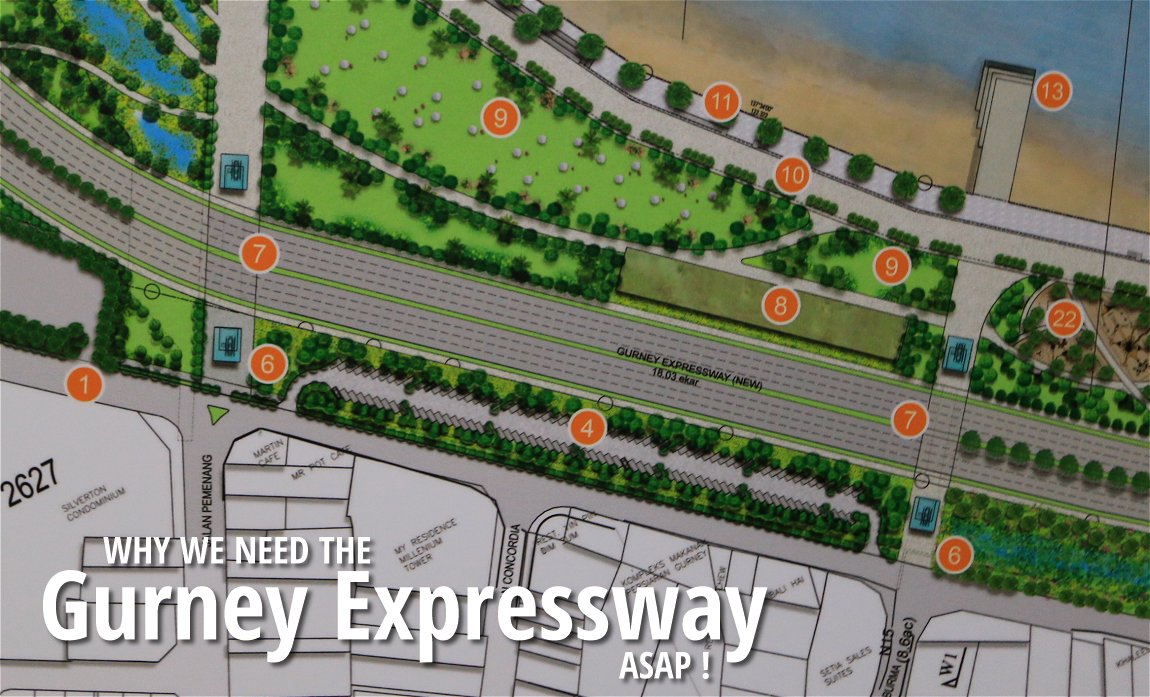
Gurney Expressway, also known as the Persiaran Gurney Paired Road, is a proposed controlled-access expressway on the north coast of George Town, Penang. Part of the George Town Outer Bypass, it is to be constructed on reclaimed land off the present coast of Gurney Drive. The reclamation will fill up the present Teluk Ayer Rajah, on which an interchange will be built linking the expressway to the Pan Island Link (1) Highway to the south, while on the northside, the road continues to Tanjong Tokong and island-side Bagan Jermal. Another highway, the George Town Inner Ring Road, will connect it over Pangkor Road on the south side, from where another interchange links it to the proposed Penang Undersea Tunnel.
The Gurney Expressway is intended to serve as a bypass for the arterial roads such as Kelawei Road and Burmah Road, which are presently playing double duty, as local roads for the Pulau Tikus area, and also shouldering traffic passing across it. The Gurney Expressway and related Pan Island Link Highway will remove this traffic from the Pulau Tikus area, the Gurney Expressway is expected to relieve congestion presently experienced there.
Updates on Gurney Expressway
24 February, 2016: The State Government unveiled plans for the development of the reclaimed land on which the expressway will be located. The area, to become a public park, will be known as Gurney Wharf.Map of approximate route of Gurney Expressway
Related Articles on the Gurney Expressway
Why we need the Gurney Expressway asap!
EnterPenang Transport Master Plan

Copyright © 2003-2025 Timothy Tye. All Rights Reserved.