 Gunung Batur (18 June, 2004)
Gunung Batur is a 3142-meter (10,350-foot) active volcano in East Bali. It comprises two concentric calderas to the northwest of Gunung Agung.
The outer caldera measures 10 km by 13 km, with part of it filled with water forming Lake Batur (Danu Batur). The innder caldera measures 7.5 km wide. It dates to between 23,670 to 28,500 years ago. Within the caldera is a 700-meter stratovolcano rising above the surface of Lake Batur.
The first documented eruption of Gunung Batur dates back to 1804, and the volcano has been active since then. Nevertheless it does not deter the locals from a life of living dangerously, with the villages of Kedisan and Toya Bungkah right on the edge of the caldera. The lake itself is a source of fish for the local population.
Gunung Batur, as with Gunung Agung, is regarded as sacred. The surrounding communities orientate their homes, temples, even their beds and the direction that they sleep to point in its direction. They believe that the spirits of their ancestors live in its peaks. Visitors wishing to climb Gunung Batur should therefore observe local sensibilities by dressing appropriately according to temple dress codes.
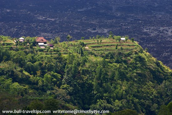 Living in close proximity of Gunung Batur (18 June, 2004)
 Latest updates on Penang Travel Tips
 Destination Indonesia

Copyright © 2003-2025 Timothy Tye. All Rights Reserved.

 Go Back