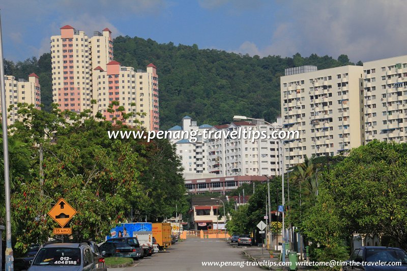
 Island Park (23 September 2012)
Island Park (GPS: 5.38971, 100.30236) is one of the earliest suburbs of George Town. It was developed in the late 1950's and 60's, following the prosperous years after the Second World War, when the population of Penang experienced a boom. Until then, it was known as Guan Joo Seng Estate, a place where you would find vegetable farms, just a stone's throw from the Batu Lanchang Cemetery. The Cathedral of the Holy Spirit was built around the time that the houses were constructed.
Today Guan Joo Seng Estate has become the residential estate of Island Park, particularly the area around Jalan Besi. The neighbourhood bordered by Jalan Masjid Negeri, Jalan Tembaga, Lorong Batu Lanchang and Jalan Besi is also known as Taman Guan Joo Seng.
Island Park is a middle class neighbourhood. It is surrounded by Greenland Heights in the east, Green Garden in the west and Taman Greenview in the south. Although the semi-detached and terrace houses there are of the 60's design, they are comparatively spacious. Many of the houses fronting the main road have been bought over for commercial purposes.
Location of Island Park
Island Park is 7.1 km to Komtar, 4.8 km to the Penang Bridge, 12.8 km to the Second Penang Bridge and 12.5 km to the Penang International Airport.Amenities in Island Park
Market: Greenlane Heights Market (GPS: 5.393627, 100.298222; 1.0 km)Hypermarket: Lotus's Penang (GPS: 5.37789, 100.31526; 2.8 km)
Petrol station: Caltex Green Lane (GPS: 5.39516, 100.30286; 650m)
Chinese primary school: SJKC Jelutong (GPS: 5.3913, 100.31044; 1.4 km)
International School: Wesley Methodist International School (GPS: 5.39706, 100.32664; 5.4 km)
Hospital: Lam Wah Ee Hospital (GPS: 5.3925, 100.30536; 650m)
Public Transport in Island Park
The bus stop at Jalan Besi is served by Rapid Penang bus 206 while the ones on Jalan Masjid Negeri is served by bus 102, 206 and 304.Traffic situation in Island Park
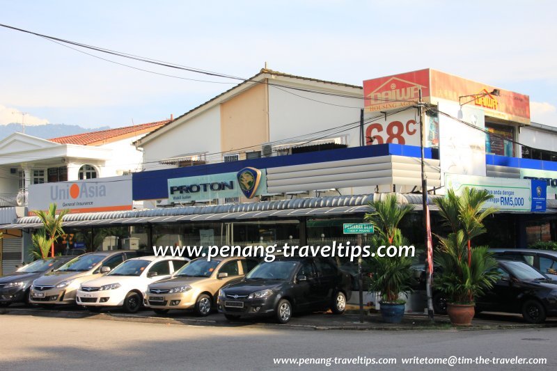
The main access road to Island Park is Jalan Masjid Negeri, formerly known as Green Lane. Traffic is usually very heavy throughout the day. However, due to Island Park's relatively central location, it doesn't take that long to exit the area, compared to more remote neighbourhoods. The main roads within Island Park are Jalan Besi and Jalan Tembaga. Traffic as well as noise level is higher along these two roads whereas the offshoots are relatively quiet. Most of the residential properties along Green Lane in Island Park are now converted to commercial use (23 September 2012)
 Businesses and Services in Island Park
- Neph Dialysis Centre (GPS: 5.3954, 100.30151)
Places to eat in Island Park
- Tong Seng Roasted House (Hainanese Chicken Rice/Duck Rice), 16, Jalan Mas, Taman Guan Joo Seng, Penang; opening hours: 9am to 4pm ( Close on Thursday)
Roads in Island Park
Island Park is  on the Map of Green Lane, Penang
List of Housing Estates in Penang and Housing Estates in Malaysia

Copyright © 2003-2025 Timothy Tye. All Rights Reserved.

 Go Back