Fukushima Prefecture is a prefecture of Japan in the Tohoku Region, in northeastern Honshu. Covering an area of 13,782 sq km, it is the third largest prefecture in Japan, and the second largest in the Tohoku Region after Iwate Prefecture. Fukushima Prefecture has a population of 2.1 million people. Its capital is the City of Fukushima.
Fukushima Prefecture is the southernmost prefecture in the Tohoku Region. The mountain ranges carve the prefecture into three areas known as Aizu, Nakadori and Hamadori. Hamadori is the coastal strip with most of the flat land.
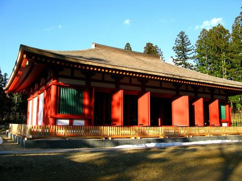
 Enichiji Temple, Fukushima Prefecture
Source: http://commons.wikimedia.org/wiki/File:Historic_Site_of_Enichiji_Temple.JPG
Author: Qwert1234

Author: Qwert1234

Fukushima Prefecture faces the Pacific Ocean to the east. It borders Miyagi Prefecture and Yamagata Prefecture to the north, Niigata Prefecture to the west, Gunma Prefecture to the southwest, Tochigi Prefecture to the south and Ibaraki Prefecture to the southeast.
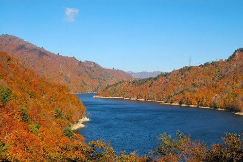
 Lake Okutadami, Fukushima Prefecture
Source: http://en.wikipedia.org/wiki/Hinoemata,_Fukushima
Author: Kropsoq

Author: Kropsoq

Updates
11 March, 2011Fukushima Prefecture suffered from massive devastation brought on by a 9.0 magnitude earthquake and subsequent tsunami, which damaged the Fukushima Nuclear Plant in the town of Okuma. Some 45,000 people living in Okuma and the surrounding towns and villages of Fukushima Prefecture were forced to evacuate due to radiation leakage.
How to go to Fukushima Prefecture
By PlaneYou can fly to Fukushima Airport. It receives regular scheduled flights by JAL and ANA.
By Train
Take the Tohoku Shinkansen bullet train from Tokyo. It makes stops in Shirakawa, Koriyama and Fukushima.
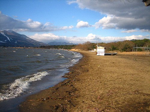
 Tenjin Beach, Lake Inawashiro
Source: http://commons.wikimedia.org/wiki/File:Tenjinhama_in_winter.JPG
Author: BrianAdler

Author: BrianAdler

Cities of Fukushima Prefecture
Tourist Attractions of Fukushima Prefecture
- Hinoemata
Village famous for its soba noodles and kabuki performances. - Lake Inawashiro
One of the biggest lakes in Japan. - Mount Bandai
Volcano in Bandai-Asahi National Park with picturesque landscape.
 Latest updates on Penang Travel Tips
 Map of Roads in Penang
Looking for information on Penang? Use this Map of Roads in Penang to zoom in on information about Penang, brought to you road by road.
Copyright © 2003-2025 Timothy Tye. All Rights Reserved.

 Go Back