 Beach in Amami, Kagoshima
Source: http://commons.wikimedia.org/wiki/File:Amami_beach.jpg
Author: TANAKA Juuyoh

Author: TANAKA Juuyoh

Kagoshima Prefecture (鹿児島県) is the southernmost prefecture of mainland Japan. It is located on the southern part of Kyushu. Covering 9,132.42 sq km, Kagoshima Prefecture has a population of 1.7 million people. Its capital is also called Kagoshima. The prefecture includes a chain of islands that continues in a southwest direction from Kyushu, among them the Amami Islands.
Kagoshima Prefecture is bordered by Kumamoto Prefecture to the north and Miyazaki Prefecture to the east. It faces the Yellow Sea to the west and the Pacific Ocean to the east. Okinawa Prefecture is located to the south. Mainland Kagoshima Prefecture comprises Satsuma Peninsula and Osumi, with Kagoshima Bay in between them.
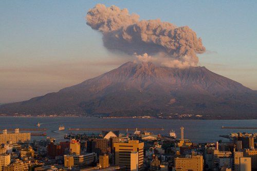
 Sakurajima, as seen from Kagoshima
Source: http://commons.wikimedia.org/wiki/File:Sakurajima_at_Sunset.jpg
Author: Kimon Berlin

Author: Kimon Berlin

The geography of Kagoshima Prefecture is characterized by a mountainous terrain punctuated by dormant and active volcanoes. One of the active volcanoes is Sakurajima, which looms over Kagoshima Bay within sight of Kagoshima City. Whenever it rumbles, one should not be without an umbrella - as protection against particles and ash.
Kagoshima Prefecture was created out of Osumi Province and Satsuma Province during the Meiji Restoration of 1871. The prefecture is rural, with its economy based on agriculture. Among its agricultural exports include green tea, sweet potato, radish and Pongee rice. Kagoshima Prefecture is also renowned for the production of a type of Japanese earthenware pottery known as Satsuma ware.
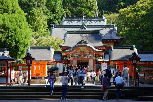
 Kirishima-jingu shrine in Kirishima, Kagoshima Prefecture
Source: http://commons.wikimedia.org/wiki/File:Kirishima-jingu01n4500.jpg
Author: 663highland

Author: 663highland

Planning your trip to Kagoshima Prefecture
The most practical way to reach Kagoshima prefecture from Tokyo is to take a flight. A flight from Tokyo Haneda to Kagoshima Airport takes about two hours. There are also flights from Osaka Itami Airport.A train journey from Tokyo to Kagoshima involves changing trains in Osaka, Fukuoka and Shin-Yatsushiro. It takes over 8 hours and costs ¥29,000.
Cities of Kagoshima Prefecture
- Kagoshima - capital
- Aira
- Akune
- Amami
- Hioki
- Ichikikushikino
- Isa
- Izumi
- Kanoya
- Makurazaki
- Minamikyushu
- Minamisatsuma
- Nishinoomote
- Satsumasendai
- Shibushi
- Soo
- Tarumizu
Tourist Attractions of Kagoshima Prefecture
- Cape Sata
- Chiran Peace Museum
- Ibusuki
- Kanoya
- Kirishima
- Kuchinoerabu
- Mishima Islands
- Okinoerabujima
- Sakurajima
- Tanegashima
- Yakushima
 Latest updates on Penang Travel Tips
 Map of Roads in Penang
Looking for information on Penang? Use this Map of Roads in Penang to zoom in on information about Penang, brought to you road by road.
Copyright © 2003-2025 Timothy Tye. All Rights Reserved.

 Go Back