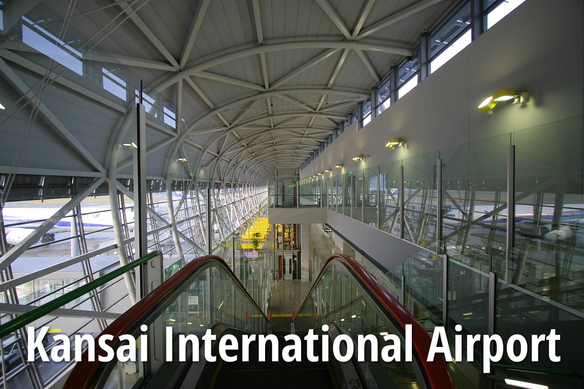
 Kansai International Airport (30 March, 2007)
Kansai International Airport (KIX) is the main international gateway to the Kansai Region, a huge metropolitan region of Japan with 18 million inhabitants. The main cities in Kansai are Osaka, Kyoto, Kobe and Nara. Kansai International Airport was built on an artificial island in Osaka Bay. The island measures 4km long and 1km wide. Construction of the island started in 1987. It included the construction of a 3km bridge that cost US$1 billion. The terminal building, designed by Italian architect Renzo Piano, is the longest building in the world. It measures 1.7km from end to end. Construction of the terminal building commenced in 1991, and was open to the public in 1994. The project cost US$15 billion, and was 40% over budget.
Kansai International Airport is the hub for Japan Airlines, All Nippon Airways, and Nippon Cargo Airlines. The airport is still massively in debt, having to service a US$560 million interest. Many airlines shy away due to its high landing fees - at $7500, it is the second highest in the world after Narita, opting for the newer Kobe Airport and Nagoya's Chubu Centrair International Airport.
Getting out of Kansai International Airport
There are several options to choose from for passengers arriving at Kansai International Airport.By train
Kansai International Airport is connected by train to Osaka and Kyoto. The Kansai Airport station is located across the road from the arrivals hall. The fastest way is to travel on the express JR Haruka and Nankai rapi:t, while the cheaper option in on the JR Rapid Service and the Nankai Rapid Service. JR and Nankai are the two train operators, and they each offer two service options.
JR Haruka
Non-reserved seats on the JR West Haruka service connects the airport to Tennoji (29 min, ¥1760), Shin-Osaka (45min, ¥2470) and Kyoto (73min, ¥2980). The trains run every 30 minutes. You can connect to the Shinkansen bullet train at the Shin-Osaka station.
JR Rapid Service
The JR Rapid Service also goes to the Tennoji station (43 min, ¥1030), continues on to Osaka station (63 min) and Kyobashi (72 min, ¥1160). The JR Rapid Service is a convenient way to connect at Osaka Station to Kobe or Kyoto, but it doesn't connect to the Shinkansen stations; to do that, you have to transfer to a local or rapid train heading for Kyoto.
Nankai rapi:t
This is a recommended means of reaching central Osaka. There are two trains, the rapi:t α and the rapi:t β The rapi:t train goes to Namba station in Osaka, with stops at Shin-Imamiya, Tengachaya, Izumisano, and Rinku, and takes 29 minutes. The rapi;t β takes 34 minutes, with stops at Sakai and Kishiwada. Both run every 30 min, and cost ¥1390, including a ¥ reservation surcharge.
Nankai Rapid Service
Just like the JR Rapid Service, this train has more stops than Nankai rapi:t. A trip to Namba takes 42 min but only costs ¥890, making it the cheapest option out of Kansai by train.
By bus
The Airport Limousine buses are available on the 1st floor outside the arrivals hall. Buses go directly to some major hotels, but may be slightly more expensive than the trains, and in good traffic conditions, may be a faster options to reach some destinations like Kobe (60 min, ¥1500).
By taxi
The most expensive choice as with anywhere in Japan, a trip by taxi from Kansai Airport to Osaka will put you back a minimum of ¥16,000; to Kyoto the meter reaches ¥32,000.
By shuttle van
This is a cheaper option than taxis, to go door-to-door. Shared shuttle van services are available from the taxi companies. Expect to pay ¥2300 per person to Kobe, ¥3000 to Kyoto, including one suitcase and one carry-on luggage, anything above that is an additional charge of ¥1000.
List of Airports in Japan
 Latest updates on Penang Travel Tips
 Map of Roads in Penang
Looking for information on Penang? Use this Map of Roads in Penang to zoom in on information about Penang, brought to you road by road.
Copyright © 2003-2025 Timothy Tye. All Rights Reserved.

 Go Back