Niihama (Japanese: 新居浜市) is a city on the eastern part of Ehime Prefecture, on the island of Shikoku, Japan. It covers 234 sq km (90 sq mi) and has a population of 126,000 people (2012 estimate).
Facing the Seto Inland Sea to the north, Imabari is surrounded by hills and mountains to the south, east and west. Due to the mountains, the city is isolated from neighboring cities such as Saijo to the west and Shikokuchuo to the east.
Facing the Seto Inland Sea to the north, Niihama is surrounded by hills and mountains to the south, east and west. Due to the mountains, the city is isolated from neighboring cities such as Saijo to the west and Shikokuchuo to the east.
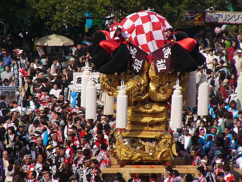
Perhaps the best time to visit Niihama is during the Niihama Taiko Festival, usually on 16-18 October annually. During this festival, huge floats - some weighing as much as two and a half tons or even more - are paraded through the streets. Within the float is a drummer beating a taiko, or big drum. These floats are carried by men and boys to the local shrines to be blessed by the Shinto priests. As with many Japanese festivals, this is accompanied by the drinking of copious amounts of sake.
Among the sights in Niihama includes Zuio-ji Temple, a Zen temple in south Niihama. There are also two waterfalls in the area. The city also has the world's largest planetarium at the Ehime Prefectural Science Museum.
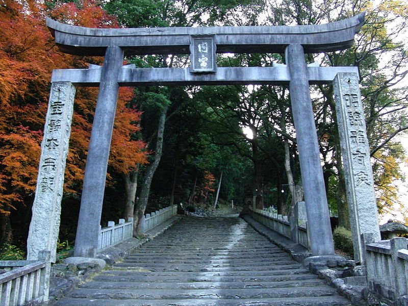
 The Ootorii of Uchinomiya-jinja Shinto Shrine in Niihama, Japan
Source: http://commons.wikimedia.org/wiki/File:Uchinomiyajinja-ootorii.jpg
Author: Munimuni2001

Author: Munimuni2001

Planning your trip to Niihama
Niihama is served by the Yosan Line of Japan Railway between Uwajima and Takamatsu. Niihama Taiko Festival
Source: http://commons.wikimedia.org/wiki/File:Niihamataikomatsuri001.jpg
Author: quicksilver733

Author: quicksilver733

Places of Interest in Niihama
- Choshi no Taki Waterfall
- Ehime Prefectural Science Museum
- Mato no Taki Waterfall
- Zuio-ji Temple
 Latest updates on Penang Travel Tips
 Map of Roads in Penang
Looking for information on Penang? Use this Map of Roads in Penang to zoom in on information about Penang, brought to you road by road.
Copyright © 2003-2025 Timothy Tye. All Rights Reserved.

 Go Back