Sendai (Japanese: 仙台市) is the capital and largest city in Miyagi Prefecture, Japan. It covers 788.09 sq km (304.28 sq mi) and has a population of over a million people (2012 estimate).
Sendai is often called the City of Trees in Japan. This is because of the zelkova trees planted along Jozenji Street and Aoba Street. Although the Sendai area has been inhabited for some 20,000 years, the present city traces its history to 1600. It was given city status on 1 April 1889. At that time, it covered only 17.45 sq km (6.74 sq mi) and had a population of 86,000 people. It has grown much bigger since then, absorbing neighboring towns and villages as it expanded. Sendai was made a Designated City on 1 April 1989.
Sendai suffered severe damage from the 9.0 earthquake of 11 March 2011, with Sendai Airport among the affected sites.
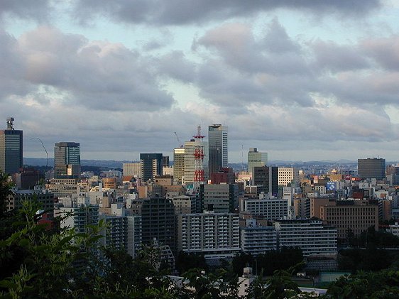
 Sendai, Miyagi Prefecture, Japan
Source: http://commons.wikimedia.org/wiki/File:Skyscrapers_near_the_X-shaped_bridge_viewed_from_Sendai_castle_1.JPG
Author: Neuropower

Author: Neuropower

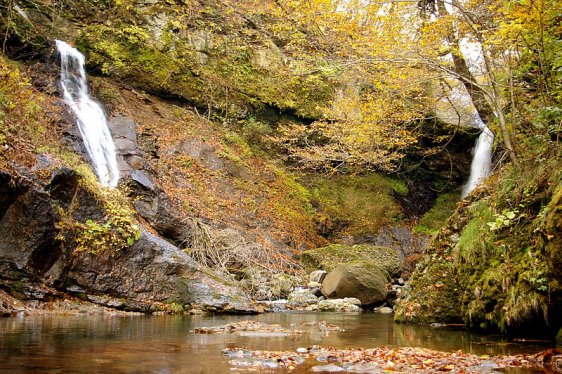
 Shimaidaki waterfalls, Sendai
Source: http://commons.wikimedia.org/wiki/File:Ane(right)and_imouto(left)falls.jpg
Author: kumamushi

Author: kumamushi

Planning your trip to Sendai
Sendai Airport has reopened since the devastation brought on by the 2011 tsunami. It receives flights mainly from domestic destinations. From the airport, take the Sendai Airport Access train to reach the JR Sendai Station. The journey takes 17-25 minutes and costs ¥630.The Tohoku Shinkansen bullet train takes about 2 hours to travel from Tokyo to Sendai. There are several services including the Hayate, the Hayabusa and the Yamibiko services.
Sights & Attractions to visit in Sendai
- Futakuchi Gorge
- Miyagi Museum of Art
- Mutsu Kokubun-ji Yakushido
- Osaki Hachiman-gu
- Sendai Bungakukan
- Sendai Castle
- Sendai City Museum
- Tomizawa Preserved Forest
- Tomizuka Tomb
 Latest updates on Penang Travel Tips
 Map of Roads in Penang
Looking for information on Penang? Use this Map of Roads in Penang to zoom in on information about Penang, brought to you road by road.
Copyright © 2003-2025 Timothy Tye. All Rights Reserved.

 Go Back