 Ritsurin Garden in Takamatsu, Kagawa Prefecture
Source: http://commons.wikimedia.org/wiki/File:Ritsurin_park11s3200.jpg
Author: 663highland

Author: 663highland

Shikoku is one of the four main islands of Japan. It covers 18,000 sq km (7,260 sq mi). In terms of size, Shikoku is the smallest of the four main islands. It has a population of 4.1 million people, making it the least populous main island, even less than that of Singapore (which is only 712 sq km/274.2 sq mi). Shikoku measures about 225 km (139.8 mi) from end to end. Its width is between 50 km to 150 km.
The island is subdivided into four prefectures namely Ehime, Kagawa, Kochi and Tokushima. These were created out of the former provinces of Awa, Iyo, Sanuki and Tosa during the Meiji Restoration of the 19th century.
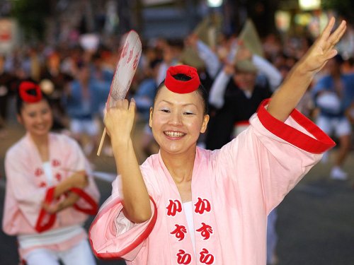
 Awa Odori Festival, Tokushima Prefecture, Shikoku
Source: http://commons.wikimedia.org/wiki/File:Awa-odori_2008_Tokushima_05.jpg
Author: Rosino

Author: Rosino

Shikoku is separated from Honshu by the Inland Sea. Across the Inland Sea are the prefectures of Wakayama, Osaka, Hyogo, Okayama, Hiroshima and Yamaguchi. To the west of Shikoku is the island of Kyushu.
Shikoku is quite mountainous. As a result, most of the population of the island is concentrated along the coast facing the Inland Sea, and in selected areas facing the Pacific Ocean. The tallest peak in Shikoku is Mount Ishizuchi (), which is 1,982 m (6,503 ft) tall. The longest river is Yoshino River (吉野川), which is 196 km (121.8 mi) long. The river ranks as the top whitewater ranking destination in Japan.
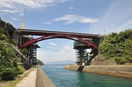
 Funakoshi Canal, Shikoku
Source: http://commons.wikimedia.org/wiki/File:Funakoshi_Canal_01.JPG
Author: Reggaeman

Author: Reggaeman

Planning your trip to Shikoku
Getting to Shikoku is now most convenient by road, as the island is connected to mainland Honshu by a number of expressways linked by massive bridges. The Kobe-Awaji-Naruto Expressway connects eastern Shikoku to Honshu, the Seto-Chuo Expressway connects Central Shikoku to Honshu, while the Nishiseto Expressway connects Western Shikoku to Honshu.The Kobe-Awaji-Naruto Expressway crosses the Akashi Strait from Hyogo Prefecture in Honshu to Tokushima Prefecture in Shikoku, connected by the Akashi-Kaikyo Bridge and Onaruto Bridge. The Great Seto Bridge, which is in fact a series of bridges, takes the Seto-Chuo Expressway across the Inland Sea, connecting Okayama Prefecture to Kagawa Prefecture. A series of nine bridges take the Nishiseto Expressway across the Inland Sea from Hiroshima Prefecture to Ehime Prefecture.
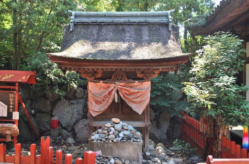
 Kariteimoten-do (a National Cultural Property) at Ishite-ji Temple, Matsuyama
Source: http://commons.wikimedia.org/wiki/File:Ishiteji_12.JPG
Author: Reggaeman

Author: Reggaeman

Main Cities on Shikoku
Prefectures of Shikoku
Tourist Attractions of Shikoku Region
- Cape Ashizuri
- Iya Valley
- Kotohira
- Mount Ishizuchi
- Yoshino River
 Latest updates on Penang Travel Tips
 Map of Roads in Penang
Looking for information on Penang? Use this Map of Roads in Penang to zoom in on information about Penang, brought to you road by road.
Copyright © 2003-2025 Timothy Tye. All Rights Reserved.

 Go Back