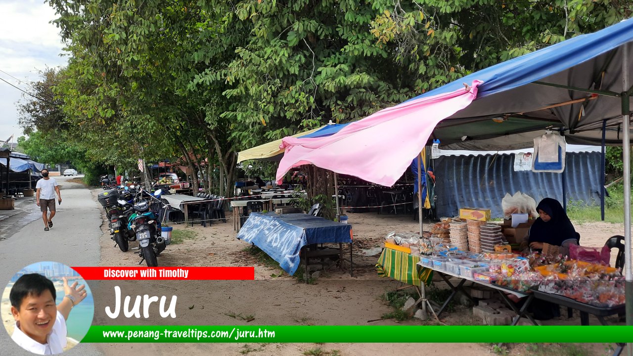
 Juru, Seberang Perai (2 February 2023)
Juru (GPS: 5.31634, 100.44396) is an industrial area in Seberang Perai. It was named after the village of Kampung Juru, which in turn was named after the river Sungai Juru.
Juru is within the Simpang Ampat postal area. However, it is geographically part of Bukit Mertajam, in Seberang Perai Tengah. It includes several heavily industrialised areas including Bukit Tengah and Bukit Minyak, as well as the villages of Kampung Bagan Nyior, Kuala Juru, Kampung Sungai Semilang, Kampung Bukit Kecil and Kampung Tok Kangar. Among the housing estates here are Taman Cendana and Taman Desa Juru. Small-scale industries can be found at Taman Perusahaan Juru and Taman Perindustrian Beringin.
A pasar malam or night market is held every Wednesday evening from 6:00pm to 9:30pm at the pasar malam site (GPS: 5.316123, 100.441290)
 along Jalan Juru.
Measured from the junction of Jalan Besar with Jalan Juru (GPS: 5.316246, 100.444009), Juru is 14.2 km to Penang Sentral, 10.9 km to the Penang Bridge, 18.3 km to the Second Penang Bridge and 28.7 km to the Penang International Airport.
 Map of Juru
Sights in Juru
- FUHotel (GPS: 5.35475, 100.41956)

- Ikan Bawal Juru Warung Kelapa Sawit Kampung Tok Kangar (GPS: 5.32024, 100.43332)

High-rise residential properties in Juru
- EXO Residences (GPS: 5.34292, 100.43563)

- Glisten Hill (GPS: 5.3207, 100.44613)

 Landed Residential Properties in Juru
- Cendana Indah Residency (GPS: 5.30983, 100.42943)

- Park View Residences (GPS: 5.33338, 100.42841)

 Commercial Properties in Juru
- EXO City (GPS: 5.34292, 100.43563)

- Juru Auto City (GPS: 5.33835, 100.43062)

 Markets in Juru
- Pasar Awam Perkampungan Juru (GPS: 5.31497, 100.44242)

- Pasar Awam Seri Delima (GPS: 5.31802, 100.43558)

 Petrol Stations in Juru
- Petron Jalan Kebun Nenas (GPS: 5.34118, 100.43403)

- Petronas Jalan Perusahaan (GPS: 5.341129, 100.429224)

 Schools in Juru
- SJK(C) True Light (GPS: 5.31571, 100.44608)

- SJK(T) Ladang Juru (GPS: 5.31384, 100.43117)

- SK Juru (GPS: 5.31485, 100.42487)

Hospitals and public clinics in Juru
- Klinik Desa Kampung Sekolah (GPS: 5.34118, 100.43403)

- Petronas Jalan Perusahaan (GPS: 5.341129, 100.429224)

Places of worship in Juru
- Masjid Bagan Nyiur (GPS: 5.32535, 100.41624)

- Masjid Jamek Kampung Sekolah Juru (GPS: 5.31808, 100.42137)

- Masjid Kuala Juru (GPS: 5.32535, 100.41624)

- Sri Maha Mariamman Temple, Kampung Dock (GPS: 5.34528, 100.42293)

Villages in Juru
Food Recommendations
What to eat in Juru? The following are recommendations of members of my Penang Hawker Food Facebook Group of what they like to eat from hawker stalls in Juru.Getting there
Exit the North-South Expressway (E1) at the Juru Interchange (Exit 160).Juru is  on the Map of Seberang Perai
Juru on Google Street View
Juru (Mar 2021)Penang Mainland; list of Towns in Penang and Towns in Malaysia

Copyright © 2003-2025 Timothy Tye. All Rights Reserved.

 Go Back


