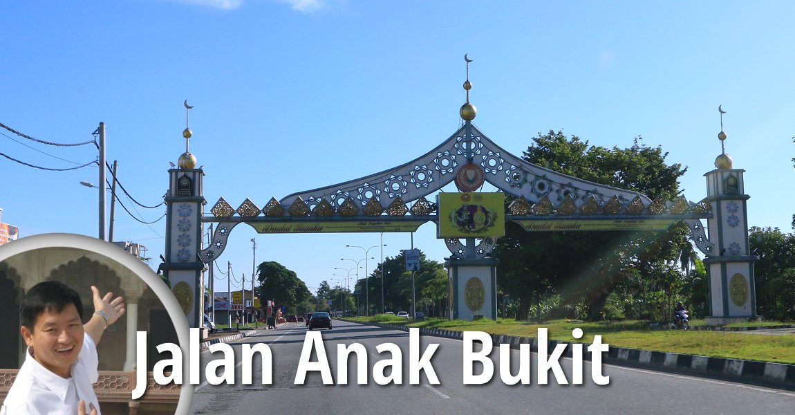
 Jalan Anak Bukit, Alor Setar (30 July, 2016)
Jalan Anak Bukit is a major road in Alor Setar. The main road through Anak Bukit, a northern suburb of the city, Jalan Anak Bukit connects Jalan Jitra in the north with Lebuhraya Darul Aman in the south, at the intersection with Jalan Sultanah. It is the main approach from the north, and is hence designated as part of Federal Route 1. Jalan Anak Bukit meets Jalan Jitra at Kepala Batas, Kedah.
Map of sights along Jalan Anak Bukit
Hotels along Jalan Anak Bukit
- TH Hotel and Convention Centre Alor Setar
 (GPS: 6.19781, 100.38865)
Sights along Jalan Anak Bukit
- Futbal Centre (GPS: 6.20028, 100.38924)

- Istana Anak Bukit (GPS: 6.15042, 100.37012)

- Padang Wisma (GPS: 6.14481, 100.37115)

- Menteri Besar's Official Residence (GPS: 6.16479, 100.36762)

- Taman Budaya Negeri (GPS: 6.15042, 100.37012)

Transport Stations along Jalan Anak Bukit
- Petron Alor Merah (GPS: 6.18315, 100.37463)

- Sultan Abdul Halim Airport (GPS: 6.19186, 100.39506)

Petrol Stations along Jalan Anak Bukit
- Petron Alor Merah (GPS: 6.14529, 100.36972)

- Petron Jalan Anak Bukit (GPS: 6.14529, 100.36972)

- Shell Alor Merah (GPS: 6.15953, 100.36856)

Markets along Jalan Anak Bukit
- Bazaar Larut Malam 1Malaysia (GPS: 6.20193, 100.41135)

- Pasar Sehari Anak Bukit (GPS: 6.18138, 100.3732)

Mosques along Jalan Anak Bukit
- Masjid Al-Bukhary Pantai Johor (GPS: 6.16742, 100.36887)

- Masjid Alor Merah (GPS: 6.1577, 100.36856)

- Masjid Intan Shafinaz (GPS: 6.17852, 100.37154)

- Masjid Kampung Titi Baru (GPS: 6.20263, 100.39912)

- Masjid Tuan Husin (GPS: 6.19642, 100.38484)

Amenities along Jalan Anak Bukit
- Anak Bukit Police Station (GPS: 6.18632, 100.37726)

- Kepala Batas Police Station (GPS: 6.20279, 100.40598)

Government Buildings along Jalan Anak Bukit
- Jabatan Pertahanan Awam Negeri Kedah (GPS: 6.18023, 100.37264)

- Kompleks Latihan PDRM (GPS: 6.1756, 100.37116)

- Kompleks Pentadbiran Kerajaan Persekutuan/Federal Government Administration Complex (GPS: 6.1847, 100.37665)

- Kuarters Meterologi Kepala Batas (GPS: 6.20311, 100.40466)

- Wisma Darul Aman (GPS: 6.14608, 100.3722)

- Wisma Perwira Kolej Tentera Udara (GPS: 6.2019, 100.4043)

Schools along Jalan Anak Bukit
- SJK (C) Soon Jian (GPS: 6.16166, 100.37013)

- SK Titi Gajah (GPS: 6.19273, 100.38227)

- SMK Tunku Abdul Halim (GPS: 6.16166, 100.37013)

Hospitals along Jalan Anak Bukit
- Kedah Medical Centre (GPS: 6.14529, 100.36972)

Housing Estates along Jalan Anak Bukit
- Taman Berlian (GPS: 6.17369, 100.36997)

- Taman Sri Pinang (GPS: 6.14529, 100.36972)

Apartments along Jalan Anak Bukit
- Apartment KCS (GPS: 6.14529, 100.36972)

Villages along Jalan Anak Bukit
- Kampung Alor Senjaya (GPS: 6.18857, 100.37934)

- Kampung Titi Gajah (GPS: 6.19159, 100.38081)

Major Junctions on Jalan Anak Bukit
Back to Discover Alor Setar mainpage; list of Streets of Alor Setar, Streets of Kedah and Streets of Malaysia
 Latest updates on Penang Travel Tips

Copyright © 2003-2025 Timothy Tye. All Rights Reserved.

 Go Back


