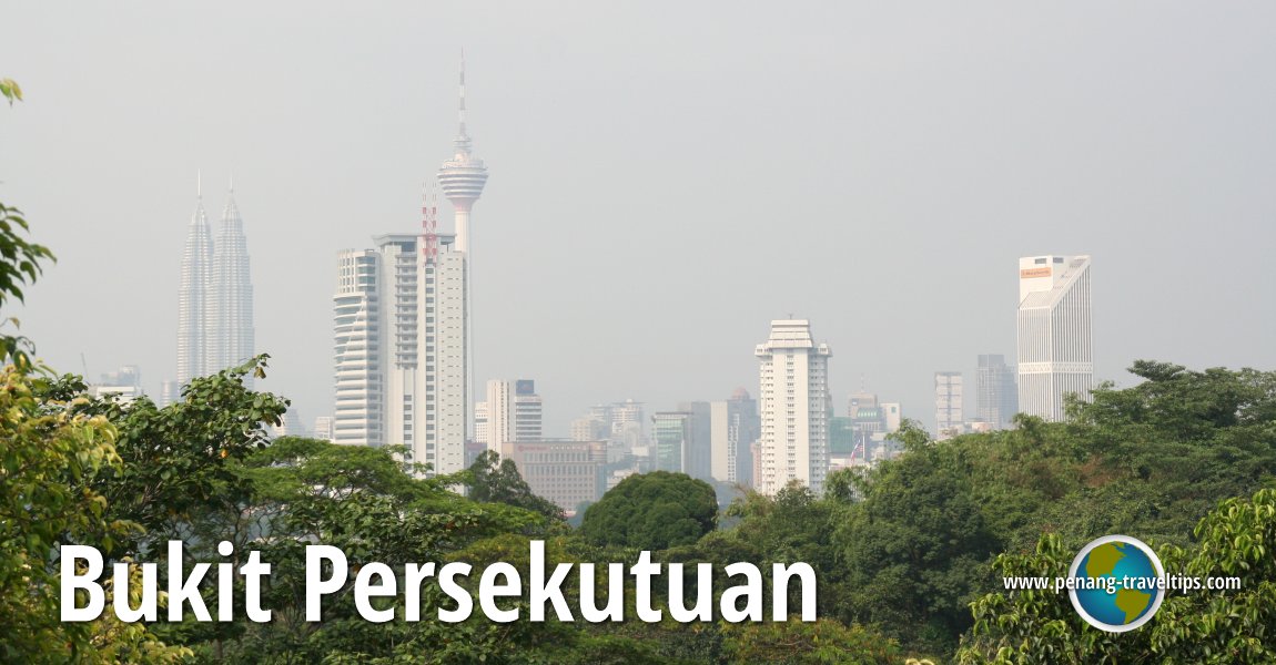
 View of the Kuala Lumpur skyline from Bukit Persekutuan (18 July, 2009)
Bukit Persekutuan (GPS: 3.13781, 101.67942) is a hilly area to the southwest of the Kuala Lumpur city centre. Also called Federal Hill, it is bordered by the Perdana Botanical Gardens (KL Lake Gardens) to the northeast, KL Sentral and Brickfields to the southeast, Bangsar to the southwest and Damansara to the northwest.
Bukit Persekutuan got its name from the government quarters that were built there since the early 20th century. During that time, the British colonial government built bungalows here to house the colonial officers of the then Federated Malay States. The road leading to these bungalows was called Federal Road (nowadays Jalan Persekutuan).
Federal Hill got its name in 1952, in commemoration of the formation of the Federation of Malaya in 19481 This was eventually translated to Bukit Persekutuan. As with so many choice localities in Kuala Lumpur, Bukit Persekutuan is today a leafy affluent neighbourhood. There aren't any high rises here, with most of the development being upscale landed properties. Several of the state royal families have their satellite palaces, or istana hinggap, on Bukit Persekutuan, including the royal houses of Kedah, Negeri Sembilan and Perak.
Sights in Bukit Persekutuan, Kuala Lumpur
Amenities in Bukit Persekutuan
- Galeria Sri Perdana (GPS: 3.14368, 101.6744)

- Istana Darul Aman (Istana Hinggap Kedah), (GPS: 3.14051, 101.67767)

- Istana Hinggap Negeri Sembilan (GPS: 3.1382, 101.68019)

- Istana Hinggap Perak (GPS: 3.13624, 101.68151)

- Travers Police Station (GPS: 3.13446, 101.6834)

Residential Estates on Bukit Persekutuan
Roads in Bukit Persekutuan
360° View of Bukit Persekutuan on Google Maps Street View
Bukit PersekutuanReferences
- Kuala Lumpur Street Names by Mariana Isa & Maganjeet Kaut, published by Marshall Cavendish (2015) page 99.
Back to Discover Kuala Lumpur; list of Neighbourhoods of Kuala Lumpur and Towns of Malaysia

Copyright © 2003-2025 Timothy Tye. All Rights Reserved.

 Go Back