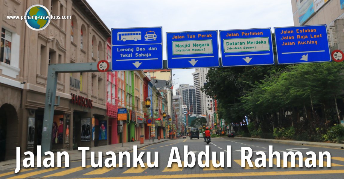
 Jalan Tuanku Abdul Rahman, Kuala Lumpur (8 July, 2016)
Jalan Tuanku Abdul Rahman is one of the major roads in Kuala Lumpur. It is today a one-way street with traffic moving from north to south, beginning at the intersection with Jalan Sultan Azlan Shah, Jalan Pahang and Jalan Raja Muda Abdul Aziz, and ends at the intersection with Jalan Tun Perak. Jalan Tuanku Abdul Rahman is a major shopping street in Kuala Lumpur, catering to a lower middle class market.
Jalan Tuanku Abdul Rahman was originally known as Batu Road. Batu Road was named after the village of Kampung Batu, which in turn was named after the rivers flowing through the area, collectively called Sungai Batu. Interestingly, the limestone caves in the vicinity are called Batu Caves, after Batu area. Batu Road was renamed Jalan Tuanku Abdul Rahman in honour of the first Yang di-Pertuan Agong, Tuanku Abdul Rahman ibni Almarhum Tuanku Muhammad. It was the main road leading to Kampung Batu, one of the early mining villages to the north of Kuala Lumpur.
From a swampy beginning, Jalan Tuanku Abdul Rahman slowly evolved to become a major working-class shopping street by the mid 20th century. The major roads intersecting Jalan Tuanku Abdul Rahman are Jalan Chow Kit, Jalan Sultan Ismail and Jalan Dang Wangi.
Map of Jalan Tuanku Abdul Rahman, Kuala Lumpur
Hotels along Jalan Tuanku Abdul Rahman
- Cititel Express
 (GPS: 3.1644, 101.69833)
- Empress Hotel - under renovation (GPS: 3.164, 101.69843)

- Frenz Hotel
 (GPS: 3.15397, 101.69657)
- Hotel Akar Kuala Lumpur (GPS: 3.16197, 101.69805)

- My Home Premier (Youth) Hotel
 (GPS: 3.16279, 101.69816)
- Neotel Hotels Kuala Lumpur
 (GPS: 3.16477, 101.69837)
- Premiera Hotel
 (GPS: 3.15833, 101.6958)
- Selesa Inn
 (GPS: 3.15903, 101.69657)
- Swiss Hotel
 (GPS: 3.15152, 101.69525)
- TTanz Hotel
 (GPS: 3.16039, 101.69677)
- Tune Hotel Downtown KL
 (GPS: 3.16039, 101.69677)
Restaurants along Jalan Tuanku Abdul Rahman
- Restoran Nasi Kandar Ibramsha (GPS: 3.15274, 101.69612)

- Restoran Nasi Kandar Penang (GPS: 3.15837, 101.69646)

- Restoran Rohani (GPS: 3.15105, 101.69531)

Shopping Malls & Department Stores along Jalan Tuanku Abdul Rahman
- Busana (GPS: 3.15813, 101.6957)

- Cosmic Wholesale Emporium (GPS: 3.15562, 101.69597)

- Maju Junction Mall
- Pertama Complex (GPS: 3.15729, 101.69517)

Department Stores along Jalan Tuanku Abdul Rahman
- Harisons Clothing Store (GPS: 3.15667, 101.69624)

- Houz Depot (GPS: 3.15739, 101.69616)

- Kamdar Jalan Tuanku Abdul Rahman (GPS: 3.15356, 101.69665)

- Mydin Wholesale Emporium (GPS: 3.16344, 101.6979)

- Sogo Department Store (GPS: 3.15611, 101.69539)

Petrol Stations along Jalan Tuanku Abdul Rahman
- Shell (GPS: 3.16353, 101.69842)
Banks along Jalan Tuanku Abdul Rahman
- Bank Muamalat (GPS: 3.16249, 101.69816)
- CIMB Bank (GPS: 3.16087, 101.69703)
- Maybank (GPS: 3.16356, 101.69794)
Public Amenities along Jalan Tuanku Abdul Rahman
- Pos Malaysia Medan Tuanku (GPS: 3.15935, 101.69686)

Commercial and high-rise properties along Jalan Tuanku Abdul Rahman
- Menara Centara (GPS: 3.1621, 101.69749)

- Menara Mara (GPS: 3.15833, 101.6958)

- Menara TH Perdana (GPS: 3.15968, 101.69608)

- Sun Life Malaysia Building (GPS: 3.16087, 101.69703)

- Wisma Bandar (GPS: 3.15173, 101.69533)

- Wisma Harwant (GPS: 3.15387, 101.69637)

- Wisma MLS (GPS: 3.15195, 101.69589)

Cinemas along Jalan Tuanku Abdul Rahman
- Coliseum Theatre (GPS: 3.15343, 101.69635)

- Odeon Cinema (GPS: 3.15707, 101.69607)

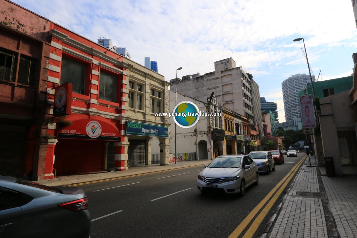 Jalan Tuanku Abdul Rahman, Kuala Lumpur (15 June, 2017)
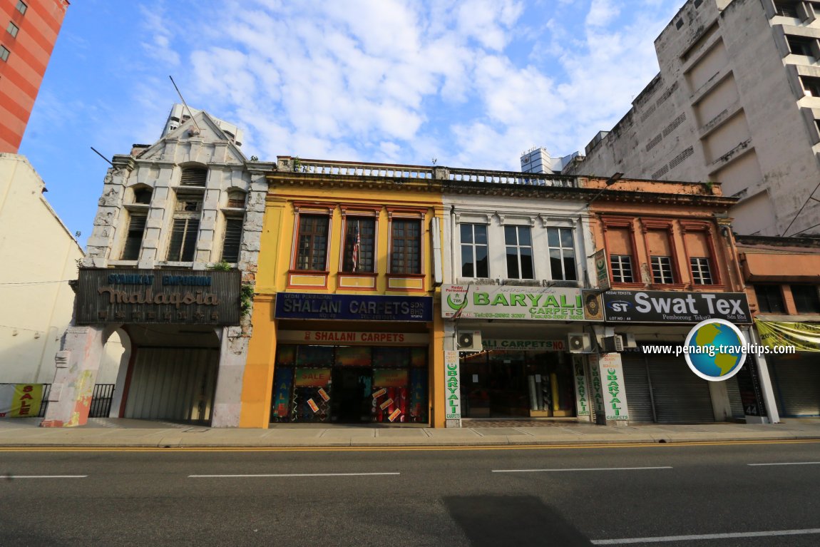 Indian Muslim businesses along Jalan Tuanku Abdul Rahman (15 June, 2017)
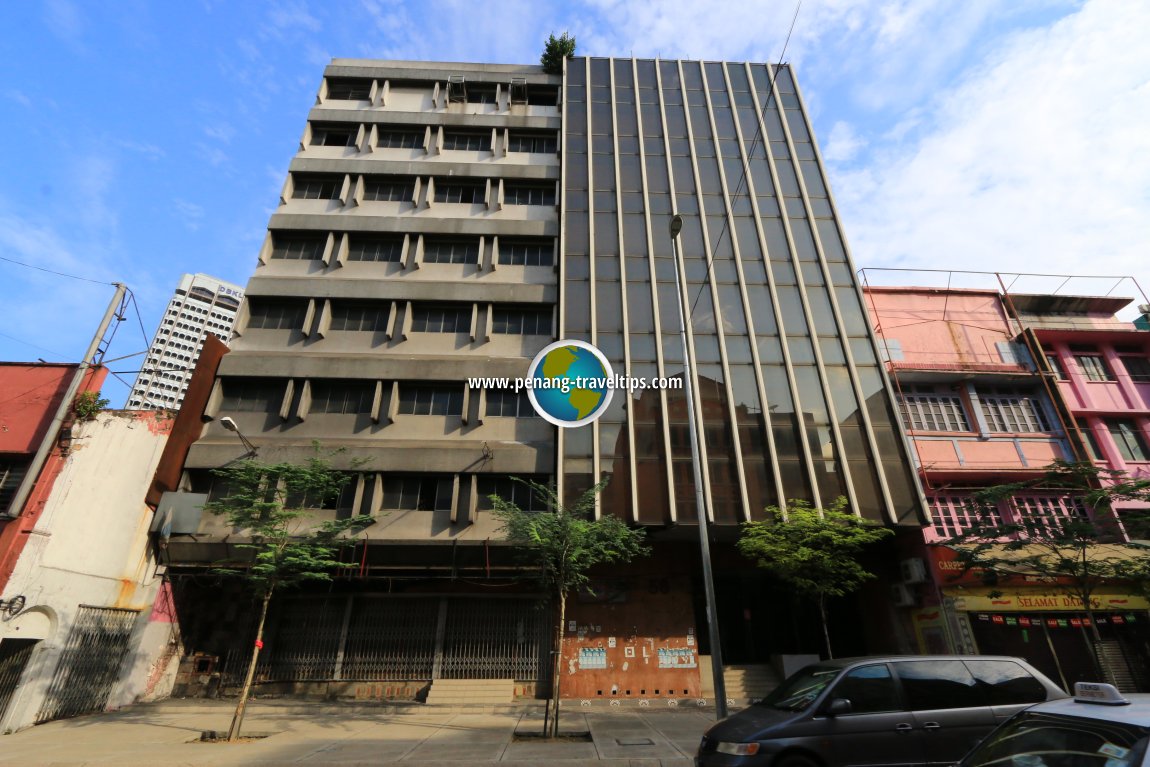 Disused buildings along Jalan Tuanku Abdul Rahman (15 June, 2017)
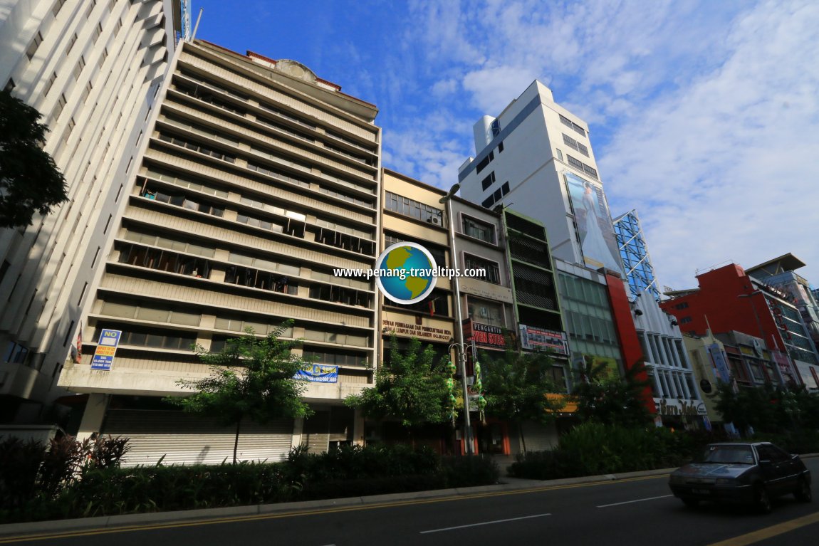 Buildings along Jalan Tuanku Abdul Rahman including the Kuala Lumpur and Selangor Indian Chamber of Commerce & Industry. (15 June, 2017)
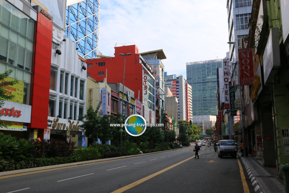 Jalan Tuanku Abdul Rahman, with Menara Mara in the distance. (15 June, 2017)
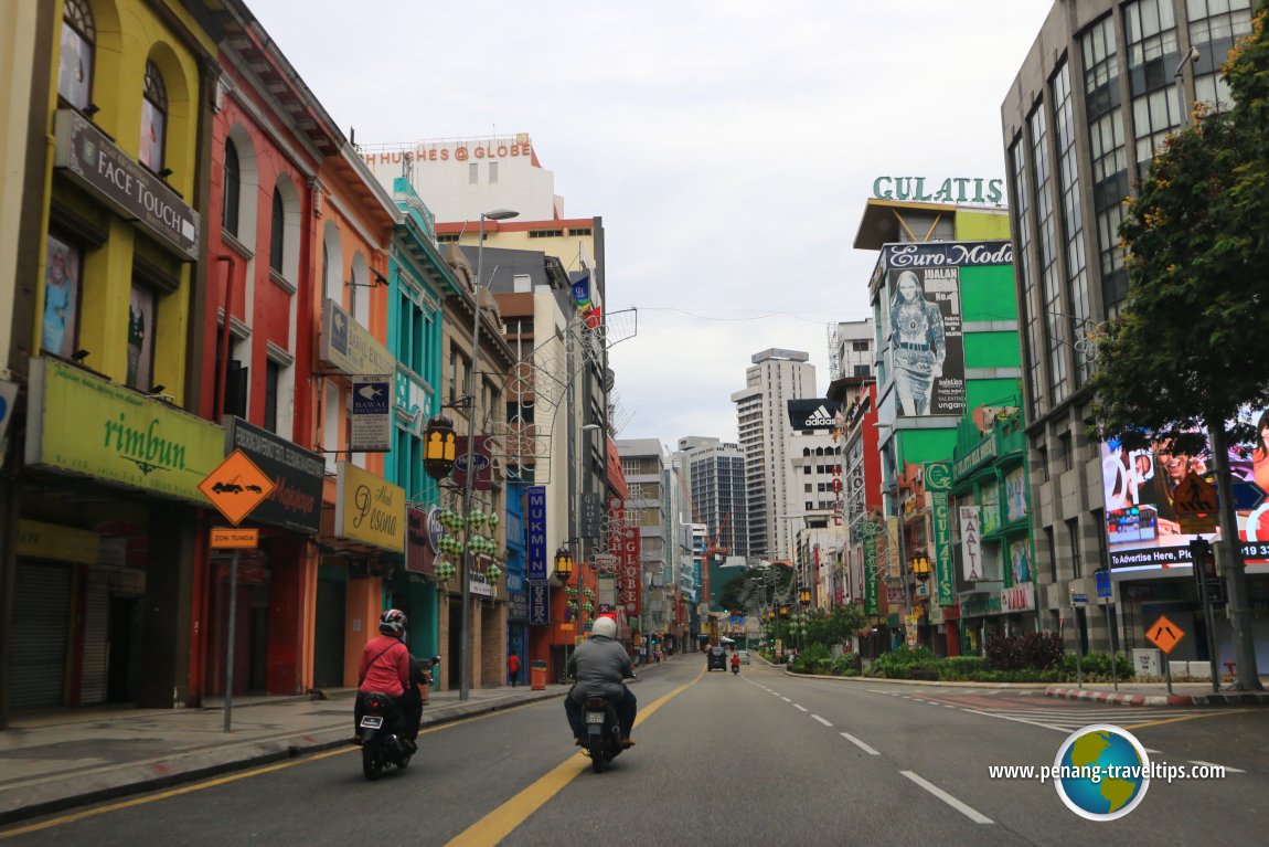 Shops along Jalan Tuanku Abdul Rahman, Kuala Lumpur (8 July, 2016)
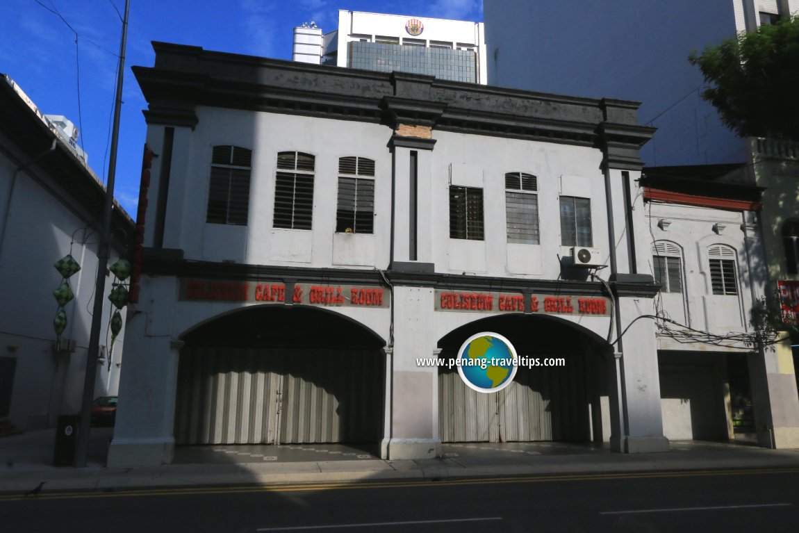 Coliseum Cafe & Grill Room, Kuala Lumpur (15 June, 2017)
Address numbering on Jalan Tuanku Abdul Rahman
Properties on Jalan Tuanku Abdul Rahman are numbered from south to north, beginning at the intersection with Jalan Tun Perak. Properties on the right carry odd number addresses while those of the left even numbers. At time of writing, No. 1, Jalan Tuanku Abdul Rahman is occupied by Restoran Rohani.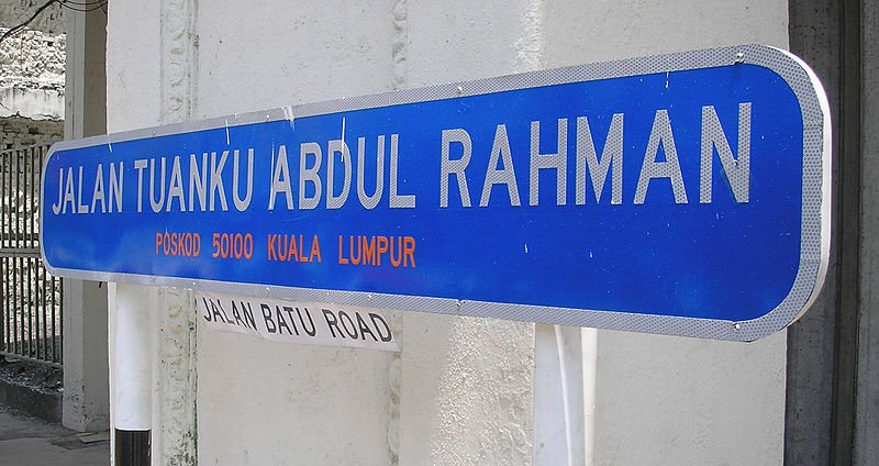 Roadsign for Jalan Tuanku Abdul Rahman with its former name signaged with both Jalan and Road
 https://commons.wikimedia.org/wiki/File:Batu_Road_street_sign_%28new_%26_old%29,_central_Kuala_Lumpur.jpg
 Two hundred percent
How to reach Jalan Tuanku Abdul Rahman
You can take the KL Monorail to the Chow Kit Monorail Station which is located at the northern end of Jalan Tuanku Abdul Rahman. In addition, the Medan Tuanku Monorail Station is located a short distance away at Jalan Sultan Ismail.References
- Kuala Lumpur Street Names by Mariana Isa & Maganjeet Kaut, published by Marshall Cavendish (2015) page 83.
Back to Discover Kuala Lumpur; list of Streets of Kuala Lumpur and Streets of Malaysia

Copyright © 2003-2025 Timothy Tye. All Rights Reserved.

 Go Back