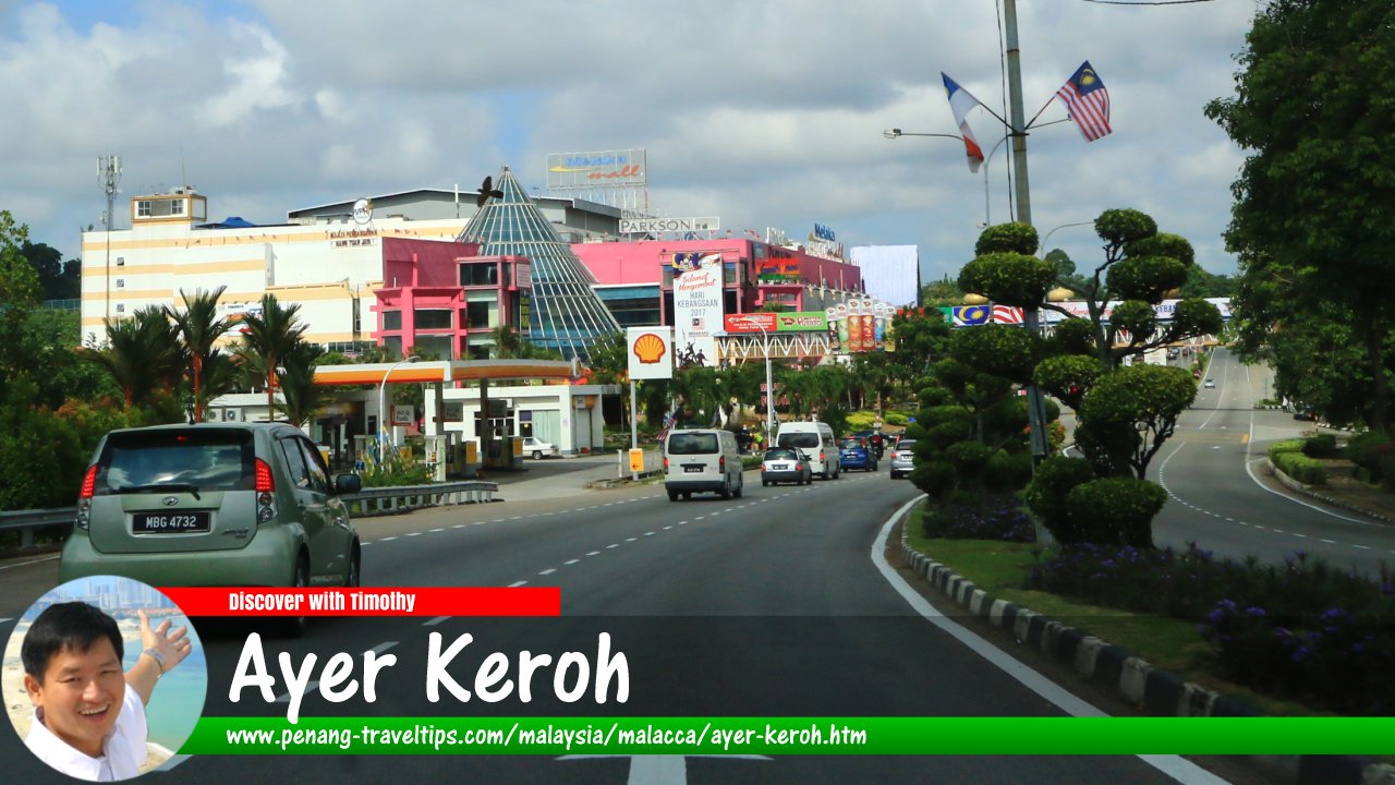
 Ayer Keroh, Malacca (9 August 2017)
Ayer Keroh (GPS: 2.27511, 102.29859) is a major town as well as mukim (or county) in Melaka Tengah, Malacca. It is located to the southeast of Durian Tunggal.
The proximity of Ayer Keroh to the North South Expressway (E2), and the fact that the Ayer Keroh Highway leads from the expressway's Ayer Keroh Interchange (Exit 231) to Malacca Town, has encouraged the development of several recreational spots and tourist attractions in Ayer Keroh. The attractions at Ayer Keroh are different from those in Malacca Town as they are all developed from scratch. Despite the presence of a few museums here, they are within the World Heritage zone. This allows for recreational development that are free from any heritage-related restrictions.
On this page I map out all the tourist attractions in and around Ayer Keroh. You can find them on the map below, as well as listed further down on this page. For each site, I try to provide you all the details you may need to pay it a visit.
Map of Ayer Keroh, Malacca
Tourist Attractions in Ayer Keroh
- Amverton Heritage Resort (GPS: 2.29124, 102.30761)

- Ayer Keroh Country Club (GPS: 2.27556, 102.30585)

- Ayer Keroh Country Resort (GPS: 2.28223, 102.3052)

- Ayer Keroh d'Village Resort (GPS: 2.27177, 102.298)

- Ayer Keroh Lake (GPS: 2.274, 102.30033)

- Balai Bomba dan Penyelamat Ayer Keroh (GPS: 2.26783, 102.28649)

- Balai Polis Ayer Keroh (GPS: 2.2751, 102.28904)

- Best Western Melaka (GPS: 2.27638, 102.29311)

- Dataran Sejarah (GPS: 2.27372, 102.29794)

- Expo Centre (GPS: 2.27418, 102.29678)

- Gerbang Ayer Keroh (GPS: 2.28762, 102.30424)

- Hotel Seri Malaysia (GPS: 2.28708, 102.30527)

- Hutan Rekreasi Ayer Keroh (GPS: 2.2807, 102.30063)

- INB Resort (GPS: 2.2807, 102.30063)

- Inkubator K-Ekonomi (GPS: 2.27408, 102.28909)

- Jabatan Audit Negara Ayer Keroh (GPS: 2.27322, 102.29108)

- Jabatan Kastam Diraja Malaysia (GPS: 2.27322, 102.29108)

- Jabatan Ketua Menteri Melaka (GPS: 2.26857, 102.30003)

- Jabatan Perkhidmatan Veterinar Negeri Melaka (GPS: 2.26765, 102.28756)

- Kolej Yayasan Saad Melaka (GPS: 2.29872, 102.32048)

- Kompleks Belia dan Sukan Negeri Melaka (GPS: 2.27254, 102.30027)

- Kompleks Kementerian Hal Ehwal Dalam Negeri (GPS: 2.26573, 102.2982)

- Kompleks Kraf Melaka (GPS: 2.28659, 102.30464)

- Kompleks Mahkamah Syariah Melaka (GPS: 2.26805, 102.28935)

- Lembaga Hasil Dalam Negeri Cawangan Melaka (GPS: 2.27322, 102.29108)

- Majlis Bandaraya Melaka Bersejarah (GPS: 2.23304, 102.28027)

- Malacca Cocoa Galleria (GPS: 2.27245, 102.292)

- Masjid Al-Alami (GPS: 2.27871, 102.29917)

- Melaka Bird Park (GPS: 2.2848, 102.29483)

- Melaka Butterfly & Reptile Sanctuary (GPS: 2.29966, 102.31128)

- Melaka Biotechnology Corporation (GPS: 2.27237, 102.29028)

- Melaka Handicraft Shop (GPS: 2.27967, 102.29997)

- Melaka International Motorsport Circuit (GPS: 2.27871, 102.29917)

- Melaka International Trade Centre (GPS: 2.27225, 102.28526)

- Melaka Planetarium (GPS: 2.27137, 102.28701)

- Melaka Wonderland Theme Park & Resort (GPS: 2.27871, 102.29917)

- Menara Persekutuan (GPS: 2.26922, 102.28726)

- MITC Hotel Melaka (GPS: 2.27345, 102.28474)

- MTC Mall (GPS: 2.27871, 102.29917)

- Muzium Orang Asli (GPS: 2.27871, 102.29917)

- Muzium Lebah Sedunia/World's Bees Museum (GPS: 2.27941, 102.29894)

- Mydin Hypermarket Ayer Keroh (GPS: 2.2708, 102.29257)

- Pantai Hospital (GPS: 2.23754, 102.28705)

- Philea Resort & Spa Melaka (GPS: 2.29826, 102.31106)

- Pusat Kemahiran Kebudayaan Murni (GPS: 2.29826, 102.31106)

- Puteri Resort Ayer Keroh (GPS: 2.29826, 102.31106)

- Putra International College (GPS: 2.28157, 102.29843)

- Rumah Media Melaka (GPS: 2.27388, 102.29025)

- Sekolah Jenis Kebangsaan (Cina) Ayer Keroh (GPS: 2.26477, 102.2837)

- Seri Bendahara (GPS: 2.2623, 102.30012)

- Snake Park (GPS: )

- Taman Botanikal Melaka (GPS: 2.28157, 102.29843)

- Taman Buaya & Rekreasi Melaka (GPS: 2.28157, 102.29843)

- Taman Budaya Negeri Melaka (GPS: 2.28908, 102.30503)

- Taman Mini Malaysia / Asean (GPS: 2.28272, 102.30387)

- Taman Seribu Bunga (GPS: 2.2667, 102.29799)

- Telekom Malaysia (GPS: 2.27237, 102.29028)

- The Muzaffar Hotel (GPS: 2.28157, 102.29843)

- Tiara Melaka Golf & Country Club (GPS: 2.26857, 102.31978)

- Tourist Help Centre (GPS: 2.28157, 102.29843)

- Wisma Negeri (GPS: 2.27171, 102.28881)

- Wisma Perkeso (GPS: 2.26923, 102.28504)

- Wisma Persekutuan (GPS: 2.27389, 102.28859)

- Zoo Melaka (GPS: 2.27639, 102.299)

Ayer Keroh is  on the Map of Towns in Malacca
Discover Malacca; list of Towns in Malacca and Towns in Malaysia
 Map of Roads in Malacca
 Latest updates on Penang Travel Tips

Copyright © 2003-2025 Timothy Tye. All Rights Reserved.

 Go Back